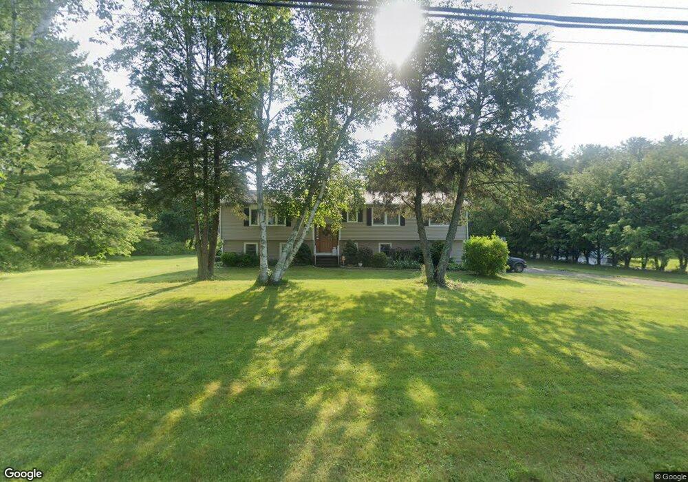
463 Burning Tree Dr Orange, CT 06477
Estimated Value: $624,071 - $674,000
4
Beds
3
Baths
1,522
Sq Ft
$428/Sq Ft
Est. Value
About This Home
This home is located at 463 Burning Tree Dr, Orange, CT 06477 and is currently estimated at $652,018, approximately $428 per square foot. 463 Burning Tree Dr is a home located in New Haven County with nearby schools including Mary L. Tracy School, Peck Place School, and Amity Middle School: Orange.
Ownership History
Date
Name
Owned For
Owner Type
Purchase Details
Closed on
Oct 1, 1999
Sold by
Benvenuto Ralph S and Benvenuto Angelina D
Bought by
Curtin Gregory P and Curtin Judith A
Current Estimated Value
Home Financials for this Owner
Home Financials are based on the most recent Mortgage that was taken out on this home.
Original Mortgage
$60,000
Interest Rate
7.85%
Create a Home Valuation Report for This Property
The Home Valuation Report is an in-depth analysis detailing your home's value as well as a comparison with similar homes in the area
Home Values in the Area
Average Home Value in this Area
Purchase History
| Date | Buyer | Sale Price | Title Company |
|---|---|---|---|
| Curtin Gregory P | $255,500 | -- | |
| Curtin Gregory P | $255,500 | -- |
Source: Public Records
Mortgage History
| Date | Status | Borrower | Loan Amount |
|---|---|---|---|
| Closed | Curtin Gregory P | $15,000 | |
| Closed | Curtin Gregory P | $54,000 | |
| Closed | Curtin Gregory P | $60,000 |
Source: Public Records
Tax History
| Year | Tax Paid | Tax Assessment Tax Assessment Total Assessment is a certain percentage of the fair market value that is determined by local assessors to be the total taxable value of land and additions on the property. | Land | Improvement |
|---|---|---|---|---|
| 2025 | $9,679 | $332,600 | $202,600 | $130,000 |
| 2024 | $10,311 | $332,600 | $202,600 | $130,000 |
| 2023 | $8,055 | $249,300 | $147,900 | $101,400 |
| 2022 | $8,155 | $249,300 | $147,900 | $101,400 |
| 2021 | $8,289 | $249,300 | $147,900 | $101,400 |
| 2020 | $8,162 | $249,300 | $147,900 | $101,400 |
| 2019 | $8,125 | $249,300 | $147,900 | $101,400 |
| 2018 | $7,978 | $249,300 | $147,900 | $101,400 |
| 2017 | $7,871 | $236,500 | $134,100 | $102,400 |
| 2016 | $7,615 | $236,500 | $134,100 | $102,400 |
| 2015 | $7,426 | $236,500 | $134,100 | $102,400 |
| 2014 | $7,213 | $236,500 | $134,100 | $102,400 |
Source: Public Records
Map
Nearby Homes
- 489 Derby Milford Rd
- 11A Derby-Milford Rd
- 24 Brierwood Dr
- 918 Wheelers Farms Rd
- 847 Glenbrook Rd
- 74 Victory St
- 830 Bayberry Ln
- 500 River Rd Unit 3
- 89 Green Meadow Rd
- 109 Green Meadow Rd
- 420 Narrow Ln
- 20 3rd Ave
- 249 Coram Rd
- 884 Grassy Hill Rd
- 317 Narrow Ln
- 25 Southwick Ct N
- 88 Rocky Rest Rd
- 4 Rivendell Dr
- 364 Orange Ave
- 492 North St
- 459 Burning Tree Dr
- 471 Burning Tree Dr
- 484 Derby Milford Rd
- 482 Derby Milford Rd
- 490 Derby Milford Rd
- 797 N Greenbrier Dr
- 464 Burning Tree Dr
- 783 N Greenbrier Dr
- 451 Burning Tree Dr
- 476 Derby Milford Rd
- 496 Derby Milford Rd
- 458 Burning Tree Dr
- 792 N Greenbrier Dr
- 470 Derby Milford Rd
- 777 N Greenbrier Dr
- 798 N Greenbrier Dr
- 786 N Greenbrier Dr
- 445 Burning Tree Dr
- 815 N Greenbrier Dr
- 452 Burning Tree Dr
Your Personal Tour Guide
Ask me questions while you tour the home.