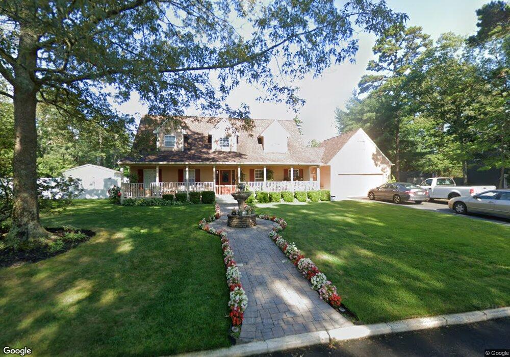
463 Franklin Dr Mays Landing, NJ 08330
Estimated Value: $543,000 - $611,000
4
Beds
3
Baths
2,485
Sq Ft
$234/Sq Ft
Est. Value
About This Home
This home is located at 463 Franklin Dr, Mays Landing, NJ 08330 and is currently estimated at $581,892, approximately $234 per square foot. 463 Franklin Dr is a home located in Atlantic County with nearby schools including George L. Hess Educational Complex, Joseph Shaner School, and William Davies Middle School.
Ownership History
Date
Name
Owned For
Owner Type
Purchase Details
Closed on
Sep 17, 2004
Sold by
Mitchell Harry G and Mitchell Elizabeth A
Bought by
Angelozzi Frank and Angelozzi Lois
Current Estimated Value
Home Financials for this Owner
Home Financials are based on the most recent Mortgage that was taken out on this home.
Original Mortgage
$169,100
Outstanding Balance
$83,832
Interest Rate
5.89%
Mortgage Type
Purchase Money Mortgage
Estimated Equity
$498,060
Purchase Details
Closed on
Aug 7, 1992
Sold by
Provenzano Anthony
Bought by
Mitchell Harry G and Mitchell Elizabeth A
Create a Home Valuation Report for This Property
The Home Valuation Report is an in-depth analysis detailing your home's value as well as a comparison with similar homes in the area
Home Values in the Area
Average Home Value in this Area
Purchase History
| Date | Buyer | Sale Price | Title Company |
|---|---|---|---|
| Angelozzi Frank | $299,000 | -- | |
| Mitchell Harry G | $50,000 | -- |
Source: Public Records
Mortgage History
| Date | Status | Borrower | Loan Amount |
|---|---|---|---|
| Open | Angelozzi Frank | $169,100 |
Source: Public Records
Tax History Compared to Growth
Tax History
| Year | Tax Paid | Tax Assessment Tax Assessment Total Assessment is a certain percentage of the fair market value that is determined by local assessors to be the total taxable value of land and additions on the property. | Land | Improvement |
|---|---|---|---|---|
| 2025 | $10,118 | $294,900 | $64,200 | $230,700 |
| 2024 | $10,118 | $294,900 | $64,200 | $230,700 |
| 2023 | $9,513 | $294,900 | $64,200 | $230,700 |
| 2022 | $9,513 | $294,900 | $64,200 | $230,700 |
| 2021 | $9,493 | $294,900 | $64,200 | $230,700 |
| 2020 | $9,493 | $294,900 | $64,200 | $230,700 |
| 2019 | $9,516 | $294,900 | $64,200 | $230,700 |
| 2018 | $9,183 | $294,900 | $64,200 | $230,700 |
| 2017 | $9,039 | $294,900 | $64,200 | $230,700 |
| 2016 | $8,785 | $294,900 | $64,200 | $230,700 |
| 2015 | $8,487 | $294,900 | $64,200 | $230,700 |
| 2014 | $8,475 | $322,600 | $79,200 | $243,400 |
Source: Public Records
Map
Nearby Homes
- 570 North St
- 116 Post Rd
- 1303 W Riverside Dr
- 1410 Cantillon Blvd
- 246 Old River Rd
- 355 Penny Ln
- 15 Lowell St
- 1403 Loretta Ave
- 225 Old River Rd
- 1404 Loretta Ave
- 1 Lafayette Ave
- 1305 Matthews Ave
- 504 Meadowbrook Dr
- 148 Marucci Place
- 109 Deal Ln
- 5745 2nd St
- 112 Giunta Walk
- 98 Gasko Rd
- 76 Gasko Rd
- 144 Knights Bridge Way
- 461 Franklin Dr
- 465 Franklin Dr
- 464 Franklin Dr
- 462 Franklin Dr
- 349 Clarkstown Rd
- 341 Clarkstown Rd
- 453 Clarkstown Rd
- 467 Franklin Dr
- 471 Franklin Dr
- 459 Franklin Dr
- 473 Franklin Dr
- 460 Franklin Dr
- 445 Clarkstown Rd
- 469 Franklin Dr
- 439 Clarkstown Rd
- 475 Franklin Dr
- 431 Clarkstown Rd
- 470 Franklin Dr
- 474 Franklin Dr
- 472 Franklin Dr