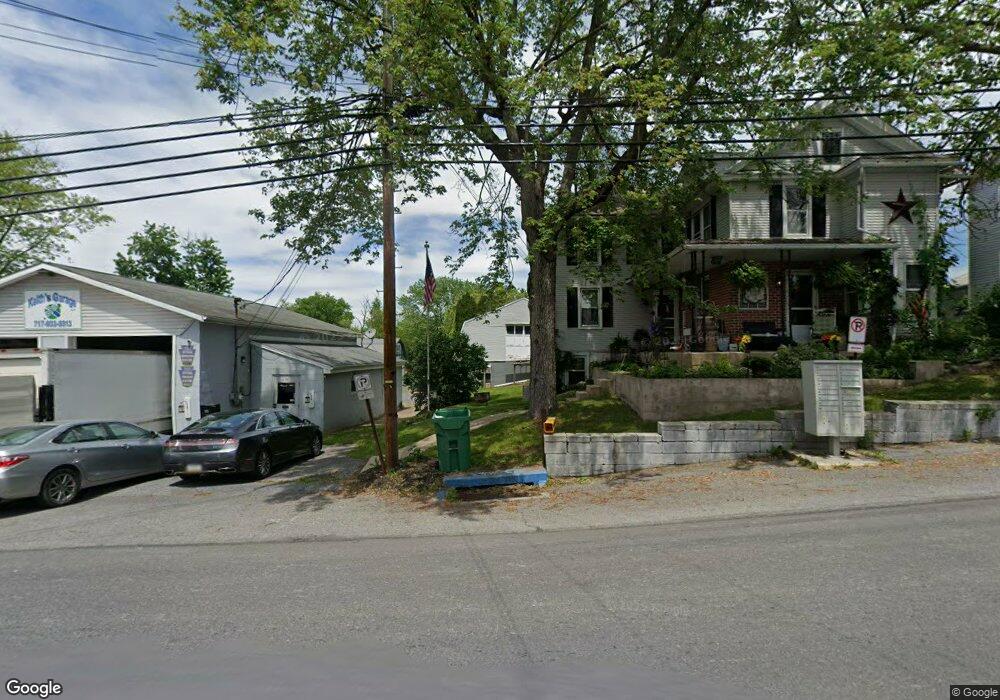
463 Frystown Rd Myerstown, PA 17067
Estimated Value: $259,000 - $342,000
3
Beds
2
Baths
2,040
Sq Ft
$154/Sq Ft
Est. Value
About This Home
This home is located at 463 Frystown Rd, Myerstown, PA 17067 and is currently estimated at $313,432, approximately $153 per square foot. 463 Frystown Rd is a home located in Berks County with nearby schools including Tulpehocken Junior/Senior High School, Lebanon Valley Christian School, and County Line School.
Ownership History
Date
Name
Owned For
Owner Type
Purchase Details
Closed on
Nov 30, 2015
Sold by
Brugger John E and Carefoot Christopher
Bought by
Carefoot Christopher
Current Estimated Value
Purchase Details
Closed on
Jul 28, 2006
Sold by
Gery Michael and Gery Heather
Bought by
Carefoot Christopher and Brugger John
Home Financials for this Owner
Home Financials are based on the most recent Mortgage that was taken out on this home.
Original Mortgage
$158,050
Interest Rate
6.7%
Mortgage Type
New Conventional
Purchase Details
Closed on
Jul 18, 2003
Sold by
Marks F Ray and Marks Linda
Bought by
Gery Michael and Gery Heather
Home Financials for this Owner
Home Financials are based on the most recent Mortgage that was taken out on this home.
Original Mortgage
$74,192
Interest Rate
5.28%
Mortgage Type
Purchase Money Mortgage
Create a Home Valuation Report for This Property
The Home Valuation Report is an in-depth analysis detailing your home's value as well as a comparison with similar homes in the area
Home Values in the Area
Average Home Value in this Area
Purchase History
| Date | Buyer | Sale Price | Title Company |
|---|---|---|---|
| Carefoot Christopher | $159,300 | None Available | |
| Carefoot Christopher | $159,300 | None Available | |
| Gery Michael | $92,741 | -- |
Source: Public Records
Mortgage History
| Date | Status | Borrower | Loan Amount |
|---|---|---|---|
| Previous Owner | Carefoot Christopher | $158,050 | |
| Previous Owner | Gery Michael | $74,192 |
Source: Public Records
Tax History Compared to Growth
Tax History
| Year | Tax Paid | Tax Assessment Tax Assessment Total Assessment is a certain percentage of the fair market value that is determined by local assessors to be the total taxable value of land and additions on the property. | Land | Improvement |
|---|---|---|---|---|
| 2025 | $967 | $84,300 | $27,900 | $56,400 |
| 2024 | $3,047 | $84,300 | $27,900 | $56,400 |
| 2023 | $2,997 | $84,300 | $27,900 | $56,400 |
| 2022 | $3,006 | $84,300 | $27,900 | $56,400 |
| 2021 | $3,069 | $84,300 | $27,900 | $56,400 |
| 2020 | $3,078 | $84,300 | $27,900 | $56,400 |
| 2019 | $3,099 | $84,300 | $27,900 | $56,400 |
| 2018 | $3,141 | $84,300 | $27,900 | $56,400 |
| 2017 | $3,125 | $84,300 | $27,900 | $56,400 |
| 2016 | $832 | $84,300 | $27,900 | $56,400 |
| 2015 | $832 | $84,300 | $27,900 | $56,400 |
| 2014 | $832 | $84,300 | $27,900 | $56,400 |
Source: Public Records
Map
Nearby Homes
- 37 Seymour Dr
- 40 Seymour Dr
- 711 Little Mountain Rd
- 625 Brown Rd
- 230 School Rd
- 360 Woleber Rd
- 40 Clover Dr Unit 49
- 46 Clover Dr Unit 46
- 27 Clover Dr Unit 59
- 37 Clover Dr Unit 63
- 66 Clover Dr Unit 36
- 72 Clover Dr Unit 33
- 49 Clover Dr Unit 65
- 31 Clover Dr Unit 61
- 58 Clover Dr Unit 40
- 60 Clover Dr Unit 39
- 48 Clover Dr Unit 45
- 64 Clover Dr Unit 37
- 62 Clover Dr Unit 38
- 57 Clover Dr Unit 67
- 455 Frystown Rd
- 460 Frystown Rd
- 464 Frystown Rd
- 468 Frystown Rd
- 445 Frystown Rd
- 440 Frystown Rd
- 441 Frystown Rd
- 452 Frystown Rd
- 437 Frystown Rd
- 436 Frystown Rd
- 491 Frystown Rd
- 433 Frystown Rd
- 492 Frystown Rd
- 499 Frystown Rd
- 432 Frystown Rd
- 429 Frystown Rd
- 428 Frystown Rd
- 425 Frystown Rd
- 1881 Camp Swatara Rd
- 501 Frystown Rd