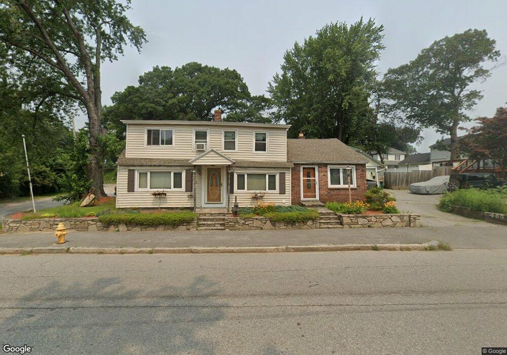
463 Sunderland Rd Worcester, MA 01604
Grafton Hill NeighborhoodEstimated Value: $405,000 - $469,000
2
Beds
2
Baths
1,746
Sq Ft
$251/Sq Ft
Est. Value
About This Home
This home is located at 463 Sunderland Rd, Worcester, MA 01604 and is currently estimated at $438,680, approximately $251 per square foot. 463 Sunderland Rd is a home located in Worcester County with nearby schools including Roosevelt Elementary School, Jacob Hiatt Magnet School, and Chandler Magnet.
Create a Home Valuation Report for This Property
The Home Valuation Report is an in-depth analysis detailing your home's value as well as a comparison with similar homes in the area
Home Values in the Area
Average Home Value in this Area
Tax History
| Year | Tax Paid | Tax Assessment Tax Assessment Total Assessment is a certain percentage of the fair market value that is determined by local assessors to be the total taxable value of land and additions on the property. | Land | Improvement |
|---|---|---|---|---|
| 2025 | $4,948 | $375,100 | $118,800 | $256,300 |
| 2024 | $4,777 | $347,400 | $118,800 | $228,600 |
| 2023 | $4,597 | $320,600 | $103,300 | $217,300 |
| 2022 | $4,256 | $279,800 | $82,600 | $197,200 |
| 2021 | $4,182 | $256,900 | $66,100 | $190,800 |
| 2020 | $4,021 | $236,500 | $66,100 | $170,400 |
| 2019 | $3,893 | $216,300 | $59,600 | $156,700 |
| 2018 | $3,909 | $206,700 | $59,600 | $147,100 |
| 2017 | $3,771 | $196,200 | $59,600 | $136,600 |
| 2016 | $3,741 | $181,500 | $43,900 | $137,600 |
| 2015 | $3,643 | $181,500 | $43,900 | $137,600 |
| 2014 | $3,547 | $181,500 | $43,900 | $137,600 |
Source: Public Records
Map
Nearby Homes
- 1195 Grafton St Unit 29
- 1195 Grafton St Unit 39
- 7 Clarissa St
- 270 Sunderland Rd Unit 73
- 6 Nathaniel St
- 9 Marissa Cir
- 2 Salisbury St
- 182 Weatherstone Dr
- 365 Lake Ave
- 143 Commonwealth Ave
- 62 Edgemere Blvd
- 15 Lakeside Dr
- 1459 Grafton Rd
- 63 Progressive St
- 25 Stoneham Rd
- 7 Barbara St
- 266 Massasoit Rd
- 11 Maplewood Rd
- 259 Massasoit Rd
- 12 Benham St
Your Personal Tour Guide
Ask me questions while you tour the home.