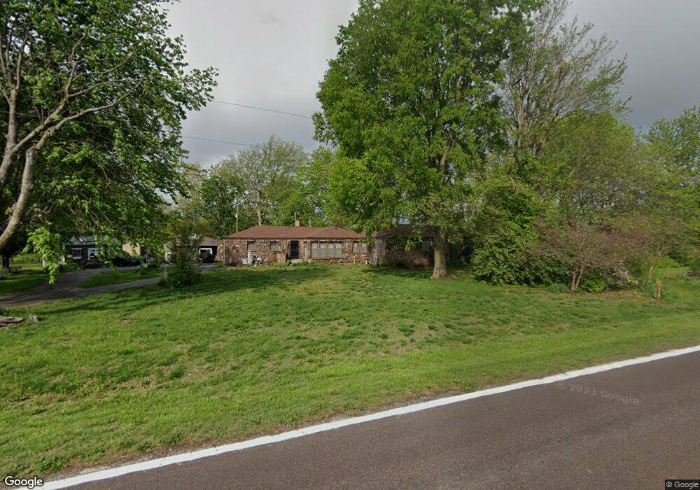
4630 W Willard Rd Springfield, MO 65803
Estimated Value: $253,224 - $392,000
3
Beds
1
Bath
2,584
Sq Ft
$125/Sq Ft
Est. Value
About This Home
This home is located at 4630 W Willard Rd, Springfield, MO 65803 and is currently estimated at $322,556, approximately $124 per square foot. 4630 W Willard Rd is a home located in Greene County with nearby schools including Willard Central Elementary School, Willard Intermediate School North, and Christian Schools Of Springfield.
Ownership History
Date
Name
Owned For
Owner Type
Purchase Details
Closed on
Mar 2, 2021
Sold by
Quinn Mary E and Quinn James D
Bought by
Zapatka Michael
Current Estimated Value
Purchase Details
Closed on
Jun 1, 2018
Sold by
Norris P Kimberly
Bought by
Reynolds Chase B
Home Financials for this Owner
Home Financials are based on the most recent Mortgage that was taken out on this home.
Original Mortgage
$123,500
Interest Rate
4.4%
Mortgage Type
New Conventional
Create a Home Valuation Report for This Property
The Home Valuation Report is an in-depth analysis detailing your home's value as well as a comparison with similar homes in the area
Purchase History
| Date | Buyer | Sale Price | Title Company |
|---|---|---|---|
| Zapatka Michael | -- | None Listed On Document | |
| Reynolds Chase B | -- | Waco Title Co |
Source: Public Records
Mortgage History
| Date | Status | Borrower | Loan Amount |
|---|---|---|---|
| Previous Owner | Reynolds Chase B | $123,500 |
Source: Public Records
Tax History
| Year | Tax Paid | Tax Assessment Tax Assessment Total Assessment is a certain percentage of the fair market value that is determined by local assessors to be the total taxable value of land and additions on the property. | Land | Improvement |
|---|---|---|---|---|
| 2025 | $1,504 | $27,820 | $7,130 | $20,690 |
| 2024 | $1,338 | $24,300 | $4,750 | $19,550 |
| 2023 | $1,333 | $24,300 | $4,750 | $19,550 |
| 2022 | $1,288 | $23,370 | $4,750 | $18,620 |
| 2021 | $1,289 | $23,370 | $4,750 | $18,620 |
| 2020 | $1,233 | $22,150 | $4,750 | $17,400 |
| 2019 | $1,228 | $22,150 | $4,750 | $17,400 |
| 2018 | $1,154 | $20,710 | $4,750 | $15,960 |
| 2017 | $1,144 | $20,670 | $4,750 | $15,920 |
| 2016 | $1,135 | $20,670 | $4,750 | $15,920 |
| 2015 | $1,127 | $20,670 | $4,750 | $15,920 |
| 2014 | $1,135 | $20,690 | $4,750 | $15,940 |
Source: Public Records
Map
Nearby Homes
- 4620 W Willard Rd
- 4107 W Kearney St
- 2541 N Eldon Ave
- 5589 W Farm Road 104
- 3526 Fratelli Ln
- 3443 W Hestand St
- 4063 W Camden St
- 3486 N Ohara Ave
- 3272 N Ohara Ave
- 000 N Farm Road 127
- 2940 N Nixon Ave
- 3340 W Bellaire St
- 3229 W McClernon St
- 6307 W Cottonwood Rd
- 6334 Crystal Ln W
- 6208 W State Highway Ee
- 2571 N Honeysuckle Way
- 1311 N Dawn Ave
- 2600 N Wildberry Ct
- 2506 N Meadow Lake Dr
- 4640 W Willard Rd
- 4640 W Willard Rd
- 4615 W Willard Rd
- 4611 N Willard Rd
- 4656 Pfeiffer Ct
- 4666 Pfeiffer Ct
- 4648 Pfeiffer Ct
- 0 W Willard Rd Unit 11012306
- 2749 N General Aviation Ave Unit A
- 3083 N Farm Road 123
- 2904 N Farm Road 123
- 3117 N Farm Road 123
- 3015 N Lester Jones Ave Unit A & B
- 4655 W Kearney St
- 0 N Westgate Ave Unit 60108161
- 0 N Westgate Ave Unit 60133450
- 3818 N Farm Road 123
- 3012 N Farm Road 123
- 4646 W Kearney St
- 4656 W Kearney St
Your Personal Tour Guide
Ask me questions while you tour the home.