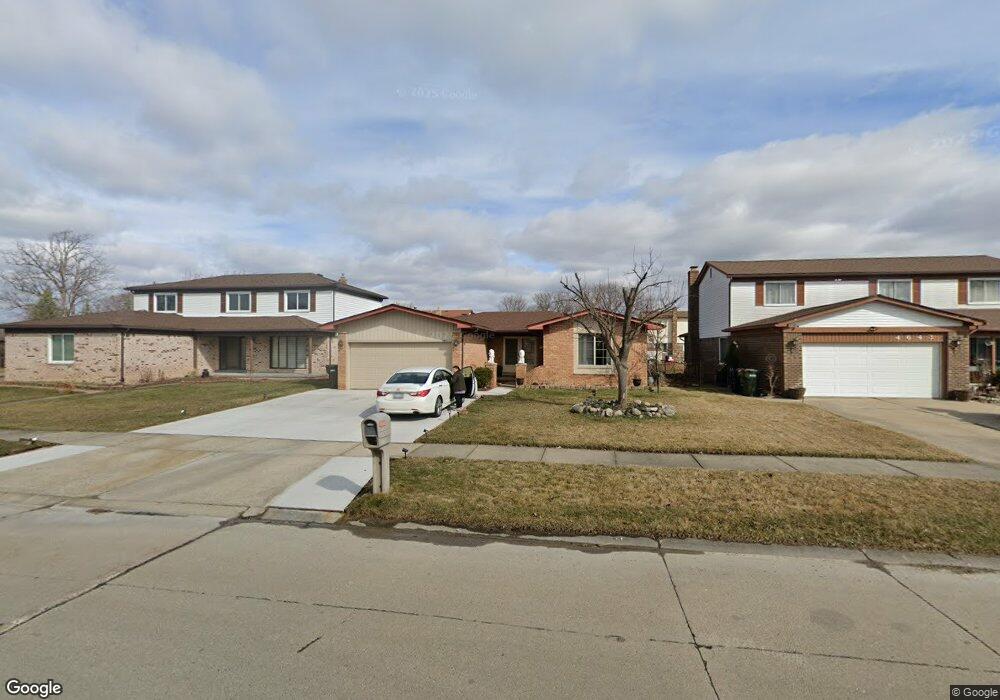
4631 Bloomfield Dr Sterling Heights, MI 48310
Estimated Value: $325,499 - $370,000
3
Beds
2
Baths
1,531
Sq Ft
$231/Sq Ft
Est. Value
About This Home
This home is located at 4631 Bloomfield Dr, Sterling Heights, MI 48310 and is currently estimated at $353,875, approximately $231 per square foot. 4631 Bloomfield Dr is a home located in Macomb County with nearby schools including Jefferson Elementary School, Grissom Middle School, and Sterling Heights Senior H.S..
Ownership History
Date
Name
Owned For
Owner Type
Purchase Details
Closed on
Jun 27, 2019
Sold by
Rovena Mucka Dervish and Rovena Locaj
Bought by
Mucka Dervish and Mucka Ruzhdie
Current Estimated Value
Home Financials for this Owner
Home Financials are based on the most recent Mortgage that was taken out on this home.
Original Mortgage
$108,500
Outstanding Balance
$95,405
Interest Rate
4%
Mortgage Type
New Conventional
Estimated Equity
$258,470
Purchase Details
Closed on
Apr 11, 2011
Sold by
Estate Of Leo Laratta
Bought by
Rovena Mucka Dervish and Rovena Locaj
Create a Home Valuation Report for This Property
The Home Valuation Report is an in-depth analysis detailing your home's value as well as a comparison with similar homes in the area
Home Values in the Area
Average Home Value in this Area
Purchase History
| Date | Buyer | Sale Price | Title Company |
|---|---|---|---|
| Mucka Dervish | -- | None Available | |
| Rovena Mucka Dervish | $125,000 | Sterling Title Agency |
Source: Public Records
Mortgage History
| Date | Status | Borrower | Loan Amount |
|---|---|---|---|
| Open | Mucka Dervish | $108,500 |
Source: Public Records
Tax History Compared to Growth
Tax History
| Year | Tax Paid | Tax Assessment Tax Assessment Total Assessment is a certain percentage of the fair market value that is determined by local assessors to be the total taxable value of land and additions on the property. | Land | Improvement |
|---|---|---|---|---|
| 2025 | $3,452 | $150,100 | $0 | $0 |
| 2024 | $3,330 | $140,900 | $0 | $0 |
| 2023 | $3,161 | $127,100 | $0 | $0 |
| 2022 | $3,065 | $113,700 | $0 | $0 |
| 2021 | $3,168 | $107,600 | $0 | $0 |
| 2020 | $3,012 | $101,600 | $0 | $0 |
| 2019 | $2,827 | $96,100 | $0 | $0 |
| 2018 | $2,996 | $89,900 | $0 | $0 |
| 2017 | $2,888 | $83,800 | $13,500 | $70,300 |
| 2016 | $2,827 | $83,800 | $0 | $0 |
| 2015 | -- | $76,800 | $0 | $0 |
| 2014 | -- | $64,600 | $0 | $0 |
Source: Public Records
Map
Nearby Homes
- 4653 Lucerne Dr
- 4622 Ardmore Dr
- 4761 Fox Hill Dr
- 4325 Fox Hill Dr
- 38576 Cottonwood Dr
- 38172 Yonkers Dr
- 38338 Coronation Dr
- 38638 Harrison Dr
- 38968 Harrison Dr
- 4768 Dreon Ct
- 37683 Adrian Dr
- 37288 Vernon Dr
- 37258 Carpathia Blvd
- 3816 Pokley Ct
- 37228 Vernon Dr
- 39329 Hyland Dr
- 3601 Denson Dr
- 5477 Victory Cir Unit 70
- 5118 Fredrick Dr
- 37207 Almont Dr E
- 4643 Bloomfield Dr
- 4632 Admiral Dr
- 4655 Bloomfield Dr Unit Bldg-Unit
- 4655 Bloomfield Dr
- 4644 Admiral Dr
- 4620 Admiral Dr
- 4656 Admiral Dr
- 4667 Bloomfield Dr
- 4624 Bloomfield Dr
- 4483 Bloomfield Dr
- 4610 Bloomfield Dr
- 4668 Admiral Dr
- 4654 Bloomfield Dr
- 4679 Bloomfield Dr
- 38321 Cheviot Dr
- 4492 Bloomfield Dr
- 4666 Bloomfield Dr
- 4680 Admiral Dr
- 38333 Cheviot Dr
- 38137 Afton Dr