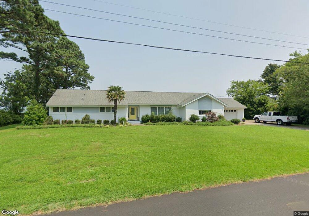
4631 River Shore Rd Portsmouth, VA 23703
Churchland NeighborhoodEstimated Value: $562,000 - $619,000
3
Beds
4
Baths
2,700
Sq Ft
$218/Sq Ft
Est. Value
About This Home
This home is located at 4631 River Shore Rd, Portsmouth, VA 23703 and is currently estimated at $589,813, approximately $218 per square foot. 4631 River Shore Rd is a home located in Portsmouth City with nearby schools including Churchland Primary/Intermediate School, Churchland Middle School, and Churchland High School.
Ownership History
Date
Name
Owned For
Owner Type
Purchase Details
Closed on
Nov 8, 2019
Sold by
Sykes Harry E and The Harry And Marion Sykes Fam
Bought by
Thompkins Pamela K
Current Estimated Value
Home Financials for this Owner
Home Financials are based on the most recent Mortgage that was taken out on this home.
Original Mortgage
$340,000
Outstanding Balance
$298,765
Interest Rate
3.65%
Estimated Equity
$291,048
Create a Home Valuation Report for This Property
The Home Valuation Report is an in-depth analysis detailing your home's value as well as a comparison with similar homes in the area
Home Values in the Area
Average Home Value in this Area
Purchase History
| Date | Buyer | Sale Price | Title Company |
|---|---|---|---|
| Thompkins Pamela K | $425,000 | Attorney |
Source: Public Records
Mortgage History
| Date | Status | Borrower | Loan Amount |
|---|---|---|---|
| Open | Thompkins Pamela K | $340,000 |
Source: Public Records
Tax History Compared to Growth
Tax History
| Year | Tax Paid | Tax Assessment Tax Assessment Total Assessment is a certain percentage of the fair market value that is determined by local assessors to be the total taxable value of land and additions on the property. | Land | Improvement |
|---|---|---|---|---|
| 2025 | $6,590 | $524,510 | $222,860 | $301,650 |
| 2024 | $6,590 | $521,870 | $222,860 | $299,010 |
| 2023 | $6,259 | $500,700 | $222,860 | $277,840 |
| 2022 | $6,721 | $517,020 | $220,660 | $296,360 |
| 2021 | $6,388 | $491,350 | $210,870 | $280,480 |
| 2020 | $6,257 | $481,310 | $200,830 | $280,480 |
| 2019 | $6,188 | $476,020 | $200,830 | $275,190 |
| 2018 | $6,051 | $465,440 | $200,830 | $264,610 |
| 2017 | $6,051 | $465,440 | $200,830 | $264,610 |
| 2016 | $6,051 | $465,440 | $200,830 | $264,610 |
| 2015 | $6,051 | $465,440 | $200,830 | $264,610 |
| 2014 | $5,911 | $465,440 | $200,830 | $264,610 |
Source: Public Records
Map
Nearby Homes
- 4619 River Shore Rd
- 4444 Southampton Arch
- 4726 River Shore Rd
- 21 Windy Pines Crescent
- 5833 Hawthorne Ln
- 5728 Hawthorne Ln
- 5693 Rivermill Cir
- 4224 Burnham Dr
- 4232 Summerset Dr
- 6750 Burbage Landing Cir
- 5606 Gregory Ct
- 8 Compass Ct
- 6602 James Point Ct
- 4200 Quince Rd
- 5028 Bay Cir
- 4071 Long Point Blvd
- 17 Shoal Ct
- 6832 Ivanhoe Ct
- 4100 Mayfair Way
- 4028 Swannanoa Dr
- 4635 River Shore Rd
- 4627 River Shore Rd
- 4630 River Shore Rd
- 4634 River Shore Rd
- 4639 River Shore Rd
- 4624 River Shore Rd
- 4638 River Shore Rd
- 4623 River Shore Rd
- 4621 Southampton Arch
- 4622 River Shore Rd
- 4623 Southampton Arch
- 4643 River Shore Rd
- 4619 Southampton Arch
- 4640 River Shore Rd
- 4625 Southampton Arch
- 4617 Southampton Arch
- 4627 Southampton Arch
- 4618 River Shore Rd
- 4644 River Shore Rd
- 4615 Southampton Arch