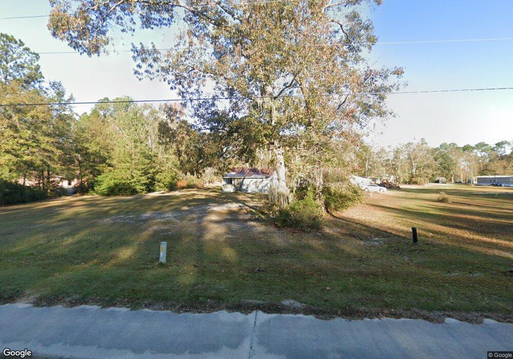
4633 W Oglethorpe Hwy Hinesville, GA 31313
Estimated Value: $105,606 - $219,000
2
Beds
1
Bath
840
Sq Ft
$197/Sq Ft
Est. Value
About This Home
This home is located at 4633 W Oglethorpe Hwy, Hinesville, GA 31313 and is currently estimated at $165,652, approximately $197 per square foot. 4633 W Oglethorpe Hwy is a home with nearby schools including Lyman Hall Elementary School, Lewis Frasier Middle School, and Bradwell Institute.
Ownership History
Date
Name
Owned For
Owner Type
Purchase Details
Closed on
Feb 13, 2017
Sold by
Roberts Emma L
Bought by
Roberts Gordon
Current Estimated Value
Purchase Details
Closed on
Sep 1, 2007
Sold by
Roberts Gordon and Roberts Emma L
Bought by
Roberts-Comar Ruth I
Purchase Details
Closed on
Jul 5, 2004
Sold by
Roberts Gordon
Bought by
Roberts Gordon and Roberts Emma L
Purchase Details
Closed on
Jan 11, 1985
Bought by
Roberts Gordon
Create a Home Valuation Report for This Property
The Home Valuation Report is an in-depth analysis detailing your home's value as well as a comparison with similar homes in the area
Home Values in the Area
Average Home Value in this Area
Purchase History
| Date | Buyer | Sale Price | Title Company |
|---|---|---|---|
| Roberts Gordon | -- | -- | |
| Roberts Gordon | -- | -- | |
| Roberts-Comar Ruth I | -- | -- | |
| Roberts Gordon | -- | -- | |
| Roberts Gordon | $1,000 | -- |
Source: Public Records
Tax History Compared to Growth
Tax History
| Year | Tax Paid | Tax Assessment Tax Assessment Total Assessment is a certain percentage of the fair market value that is determined by local assessors to be the total taxable value of land and additions on the property. | Land | Improvement |
|---|---|---|---|---|
| 2024 | $180 | $20,536 | $7,000 | $13,536 |
| 2023 | $180 | $18,672 | $7,000 | $11,672 |
| 2022 | $30 | $14,895 | $5,600 | $9,295 |
| 2021 | $30 | $13,704 | $5,600 | $8,104 |
| 2020 | $29 | $11,508 | $5,600 | $5,908 |
| 2019 | $29 | $11,705 | $5,600 | $6,105 |
| 2018 | $29 | $11,901 | $5,600 | $6,301 |
| 2017 | $513 | $12,098 | $5,600 | $6,498 |
| 2016 | $29 | $12,294 | $5,600 | $6,694 |
| 2015 | $29 | $11,244 | $4,550 | $6,694 |
| 2014 | $29 | $19,217 | $4,550 | $14,667 |
| 2013 | -- | $19,254 | $6,446 | $12,807 |
Source: Public Records
Map
Nearby Homes
- 89 Salette St
- 0 W Oglethorpe Hwy
- 534 Deer Meadow Way
- 685 Deer Meadow Way
- 256 Deer Meadow Way
- 1118 Buckhead Loop
- 684 Deer Meadow Way
- 514 Deer Meadow Way
- 554 Deer Meadow Way
- 704 Deer Meadow Way
- 575 Deer Meadow Way
- 593 Deer Meadow Way
- 662 Deer Meadow Way
- 374 Deer Meadow Way
- 663 Deer Meadow Way
- 645 Deer Meadow Way
- 625 Deer Meadow Way
- 166 Stephanie Dr
- 619 Mccumber Dr
- 0 & 1 Denise Ln
- 4667 W Oglethorpe Hwy
- 84 Cheryl Ct NE
- 71 Salette St
- 4668 W Oglethorpe Hwy
- 4698 W Oglethorpe Hwy
- 51 Salette St
- 25 Salette St
- 105 Salette St
- 4755 W Oglethorpe Hwy
- 37 Davis St
- 63 Cynthia Ln
- 4738 W Oglethorpe Hwy
- 4674 W Oglethorpe Hwy
- 4801 W Oglethorpe Hwy
- 52 Davis St
- 4710 W Oglethorpe Hwy
- 0 King Rd
- 4491 W Oglethorpe Hwy
- 75 Davis St
- 28 King Rd