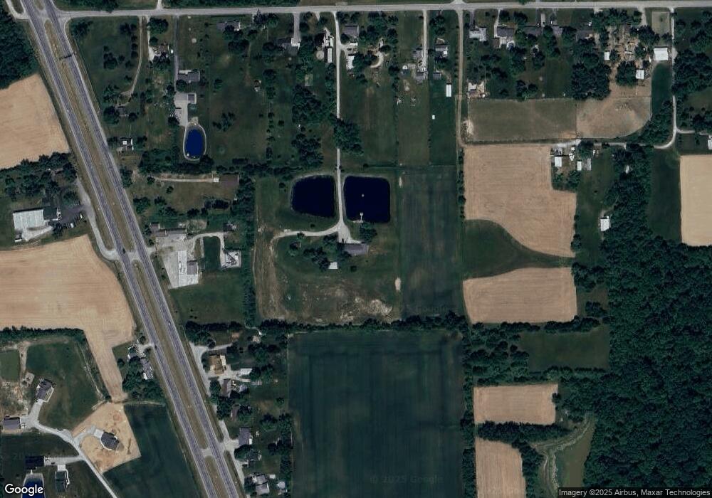
4634 Monroeville Rd Fort Wayne, IN 46816
Estimated Value: $392,000 - $561,000
4
Beds
3
Baths
2,666
Sq Ft
$180/Sq Ft
Est. Value
About This Home
This home is located at 4634 Monroeville Rd, Fort Wayne, IN 46816 and is currently estimated at $480,461, approximately $180 per square foot. 4634 Monroeville Rd is a home located in Allen County with nearby schools including Heritage Junior/Senior High School, St. Joseph Hessen Cassel School, and Martin Luther King Montessori School.
Ownership History
Date
Name
Owned For
Owner Type
Purchase Details
Closed on
Aug 19, 2017
Sold by
Brown Kevin L
Bought by
Armstrong Scott A
Current Estimated Value
Home Financials for this Owner
Home Financials are based on the most recent Mortgage that was taken out on this home.
Original Mortgage
$251,750
Outstanding Balance
$208,552
Interest Rate
3.96%
Mortgage Type
New Conventional
Estimated Equity
$271,909
Purchase Details
Closed on
Oct 22, 2004
Sold by
Beal John R and Beal Carol A
Bought by
Brown Kevin L and Brown Tracy A
Home Financials for this Owner
Home Financials are based on the most recent Mortgage that was taken out on this home.
Original Mortgage
$100,000
Interest Rate
5.81%
Mortgage Type
Purchase Money Mortgage
Purchase Details
Closed on
Jul 19, 2004
Sold by
Follis Lola E
Bought by
Beal John R and Beal Carol A
Create a Home Valuation Report for This Property
The Home Valuation Report is an in-depth analysis detailing your home's value as well as a comparison with similar homes in the area
Purchase History
| Date | Buyer | Sale Price | Title Company |
|---|---|---|---|
| Armstrong Scott A | $265,000 | -- | |
| Armstrong Scott A | $265,000 | Meridian Title | |
| Brown Kevin L | -- | Ace Title Box | |
| Brown Kevin L | -- | Ace Title Box | |
| Beal John R | -- | -- |
Source: Public Records
Mortgage History
| Date | Status | Borrower | Loan Amount |
|---|---|---|---|
| Open | Armstrong Scott A | $251,750 | |
| Previous Owner | Brown Kevin L | $100,000 |
Source: Public Records
Tax History
| Year | Tax Paid | Tax Assessment Tax Assessment Total Assessment is a certain percentage of the fair market value that is determined by local assessors to be the total taxable value of land and additions on the property. | Land | Improvement |
|---|---|---|---|---|
| 2025 | $4,453 | $426,600 | $120,700 | $305,900 |
| 2024 | $3,466 | $432,900 | $120,700 | $312,200 |
| 2022 | $2,264 | $300,500 | $55,900 | $244,600 |
| 2021 | $1,862 | $230,800 | $54,800 | $176,000 |
| 2020 | $1,909 | $230,800 | $54,800 | $176,000 |
| 2019 | $1,536 | $207,200 | $34,900 | $172,300 |
| 2018 | $1,603 | $207,200 | $34,900 | $172,300 |
| 2017 | $1,390 | $183,300 | $34,900 | $148,400 |
| 2016 | $1,282 | $172,400 | $34,900 | $137,500 |
| 2014 | $1,235 | $168,900 | $35,000 | $133,900 |
| 2013 | $1,209 | $163,400 | $35,000 | $128,400 |
Source: Public Records
Map
Nearby Homes
- 10630 Marion Center Rd
- 10630 & 10640 Marion Center Rd
- 10640 Marion Center Rd
- 5933 Hoagland Rd
- 7053 Starks Blvd
- 9830 Muldoon Rd
- 10335 Wayne Trace
- 3516 Debeney Dr
- 7903 Chinchilla Ln Unit 26
- 7231 Treverton Dr
- 7845 Chinchilla Ln
- 7212 Treverton Dr
- 7398 Starks Blvd
- 7354 Starks Blvd
- 7327 Starks (Lot 41) Blvd
- 7264 Blvd Unit Lot 12
- 7230 Starks Blvd
- 7205 Starks Blvd
- 7208 Starks Blvd
- 7183 Starks Blvd
- 12309 Us Highway 27 S
- 12211 Us Highway 27 S
- 12211 S Us Highway 27
- 12319 Us Highway 27 S
- 12321 Us Highway 27 S
- 12401 Us Highway 27 S
- 12609 S Us Highway 27
- 4730 Monroeville Rd
- 4620 Monroeville Rd
- 4604 Monroeville Rd
- 4736 Monroeville Rd
- 4704 Monroeville Rd
- 12411 S Us Highway 27
- 4512 Monroeville Rd
- 12423 Us Highway 27 S
- 12109 S Us Highway 27
- 4810 Monroeville Rd
- 12433 Us Highway 27 S
- 4520 Monroeville Rd
- 12025 S Us Highway 27
Your Personal Tour Guide
Ask me questions while you tour the home.
