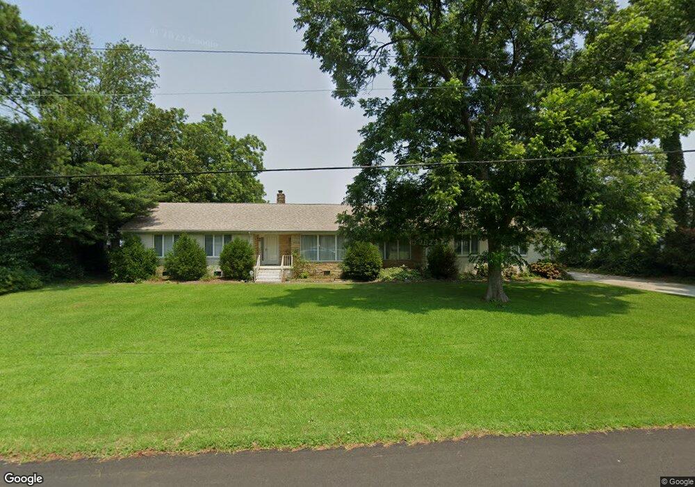
4635 River Shore Rd Portsmouth, VA 23703
Churchland NeighborhoodEstimated Value: $540,756 - $568,000
3
Beds
3
Baths
2,823
Sq Ft
$196/Sq Ft
Est. Value
About This Home
This home is located at 4635 River Shore Rd, Portsmouth, VA 23703 and is currently estimated at $551,919, approximately $195 per square foot. 4635 River Shore Rd is a home located in Portsmouth City with nearby schools including Churchland Primary/Intermediate School, Churchland Middle School, and Churchland High School.
Ownership History
Date
Name
Owned For
Owner Type
Purchase Details
Closed on
Jan 31, 2013
Sold by
Medlin Exr Roger C and The Estate Of Beulah H Medlin
Bought by
Smith Robert E and Hickmott Karen M
Current Estimated Value
Home Financials for this Owner
Home Financials are based on the most recent Mortgage that was taken out on this home.
Original Mortgage
$337,500
Outstanding Balance
$232,014
Interest Rate
3.13%
Mortgage Type
New Conventional
Estimated Equity
$319,905
Create a Home Valuation Report for This Property
The Home Valuation Report is an in-depth analysis detailing your home's value as well as a comparison with similar homes in the area
Home Values in the Area
Average Home Value in this Area
Purchase History
| Date | Buyer | Sale Price | Title Company |
|---|---|---|---|
| Smith Robert E | $375,000 | -- |
Source: Public Records
Mortgage History
| Date | Status | Borrower | Loan Amount |
|---|---|---|---|
| Open | Smith Robert E | $337,500 |
Source: Public Records
Tax History Compared to Growth
Tax History
| Year | Tax Paid | Tax Assessment Tax Assessment Total Assessment is a certain percentage of the fair market value that is determined by local assessors to be the total taxable value of land and additions on the property. | Land | Improvement |
|---|---|---|---|---|
| 2025 | $6,003 | $476,360 | $223,520 | $252,840 |
| 2024 | $6,003 | $474,170 | $223,520 | $250,650 |
| 2023 | $5,708 | $456,630 | $223,520 | $233,110 |
| 2022 | $6,107 | $469,780 | $221,320 | $248,460 |
| 2021 | $5,809 | $446,830 | $211,530 | $235,300 |
| 2020 | $5,678 | $436,760 | $201,460 | $235,300 |
| 2019 | $5,621 | $432,380 | $201,460 | $230,920 |
| 2018 | $5,102 | $392,460 | $201,460 | $191,000 |
| 2017 | $5,102 | $392,460 | $201,460 | $191,000 |
| 2016 | $5,102 | $392,460 | $201,460 | $191,000 |
| 2015 | $5,075 | $390,370 | $201,460 | $188,910 |
| 2014 | $4,925 | $387,780 | $201,460 | $186,320 |
Source: Public Records
Map
Nearby Homes
- 4619 River Shore Rd
- 4726 River Shore Rd
- 4444 Southampton Arch
- 21 Windy Pines Crescent
- 5833 Hawthorne Ln
- 5728 Hawthorne Ln
- 5693 Rivermill Cir
- 6750 Burbage Landing Cir
- 4224 Burnham Dr
- 4232 Summerset Dr
- 6602 James Point Ct
- 5606 Gregory Ct
- 8 Compass Ct
- 5613 Gregory Ct
- 5611 Gregory Ct
- 5609 Gregory Ct
- 5607 Gregory Ct Unit Ct
- 5028 Bay Cir
- 4200 Quince Rd
- 4071 Long Point Blvd
- 4639 River Shore Rd
- 4631 River Shore Rd
- 4634 River Shore Rd
- 4643 River Shore Rd
- 4638 River Shore Rd
- 4630 River Shore Rd
- 4627 River Shore Rd
- 4640 River Shore Rd
- 4647 River Shore Rd
- 4624 River Shore Rd
- 4625 Southampton Arch
- 4623 Southampton Arch
- 4644 River Shore Rd
- 4627 Southampton Arch
- 4621 Southampton Arch
- 4623 River Shore Rd
- 4629 Southampton Arch
- 4619 Southampton Arch
- 4622 River Shore Rd
- 4651 River Shore Rd