Estimated Value: $237,713 - $378,000
--
Bed
2
Baths
1,680
Sq Ft
$191/Sq Ft
Est. Value
About This Home
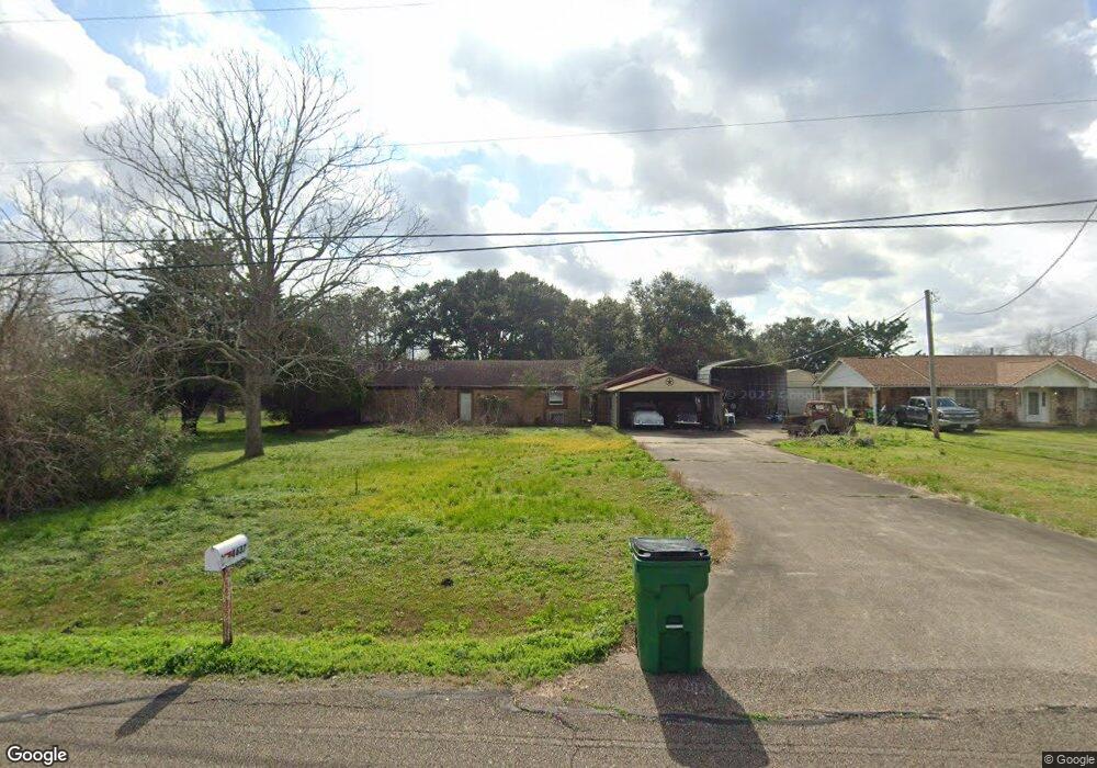
This home is located at 4637 County Road 138a, Alvin, TX 77511 and is currently estimated at $321,428, approximately $191 per square foot. 4637 County Road 138a is a home located in Brazoria County with nearby schools including Bob & Betty Nelson Elementary School, Fairview Junior High School, and Alvin High School.
Ownership History
Date
Name
Owned For
Owner Type
Purchase Details
Closed on
Dec 20, 1993
Sold by
Sikes Karen M and Sikes Travis G
Bought by
Landry Gary Dean
Current Estimated Value
Home Financials for this Owner
Home Financials are based on the most recent Mortgage that was taken out on this home.
Original Mortgage
$51,600
Interest Rate
7.06%
Create a Home Valuation Report for This Property
The Home Valuation Report is an in-depth analysis detailing your home's value as well as a comparison with similar homes in the area
Home Values in the Area
Average Home Value in this Area
Purchase History
| Date | Buyer | Sale Price | Title Company |
|---|---|---|---|
| Landry Gary Dean | -- | Houston Title Company |
Source: Public Records
Mortgage History
| Date | Status | Borrower | Loan Amount |
|---|---|---|---|
| Closed | Landry Gary Dean | $51,600 |
Source: Public Records
Tax History Compared to Growth
Tax History
| Year | Tax Paid | Tax Assessment Tax Assessment Total Assessment is a certain percentage of the fair market value that is determined by local assessors to be the total taxable value of land and additions on the property. | Land | Improvement |
|---|---|---|---|---|
| 2025 | $260 | $121,250 | $22,970 | $98,280 |
| 2023 | $260 | $117,540 | $71,280 | $46,260 |
| 2022 | $2,283 | $107,150 | $15,840 | $91,310 |
| 2021 | $2,663 | $120,000 | $25,340 | $94,660 |
| 2020 | $2,699 | $120,000 | $25,340 | $94,660 |
| 2019 | $3,387 | $164,880 | $19,010 | $145,870 |
| 2018 | $3,097 | $137,540 | $19,010 | $118,530 |
| 2017 | $2,860 | $137,540 | $19,010 | $118,530 |
| 2016 | $2,618 | $130,560 | $20,590 | $109,970 |
| 2015 | $1,028 | $100,630 | $15,840 | $84,790 |
| 2014 | $1,028 | $103,180 | $15,840 | $87,340 |
Source: Public Records
Map
Nearby Homes
- 1682 Herring Rd
- 0 Schroeder Lane B
- 10618 County Road 583b
- 2703 County Road 962d
- 4901 Highway 6
- 925 County Road 737b
- 694 County Road 941
- 3245 W Highway 6
- 3293 County Road 181
- 0 County Road 169 Off Nar
- 407 Riesling Dr
- 318 Merlot Dr
- 418 Riesling Dr
- 422 Riesling Dr
- 23310 Bordeaux Dr
- 426 Riesling Dr
- Emerson Plan at Martha's Vineyard
- Silverthorne Plan at Martha's Vineyard
- Snowmass Plan at Martha's Vineyard
- San Marcos Plan at Martha's Vineyard
- 5112 County Road 138b
- 5143 County Road 538
- 5143 County Rd
- 4636 County Road 138a
- 5126 County Road 138b
- 4544 County Road 138a
- 4544 Cr 138 A
- 4541 County Road 138a
- 5139 County Road 138b
- 5204 County Road 138b
- 5141 County Rd
- 4502 County Road 138d
- 5224 County Road 138b
- 4490 County Road 138a
- 4522 County Road 138a
- 5225 County Road 138b
- 4503 County Road 138d
- 4502 County Road 138e
- 4461 County Road 138a
- 4644 County Road 138e