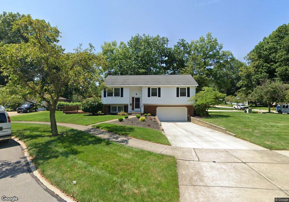
4638 Brendan Cir North Olmsted, OH 44070
Estimated Value: $291,100 - $321,000
3
Beds
2
Baths
1,750
Sq Ft
$175/Sq Ft
Est. Value
About This Home
This home is located at 4638 Brendan Cir, North Olmsted, OH 44070 and is currently estimated at $305,525, approximately $174 per square foot. 4638 Brendan Cir is a home located in Cuyahoga County with nearby schools including Maple Intermediate Elementary School, Pine Intermediate School, and North Olmsted Middle School.
Ownership History
Date
Name
Owned For
Owner Type
Purchase Details
Closed on
Oct 8, 2001
Sold by
Jares James R and Jares Louise M
Bought by
Jares James R and Jares Louise M
Current Estimated Value
Purchase Details
Closed on
Mar 19, 1987
Sold by
Fernandez Ernesto V and Fernandez Lolita
Bought by
Jares James R
Purchase Details
Closed on
Apr 18, 1985
Sold by
Palladino Fred
Bought by
Fernandez Ernesto and Fernandez Lolita
Purchase Details
Closed on
Aug 19, 1983
Sold by
Palladino Angelo
Bought by
Palladino Fred
Purchase Details
Closed on
Jun 7, 1983
Bought by
Palladino Angelo
Purchase Details
Closed on
Sep 20, 1982
Bought by
Continental Fed S&L Assoc
Purchase Details
Closed on
Apr 24, 1979
Bought by
Clear-Cor Development Inc
Purchase Details
Closed on
Jan 1, 1978
Bought by
Huntington Valley Est Inc
Create a Home Valuation Report for This Property
The Home Valuation Report is an in-depth analysis detailing your home's value as well as a comparison with similar homes in the area
Home Values in the Area
Average Home Value in this Area
Purchase History
| Date | Buyer | Sale Price | Title Company |
|---|---|---|---|
| Jares James R | -- | -- | |
| Jares James R | $85,000 | -- | |
| Fernandez Ernesto | $76,900 | -- | |
| Palladino Fred | -- | -- | |
| Palladino Angelo | $25,000 | -- | |
| Continental Fed S&L Assoc | -- | -- | |
| Clear-Cor Development Inc | $22,000 | -- | |
| Huntington Valley Est Inc | -- | -- |
Source: Public Records
Tax History Compared to Growth
Tax History
| Year | Tax Paid | Tax Assessment Tax Assessment Total Assessment is a certain percentage of the fair market value that is determined by local assessors to be the total taxable value of land and additions on the property. | Land | Improvement |
|---|---|---|---|---|
| 2024 | $4,781 | $79,555 | $16,975 | $62,580 |
| 2023 | $4,823 | $68,220 | $15,750 | $52,470 |
| 2022 | $4,831 | $68,220 | $15,750 | $52,470 |
| 2021 | $4,372 | $68,220 | $15,750 | $52,470 |
| 2020 | $3,879 | $55,480 | $12,810 | $42,670 |
| 2019 | $3,775 | $158,500 | $36,600 | $121,900 |
| 2018 | $3,665 | $55,480 | $12,810 | $42,670 |
| 2017 | $3,561 | $48,760 | $10,500 | $38,260 |
| 2016 | $3,530 | $48,760 | $10,500 | $38,260 |
| 2015 | $3,466 | $48,760 | $10,500 | $38,260 |
| 2014 | $3,466 | $47,810 | $10,290 | $37,520 |
Source: Public Records
Map
Nearby Homes
- 4666 Brendan Cir
- 4590 Brendan Ln
- 4505 Oak Cir
- 4849 Grace Rd Unit 121
- 22895 Mastick Rd
- 22934 Mastick Rd Unit 102
- 0 Mastick Rd Unit 5112571
- 22247 Mastick Rd
- 22534 Bard Ave
- 24326 Mastick Rd
- 24300 Mastick Rd
- 0 V L Clareshire Dr
- 4187 Columbia Rd Unit 126
- 22503 Sandy Ln
- 22506 Sharon Ln
- 5308 Columbia Rd
- 23993 Fairlawn Dr
- 5951 Rockport Ln
- 4514 Orchard Rd
- 3463 Clague Rd
- 23483 Elm Rd
- 4652 Brendan Cir
- 4639 Brendan Cir
- 4610 Brendan Ln
- 4617 Michael Ave
- 4629 Michael Ave
- 4641 Michael Ave
- 4600 Brendan Ln
- 23411 Elm Rd
- 4585 Michael Ave
- 4667 Brendan Cir
- 4611 Brendan Ln
- 4670 Brendan Cir
- 4653 Michael Ave
- 4653 Brendan Cir
- 4573 Michael Ave
- 23393 Elm Rd
- 4601 Brendan Ln
- 4665 Michael Ave
- 4561 Michael Ave