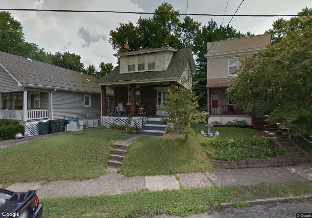
4638 Mcneil Ave Cincinnati, OH 45212
Estimated Value: $176,293 - $223,000
2
Beds
2
Baths
1,191
Sq Ft
$172/Sq Ft
Est. Value
About This Home
This home is located at 4638 Mcneil Ave, Cincinnati, OH 45212 and is currently estimated at $205,073, approximately $172 per square foot. 4638 Mcneil Ave is a home located in Hamilton County with nearby schools including Norwood High School, Cornerstone Christian Academy, and Immaculate Conception Academy.
Ownership History
Date
Name
Owned For
Owner Type
Purchase Details
Closed on
Aug 17, 1995
Sold by
Pendery Katherine L
Bought by
Pendery Robert Gary
Current Estimated Value
Home Financials for this Owner
Home Financials are based on the most recent Mortgage that was taken out on this home.
Original Mortgage
$52,000
Interest Rate
7.81%
Create a Home Valuation Report for This Property
The Home Valuation Report is an in-depth analysis detailing your home's value as well as a comparison with similar homes in the area
Home Values in the Area
Average Home Value in this Area
Purchase History
| Date | Buyer | Sale Price | Title Company |
|---|---|---|---|
| Pendery Robert Gary | -- | -- |
Source: Public Records
Mortgage History
| Date | Status | Borrower | Loan Amount |
|---|---|---|---|
| Closed | Pendery Robert Gary | $52,000 |
Source: Public Records
Tax History
| Year | Tax Paid | Tax Assessment Tax Assessment Total Assessment is a certain percentage of the fair market value that is determined by local assessors to be the total taxable value of land and additions on the property. | Land | Improvement |
|---|---|---|---|---|
| 2025 | $2,327 | $45,000 | $10,017 | $34,983 |
| 2023 | $2,321 | $45,000 | $10,017 | $34,983 |
| 2022 | $1,855 | $30,202 | $6,727 | $23,475 |
| 2021 | $1,803 | $30,202 | $6,727 | $23,475 |
| 2020 | $1,809 | $30,202 | $6,727 | $23,475 |
| 2019 | $1,715 | $26,492 | $5,901 | $20,591 |
| 2018 | $1,717 | $26,492 | $5,901 | $20,591 |
| 2017 | $1,619 | $26,492 | $5,901 | $20,591 |
| 2016 | $1,628 | $25,712 | $5,548 | $20,164 |
| 2015 | $1,451 | $25,712 | $5,548 | $20,164 |
| 2014 | $1,448 | $25,712 | $5,548 | $20,164 |
| 2013 | $1,523 | $27,353 | $5,901 | $21,452 |
Source: Public Records
Map
Nearby Homes
- 1819 Maple Ave
- 1827 Maple Ave
- 1808 Maple Ave
- 1812 Tilden Ave
- 1701 Sherman Ave
- 1762 Cleveland Ave
- 4635 Baker St
- 1816 Cleveland Ave
- 3 Baker Cir
- 1907 Crown Ave
- 1901 Sherman Ave
- 1952 Maple Ave
- 1841 Mills Ave
- 4719 Section Ave
- 2005 Crown Ave
- 1354 Avon Dr
- 2030 Elm Ave
- 2043 Lawrence Ave
- 2049 Sherman Ave
- 1266 Avon Dr
- 4636 Mcneil Ave
- 4640 Mcneil Ave
- 4634 Mcneil Ave
- 4642 Mcneil Ave
- 4644 Mcneil Ave
- 4630 Mcneil Ave
- 4648 Mcneil Ave
- 4645 Carter Ave
- 4643 Carter Ave
- 4633 Mcneil Ave
- 4641 Carter Ave
- 4629 Mcneil Ave
- 4647 Carter Ave
- 4624 Mcneil Ave
- 4635 Carter Ave
- 4622 Mcneil Ave
- 4649 Carter Ave
- 4652 Mcneil Ave
- 4641 Mcneil Ave
- 4620 Mcneil Ave
Your Personal Tour Guide
Ask me questions while you tour the home.