Estimated Value: $281,000 - $306,000
3
Beds
2
Baths
2,000
Sq Ft
$146/Sq Ft
Est. Value
About This Home
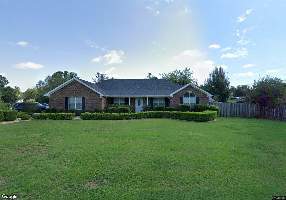
This home is located at 4638 Sheffield Dr, Evans, GA 30809 and is currently estimated at $292,786, approximately $146 per square foot. 4638 Sheffield Dr is a home located in Columbia County with nearby schools including Evans Elementary School, Evans Middle School, and Evans High School.
Ownership History
Date
Name
Owned For
Owner Type
Purchase Details
Closed on
Apr 1, 2002
Sold by
Delacruz Dominic
Bought by
Do Dung
Current Estimated Value
Purchase Details
Closed on
Apr 1, 2001
Sold by
Do Dung
Bought by
Do Dung and Nguyen Charlie
Home Financials for this Owner
Home Financials are based on the most recent Mortgage that was taken out on this home.
Original Mortgage
$100,000
Interest Rate
6.8%
Create a Home Valuation Report for This Property
The Home Valuation Report is an in-depth analysis detailing your home's value as well as a comparison with similar homes in the area
Home Values in the Area
Average Home Value in this Area
Purchase History
| Date | Buyer | Sale Price | Title Company |
|---|---|---|---|
| Do Dung | $127,000 | -- | |
| Do Dung | -- | -- |
Source: Public Records
Mortgage History
| Date | Status | Borrower | Loan Amount |
|---|---|---|---|
| Previous Owner | Do Dung | $100,000 |
Source: Public Records
Tax History
| Year | Tax Paid | Tax Assessment Tax Assessment Total Assessment is a certain percentage of the fair market value that is determined by local assessors to be the total taxable value of land and additions on the property. | Land | Improvement |
|---|---|---|---|---|
| 2025 | $2,684 | $112,035 | $23,574 | $88,461 |
| 2024 | $2,695 | $107,482 | $23,574 | $83,908 |
| 2023 | $2,695 | $110,634 | $20,406 | $90,228 |
| 2022 | $2,471 | $94,794 | $20,406 | $74,388 |
| 2021 | $2,478 | $90,950 | $19,119 | $71,831 |
| 2020 | $2,174 | $78,131 | $16,941 | $61,190 |
| 2019 | $2,246 | $80,710 | $17,604 | $63,106 |
| 2018 | $2,007 | $71,855 | $15,404 | $56,451 |
| 2017 | $1,979 | $70,597 | $15,304 | $55,293 |
| 2016 | $1,864 | $68,952 | $14,180 | $54,772 |
| 2015 | $1,884 | $69,564 | $13,980 | $55,584 |
| 2014 | $1,725 | $62,910 | $13,280 | $49,630 |
Source: Public Records
Map
Nearby Homes
- 4622 Brittany Dr
- 5068 Hereford Farm Rd
- 4560 Mulberry Creek Dr
- 456 Connemara Trail
- 625 Dunloe Cir
- 4712 Walnut Hill Dr
- 385 Canterbury Dr
- 599 Windward Ct
- 604 Kimberley Place
- 4421 Hereford Farm Rd
- 358 Canterbury Dr
- 4517 Glennwood Dr
- 4535 Glenda Ln
- 648 River Oaks Ln
- 4558 Glenda Ln
- 642 Kimberley Place
- 525 Pheasant Run Dr
- 245 Belair Rd N
- 736 Low Meadow Dr
- 4724 Canterbury Ln
- 4636 Sheffield Dr
- 4634 Sheffield Dr
- 4641 Sheffield Dr
- 4639 Sheffield Dr
- 4632 Sheffield Dr
- 4637 Sheffield Dr
- 4635 Sheffield Dr
- 526 Gibbs Rd
- 4630 Sheffield Dr
- 4643 Sheffield Dr
- 4628 Sheffield Dr
- 4633 Sheffield Dr
- 4631 Sheffield Dr
- 4626 Sheffield Dr
- 4624 Sheffield Dr
- 4629 Sheffield Dr
- 4598 Hebbard Way
- 4596 Hebbard Way
- 4627 Sheffield Dr
- 4594 Hebbard Way
Your Personal Tour Guide
Ask me questions while you tour the home.