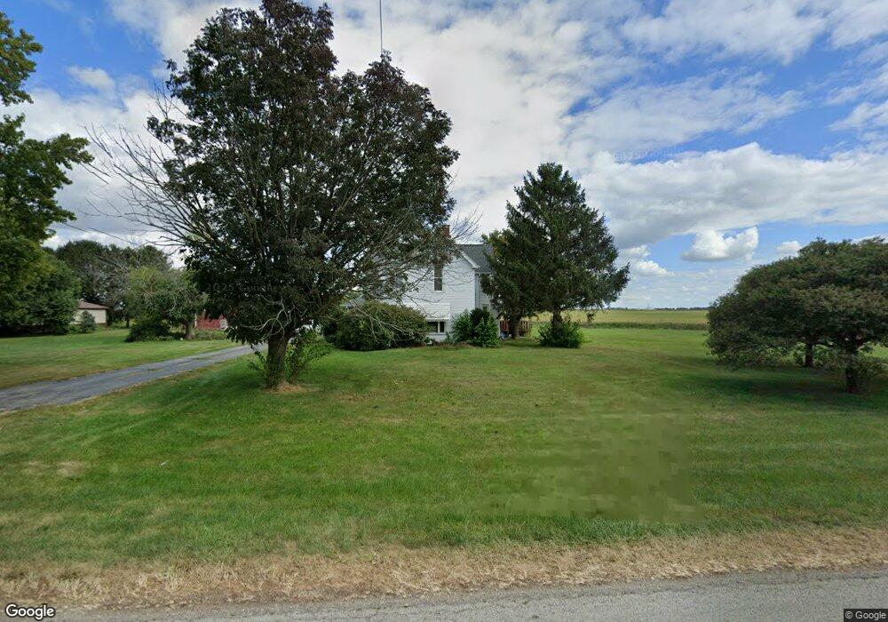
4639 S County Road 0 Ew Frankfort, IN 46041
Estimated Value: $275,000 - $340,000
4
Beds
2
Baths
2,320
Sq Ft
$133/Sq Ft
Est. Value
About This Home
This home is located at 4639 S County Road 0 Ew, Frankfort, IN 46041 and is currently estimated at $308,088, approximately $132 per square foot. 4639 S County Road 0 Ew is a home located in Clinton County with nearby schools including Clinton Prairie Elementary School and Clinton Prairie Junior/Senior High School.
Ownership History
Date
Name
Owned For
Owner Type
Purchase Details
Closed on
Feb 5, 2009
Sold by
Guffy James D and Guffy Teresa A
Bought by
Thomas Randal J and Thomas Guadalupe
Current Estimated Value
Home Financials for this Owner
Home Financials are based on the most recent Mortgage that was taken out on this home.
Original Mortgage
$112,000
Outstanding Balance
$70,646
Interest Rate
5.06%
Mortgage Type
New Conventional
Estimated Equity
$237,442
Purchase Details
Closed on
Aug 31, 2006
Sold by
Brewer Kent A and Brewer Kimberly J
Bought by
Guffy James D and Guffy Teresa A
Home Financials for this Owner
Home Financials are based on the most recent Mortgage that was taken out on this home.
Original Mortgage
$95,000
Interest Rate
6.7%
Mortgage Type
New Conventional
Create a Home Valuation Report for This Property
The Home Valuation Report is an in-depth analysis detailing your home's value as well as a comparison with similar homes in the area
Home Values in the Area
Average Home Value in this Area
Purchase History
| Date | Buyer | Sale Price | Title Company |
|---|---|---|---|
| Thomas Randal J | $132,500 | Lawyers Title | |
| Thomas Randal J | -- | None Available | |
| Guffy James D | -- | None Available |
Source: Public Records
Mortgage History
| Date | Status | Borrower | Loan Amount |
|---|---|---|---|
| Open | Thomas Randal J | $112,000 | |
| Previous Owner | Guffy James D | $95,000 |
Source: Public Records
Tax History Compared to Growth
Tax History
| Year | Tax Paid | Tax Assessment Tax Assessment Total Assessment is a certain percentage of the fair market value that is determined by local assessors to be the total taxable value of land and additions on the property. | Land | Improvement |
|---|---|---|---|---|
| 2024 | $1,591 | $203,200 | $29,800 | $173,400 |
| 2023 | $1,548 | $196,000 | $29,800 | $166,200 |
| 2022 | $1,351 | $196,000 | $29,800 | $166,200 |
| 2021 | $1,092 | $158,100 | $29,800 | $128,300 |
| 2020 | $1,118 | $158,500 | $29,800 | $128,700 |
| 2019 | $860 | $139,600 | $29,800 | $109,800 |
| 2018 | $829 | $139,600 | $29,800 | $109,800 |
| 2017 | $729 | $135,000 | $29,800 | $105,200 |
| 2016 | $669 | $130,200 | $29,800 | $100,400 |
| 2014 | $529 | $122,800 | $29,800 | $93,000 |
Source: Public Records
Map
Nearby Homes
- 7147 S Co Road 130 W
- 2005 E Kelley Rd
- 1816 Southridge Dr
- 1814 Southridge Dr
- 1835 Southridge Dr
- 1017 Coin Ln
- 608 Ann St
- 401 Knox St
- 2520 W Blubaugh Ave
- 302 W Freeman St
- 901 Harvard Terrace
- 862 S Jackson St
- 1432 S County Road 200 W
- 353 Harvard Terrace
- 258 Main Ave Unit 1-8
- 1309 Lea Ct
- 820 Hackberry Ct
- 829 Sunrise Dr Unit 117
- 851 Sunrise Dr Unit 123
- 845 Sunrise Dr Unit 121
- 4644 S County Road 0 Ew
- 4626 S County Road 0 Ew
- 4601 S County Road 0 Ew
- 4608 S County Road 0 Ew
- 4464 S County Road 0 Ew
- 4590 S County Road 0 Ew
- 4570 S County Road 0 Ew
- 4682 S County Road 0 Ew
- 4552 S County Road 0 Ew
- 4534 S County Road 0 Ew
- 4514 S County Road 0 Ew
- 4452 S Co Road 0 Ew
- 4345 S County Road 0 Ew
- 125 E County Road 430 S
- 157 E County Road 430 S
- 4289 S County Road 0 Ew
- 4267 S Co Road 0 Ew
- 4294 S State Road 39
- 4267 S County Road 0 Ew
- 4268 S State Road 39