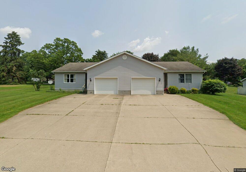
4639 Wilson Rd Wooster, OH 44691
Estimated Value: $276,000 - $318,936
4
Beds
2
Baths
2,176
Sq Ft
$139/Sq Ft
Est. Value
About This Home
This home is located at 4639 Wilson Rd, Wooster, OH 44691 and is currently estimated at $303,234, approximately $139 per square foot. 4639 Wilson Rd is a home located in Wayne County with nearby schools including Kean Elementary School, Parkview Elementary School, and Edgewood Middle School.
Ownership History
Date
Name
Owned For
Owner Type
Purchase Details
Closed on
Dec 15, 2021
Sold by
Oliver Mcclintock Harold
Bought by
Harold O Mcclintock Living Trust
Current Estimated Value
Purchase Details
Closed on
Jul 5, 2005
Sold by
Rutt Donald L
Bought by
Mcclintock Harold O and Harold O Mcclintock Living Trust
Home Financials for this Owner
Home Financials are based on the most recent Mortgage that was taken out on this home.
Original Mortgage
$75,000
Interest Rate
5.75%
Mortgage Type
Fannie Mae Freddie Mac
Purchase Details
Closed on
Jul 1, 1999
Sold by
Hershey Russell
Bought by
Rutt Donald L
Create a Home Valuation Report for This Property
The Home Valuation Report is an in-depth analysis detailing your home's value as well as a comparison with similar homes in the area
Home Values in the Area
Average Home Value in this Area
Purchase History
| Date | Buyer | Sale Price | Title Company |
|---|---|---|---|
| Harold O Mcclintock Living Trust | -- | -- | |
| Mcclintock Harold O | $154,000 | Midland Title | |
| Rutt Donald L | $25,000 | -- |
Source: Public Records
Mortgage History
| Date | Status | Borrower | Loan Amount |
|---|---|---|---|
| Previous Owner | Mcclintock Harold O | $75,000 |
Source: Public Records
Tax History Compared to Growth
Tax History
| Year | Tax Paid | Tax Assessment Tax Assessment Total Assessment is a certain percentage of the fair market value that is determined by local assessors to be the total taxable value of land and additions on the property. | Land | Improvement |
|---|---|---|---|---|
| 2024 | $3,622 | $85,290 | $11,680 | $73,610 |
| 2023 | $3,622 | $85,290 | $11,680 | $73,610 |
| 2022 | $3,320 | $62,250 | $8,520 | $53,730 |
| 2021 | $2,909 | $62,250 | $8,520 | $53,730 |
| 2020 | $2,760 | $62,250 | $8,520 | $53,730 |
| 2019 | $2,585 | $56,840 | $8,380 | $48,460 |
| 2018 | $2,593 | $56,840 | $8,380 | $48,460 |
| 2017 | $2,603 | $56,840 | $8,380 | $48,460 |
| 2016 | $2,676 | $54,660 | $8,060 | $46,600 |
| 2015 | $2,628 | $54,660 | $8,060 | $46,600 |
| 2014 | $2,629 | $54,660 | $8,060 | $46,600 |
| 2013 | $2,520 | $52,260 | $8,030 | $44,230 |
Source: Public Records
Map
Nearby Homes
- 4520 Country Ln
- 2024 E Smithville Western Rd
- 4830 Oasis Ave
- 4852 Oasis Ave
- 2102 E Smithville Western Rd
- 4897 Oasis Ave
- 2068 Prosperity Way
- 4874 Oasis Ave
- 4859 Oasis Ave
- 2082 E Prosperity Way
- 4917 Oasis Ave
- 4937 Oasis Ave
- 4957 Oasis Ave
- 1469 Stratford Way
- 3569 Cleveland Rd
- 2359 Schellin Rd
- 2667 Estate Dr
- 4475 Hunters Chase Ln
- 2330 Schellin Rd
- 4356 Hunters Chase Ln