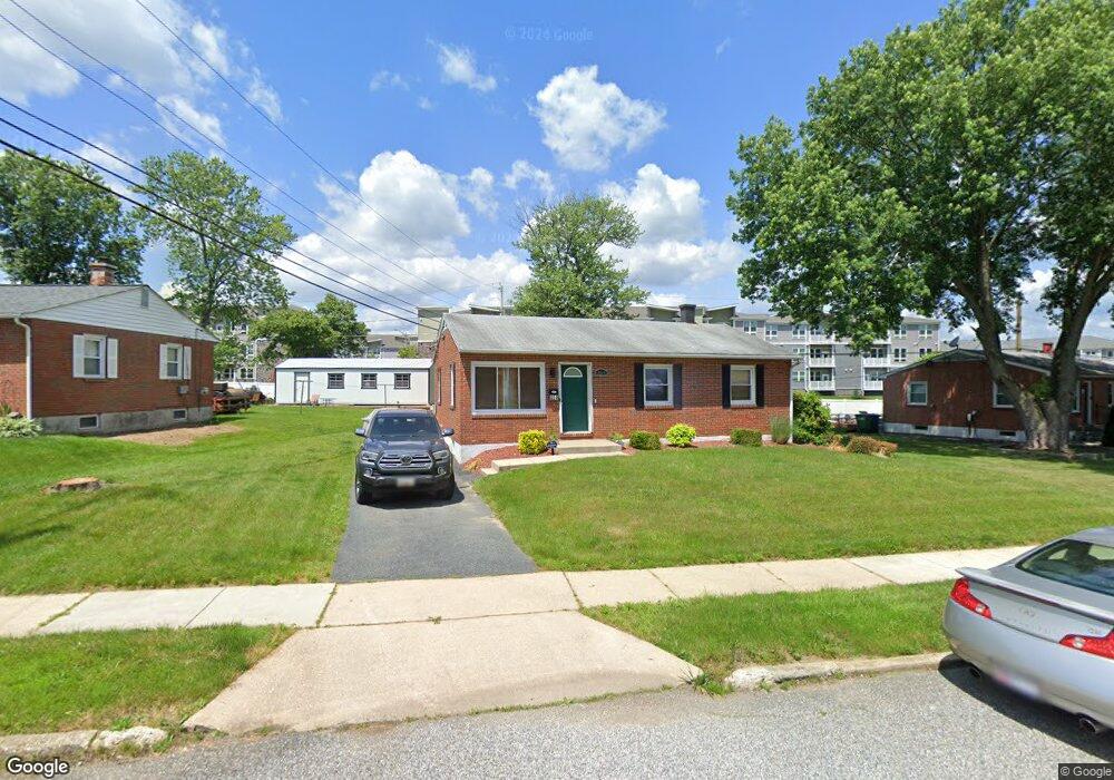
464 Doris Cir Aberdeen, MD 21001
Estimated Value: $208,000 - $287,000
Studio
1
Bath
962
Sq Ft
$261/Sq Ft
Est. Value
About This Home
This home is located at 464 Doris Cir, Aberdeen, MD 21001 and is currently estimated at $250,921, approximately $260 per square foot. 464 Doris Cir is a home located in Harford County with nearby schools including Roye-Williams Elementary School, Aberdeen Middle School, and Aberdeen High School.
Ownership History
Date
Name
Owned For
Owner Type
Purchase Details
Closed on
Nov 29, 2004
Sold by
Goedeke Michael S
Bought by
Walters Michael
Current Estimated Value
Purchase Details
Closed on
Sep 24, 2004
Sold by
Goedeke Michael S
Bought by
Walters Michael
Purchase Details
Closed on
Jun 13, 2000
Sold by
Tipton Tok Cha
Bought by
Goedeke Michael S and Goedeke Bridget L
Purchase Details
Closed on
May 24, 1990
Sold by
Eures Patrick A
Bought by
Tipton Tok Cha
Home Financials for this Owner
Home Financials are based on the most recent Mortgage that was taken out on this home.
Original Mortgage
$28,500
Interest Rate
10.37%
Create a Home Valuation Report for This Property
The Home Valuation Report is an in-depth analysis detailing your home's value as well as a comparison with similar homes in the area
Home Values in the Area
Average Home Value in this Area
Purchase History
| Date | Buyer | Sale Price | Title Company |
|---|---|---|---|
| Walters Michael | $140,000 | -- | |
| Walters Michael | $140,000 | -- | |
| Goedeke Michael S | $97,000 | -- | |
| Tipton Tok Cha | $78,500 | -- |
Source: Public Records
Mortgage History
| Date | Status | Borrower | Loan Amount |
|---|---|---|---|
| Previous Owner | Tipton Tok Cha | $28,500 | |
| Closed | Walters Michael | -- |
Source: Public Records
Tax History
| Year | Tax Paid | Tax Assessment Tax Assessment Total Assessment is a certain percentage of the fair market value that is determined by local assessors to be the total taxable value of land and additions on the property. | Land | Improvement |
|---|---|---|---|---|
| 2025 | $1,574 | $174,933 | $0 | $0 |
| 2024 | $1,574 | $165,067 | $0 | $0 |
| 2023 | $1,480 | $155,200 | $63,000 | $92,200 |
| 2022 | $1,445 | $151,533 | $0 | $0 |
| 2021 | $1,450 | $147,867 | $0 | $0 |
| 2020 | $1,450 | $144,200 | $63,000 | $81,200 |
| 2019 | $1,450 | $144,200 | $63,000 | $81,200 |
| 2018 | $1,437 | $144,200 | $63,000 | $81,200 |
| 2017 | $1,449 | $145,400 | $0 | $0 |
| 2016 | -- | $145,400 | $0 | $0 |
| 2015 | $1,555 | $145,400 | $0 | $0 |
| 2014 | $1,555 | $160,100 | $0 | $0 |
Source: Public Records
Map
Nearby Homes
- 662 Andrews Rd
- 458 Roberts Way
- 627 Northgate Rd
- 302 Graceford Dr
- 607 Northgate Rd
- 521 Beards Hill Rd
- 0 Paradise Rd
- 479 Manor Rd
- 709 Paul Dr
- 4 Morning Dove Ct
- 3605 Hays Rd
- 721 Paul Dr
- 716 Paradise Rd
- 0 Arthur Rd Unit MDHR2050208
- 555 Beards Hill Rd
- 631 W Bel Air Ave
- 812 Long Dr Unit F
- 299 Mount Royal Ave
- 412 Grasmere Dr
- 687 Plater St
Your Personal Tour Guide
Ask me questions while you tour the home.