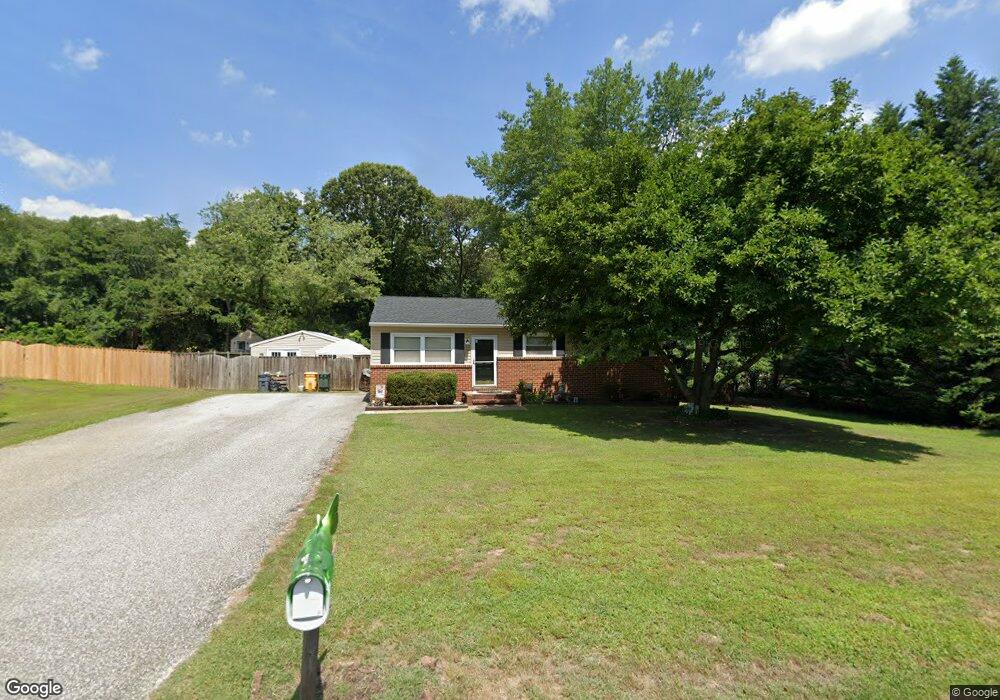
464 Martin Dr Millersville, MD 21108
Estimated Value: $396,000 - $415,000
--
Bed
2
Baths
1,040
Sq Ft
$390/Sq Ft
Est. Value
About This Home
This home is located at 464 Martin Dr, Millersville, MD 21108 and is currently estimated at $405,620, approximately $390 per square foot. 464 Martin Dr is a home located in Anne Arundel County with nearby schools including Southgate Elementary School, Old Mill Middle School North, and Old Mill High School.
Ownership History
Date
Name
Owned For
Owner Type
Purchase Details
Closed on
Sep 10, 1999
Sold by
Pantleo Linda S
Bought by
Gosnell Chris A and Gosnell Valerie B
Current Estimated Value
Purchase Details
Closed on
Jul 15, 1997
Sold by
Household Finance Corp Iii
Bought by
Pantleo Linda S
Purchase Details
Closed on
Feb 25, 1997
Sold by
Riley Thos L
Bought by
Household Finance Corp Iii
Create a Home Valuation Report for This Property
The Home Valuation Report is an in-depth analysis detailing your home's value as well as a comparison with similar homes in the area
Home Values in the Area
Average Home Value in this Area
Purchase History
| Date | Buyer | Sale Price | Title Company |
|---|---|---|---|
| Gosnell Chris A | $121,000 | -- | |
| Pantleo Linda S | $109,900 | -- | |
| Household Finance Corp Iii | $50,000 | -- |
Source: Public Records
Mortgage History
| Date | Status | Borrower | Loan Amount |
|---|---|---|---|
| Closed | Pantleo Linda S | -- |
Source: Public Records
Tax History Compared to Growth
Tax History
| Year | Tax Paid | Tax Assessment Tax Assessment Total Assessment is a certain percentage of the fair market value that is determined by local assessors to be the total taxable value of land and additions on the property. | Land | Improvement |
|---|---|---|---|---|
| 2025 | $2,734 | $363,000 | -- | -- |
| 2024 | $2,734 | $348,200 | $248,400 | $99,800 |
| 2023 | $2,120 | $337,767 | $0 | $0 |
| 2022 | $2,482 | $327,333 | $0 | $0 |
| 2021 | $2,362 | $316,900 | $216,400 | $100,500 |
| 2020 | $2,362 | $313,100 | $0 | $0 |
| 2019 | $2,329 | $309,300 | $0 | $0 |
| 2018 | $3,098 | $305,500 | $206,400 | $99,100 |
| 2017 | $2,195 | $286,233 | $0 | $0 |
| 2016 | -- | $266,967 | $0 | $0 |
| 2015 | -- | $247,700 | $0 | $0 |
| 2014 | -- | $247,700 | $0 | $0 |
Source: Public Records
Map
Nearby Homes
- 0 Connors Ln
- 8262 Kippis Rd
- 8297 Kippis Rd
- 8206 Derrymore Ct
- 8253 Rupert Rd S
- 8251 Rupert Rd S
- 8333 Kippis Rd
- 460 Marianna Dr
- 307 Sorel Ct
- 401 Green Grove Ct
- 8224 Bernard Dr N
- 601 Brightwood Rd
- 759 Stacy Oak Way
- 15 Tremont Dr
- 8011 Horicon Point Dr
- 584 Brightview Dr
- 266 Nathan Way
- 258 Nathan Way
- 258 Poplar Rd
- 2664 Carver Rd