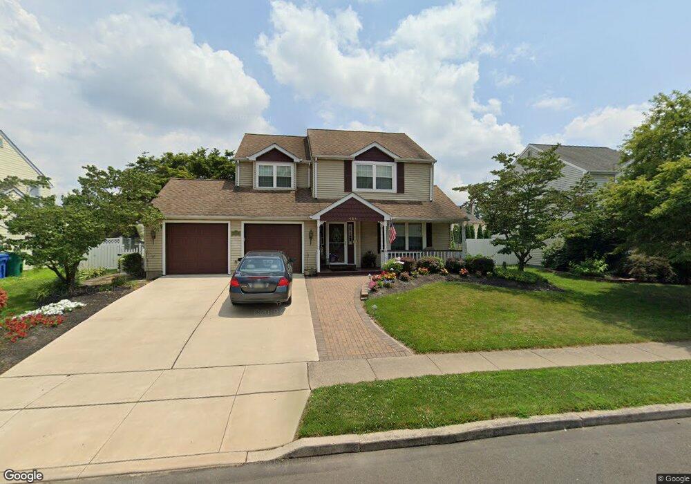
464 Pheasant Ln Fairless Hills, PA 19030
Estimated Value: $488,286 - $554,000
--
Bed
3
Baths
2,194
Sq Ft
$237/Sq Ft
Est. Value
About This Home
This home is located at 464 Pheasant Ln, Fairless Hills, PA 19030 and is currently estimated at $519,072, approximately $236 per square foot. 464 Pheasant Ln is a home located in Bucks County with nearby schools including Truman Senior High School, The Pen Ryn School, and Faith Baptist Christian Academy.
Ownership History
Date
Name
Owned For
Owner Type
Purchase Details
Closed on
Aug 1, 1997
Sold by
Fritz Christine M
Bought by
Callanan Timothy T and Callanan Teresa A
Current Estimated Value
Home Financials for this Owner
Home Financials are based on the most recent Mortgage that was taken out on this home.
Original Mortgage
$128,000
Outstanding Balance
$19,220
Interest Rate
7.56%
Estimated Equity
$499,852
Purchase Details
Closed on
Oct 1, 1986
Bought by
Fritz Christine M
Create a Home Valuation Report for This Property
The Home Valuation Report is an in-depth analysis detailing your home's value as well as a comparison with similar homes in the area
Home Values in the Area
Average Home Value in this Area
Purchase History
| Date | Buyer | Sale Price | Title Company |
|---|---|---|---|
| Callanan Timothy T | $160,000 | Lawyers Title Insurance Corp | |
| Fritz Christine M | $110,800 | -- |
Source: Public Records
Mortgage History
| Date | Status | Borrower | Loan Amount |
|---|---|---|---|
| Open | Callanan Timothy T | $128,000 |
Source: Public Records
Tax History Compared to Growth
Tax History
| Year | Tax Paid | Tax Assessment Tax Assessment Total Assessment is a certain percentage of the fair market value that is determined by local assessors to be the total taxable value of land and additions on the property. | Land | Improvement |
|---|---|---|---|---|
| 2025 | $7,799 | $28,720 | $5,200 | $23,520 |
| 2024 | $7,799 | $28,720 | $5,200 | $23,520 |
| 2023 | $7,742 | $28,720 | $5,200 | $23,520 |
| 2022 | $7,742 | $28,720 | $5,200 | $23,520 |
| 2021 | $7,742 | $28,720 | $5,200 | $23,520 |
| 2020 | $7,742 | $28,720 | $5,200 | $23,520 |
| 2019 | $7,713 | $28,720 | $5,200 | $23,520 |
| 2018 | $7,589 | $28,720 | $5,200 | $23,520 |
| 2017 | $7,474 | $28,720 | $5,200 | $23,520 |
| 2016 | $7,474 | $28,720 | $5,200 | $23,520 |
| 2015 | $5,522 | $28,720 | $5,200 | $23,520 |
| 2014 | $5,522 | $28,720 | $5,200 | $23,520 |
Source: Public Records
Map
Nearby Homes
- 525 Nel Dr
- 657 S Queen Anne Dr
- 243 Wyandotte Rd
- 513 Valmore Rd Unit L
- 208 Suffolk Rd
- 524 Ehret Rd
- 225 Yorkshire Rd Unit HIII
- 340 Appletree Dr
- 331 Doone Place
- 508 Fairhurst Rd
- 14 Appletree Dr
- 20 Appletree Dr
- 417 Chelsea Rd
- 9 Mulberry Ln
- 402 Stanford Rd
- 50 Autumn Ln
- 248 N Oxford Valley Rd
- 713 Warwick Rd
- 180 Andover Rd Unit A
- 28 Rainbow Ln
- 462 Pheasant Ln
- 466 Pheasant Ln
- 104 Antler Ct
- 106 Antler Ct
- 460 Pheasant Ln
- 465 Pheasant Ln
- 463 Pheasant Ln
- 461 Pheasant Ln
- 467 Pheasant Ln
- 102 Antler Ct
- 458 Pheasant Ln
- 472 Pheasant Ln
- 108 Antler Ct
- 459 Pheasant Ln
- 469 Pheasant Ln
- 474 Pheasant Ln
- 218 Durham Ct
- 471 Pheasant Ln
- 456 Pheasant Ln
- 100 Antler Ct