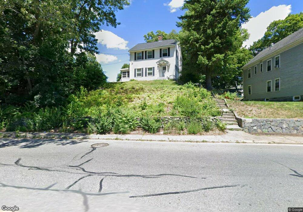
464 Rogers St Lowell, MA 01852
Belvidere NeighborhoodEstimated Value: $494,000 - $668,000
3
Beds
1
Bath
1,392
Sq Ft
$394/Sq Ft
Est. Value
About This Home
This home is located at 464 Rogers St, Lowell, MA 01852 and is currently estimated at $548,845, approximately $394 per square foot. 464 Rogers St is a home located in Middlesex County with nearby schools including Moody Elementary School, Abraham Lincoln Elementary School, and Greenhalge Elementary School.
Ownership History
Date
Name
Owned For
Owner Type
Purchase Details
Closed on
May 31, 2018
Sold by
Trejo Holly J
Bought by
Stcroix Christopher and Stcroix Ashley
Current Estimated Value
Home Financials for this Owner
Home Financials are based on the most recent Mortgage that was taken out on this home.
Original Mortgage
$176,000
Outstanding Balance
$151,866
Interest Rate
4.4%
Mortgage Type
New Conventional
Estimated Equity
$396,979
Purchase Details
Closed on
Jan 2, 2004
Sold by
Moloney James B
Bought by
Trejo Holly Jean
Create a Home Valuation Report for This Property
The Home Valuation Report is an in-depth analysis detailing your home's value as well as a comparison with similar homes in the area
Home Values in the Area
Average Home Value in this Area
Purchase History
| Date | Buyer | Sale Price | Title Company |
|---|---|---|---|
| Stcroix Christopher | $220,000 | -- | |
| Trejo Holly Jean | -- | -- | |
| Trejo Holly Jean | -- | -- |
Source: Public Records
Mortgage History
| Date | Status | Borrower | Loan Amount |
|---|---|---|---|
| Open | Stcroix Christopher | $176,000 | |
| Closed | Trejo Holly Jean | $176,000 |
Source: Public Records
Tax History Compared to Growth
Tax History
| Year | Tax Paid | Tax Assessment Tax Assessment Total Assessment is a certain percentage of the fair market value that is determined by local assessors to be the total taxable value of land and additions on the property. | Land | Improvement |
|---|---|---|---|---|
| 2025 | $5,159 | $449,400 | $242,800 | $206,600 |
| 2024 | $5,163 | $433,500 | $226,900 | $206,600 |
| 2023 | $4,820 | $388,100 | $197,200 | $190,900 |
| 2022 | $4,362 | $343,700 | $179,300 | $164,400 |
| 2021 | $4,061 | $301,700 | $155,800 | $145,900 |
| 2020 | $3,948 | $295,500 | $155,800 | $139,700 |
| 2019 | $3,972 | $282,900 | $155,000 | $127,900 |
| 2018 | $3,920 | $272,400 | $147,500 | $124,900 |
| 2017 | $3,800 | $254,700 | $136,900 | $117,800 |
| 2016 | $3,696 | $243,800 | $126,000 | $117,800 |
| 2015 | $3,585 | $231,600 | $126,000 | $105,600 |
| 2013 | $3,575 | $238,200 | $139,200 | $99,000 |
Source: Public Records
Map
Nearby Homes
- 97 Hoyt Ave
- 18 Whitehead Ave
- 44 Hanks St
- 90 Roper St Unit G
- 53 Fairmount St
- 4 Glenmere St
- 216 Nesmith St Unit 2
- 1081 Lawrence St
- 70 Enfield St
- 288 Hovey St
- 1199 Lawrence St
- 111 Draper St
- 112 Fort Hill Ave
- 5 Lenox St Unit 2
- 80 Rogers St Unit 204
- 80 Rogers St Unit 304
- 45 Luce St
- 197 Moore St
- 318 Andover St
- 22 Juniper St
- 468 Rogers St
- 450 Rogers St
- 327 Fairmount St
- 480 Rogers St
- 319 Fairmount St
- 331 Fairmount St
- 123 Rogers St
- 311 Fairmount St
- 432 Rogers St
- 22 Haines Ave
- 484 Rogers St
- 339 Fairmount St
- 305 Fairmount St
- 30 Haines Ave
- 428 Rogers St
- 428 Rogers St Unit 428
- 320 Fairmount St
- 34 Haines Ave
- 318 Fairmount St
- 297 Fairmount St