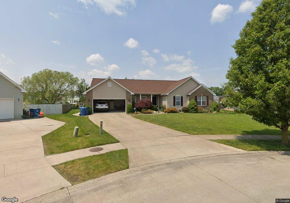
4640 Quincy Adams Ct Lorain, OH 44053
Estimated Value: $331,846 - $401,000
3
Beds
2
Baths
2,288
Sq Ft
$161/Sq Ft
Est. Value
About This Home
This home is located at 4640 Quincy Adams Ct, Lorain, OH 44053 and is currently estimated at $368,462, approximately $161 per square foot. 4640 Quincy Adams Ct is a home located in Lorain County with nearby schools including Powers Elementary School, Walter G. Nord Middle School, and Amherst Junior High School.
Ownership History
Date
Name
Owned For
Owner Type
Purchase Details
Closed on
May 25, 2005
Sold by
Oster Construction Inc
Bought by
Hammer David H and Hammer Patricia A
Current Estimated Value
Home Financials for this Owner
Home Financials are based on the most recent Mortgage that was taken out on this home.
Original Mortgage
$213,090
Interest Rate
5.87%
Mortgage Type
Fannie Mae Freddie Mac
Create a Home Valuation Report for This Property
The Home Valuation Report is an in-depth analysis detailing your home's value as well as a comparison with similar homes in the area
Home Values in the Area
Average Home Value in this Area
Purchase History
| Date | Buyer | Sale Price | Title Company |
|---|---|---|---|
| Hammer David H | $266,400 | Millennium Title Agency Ltd |
Source: Public Records
Mortgage History
| Date | Status | Borrower | Loan Amount |
|---|---|---|---|
| Closed | Hammer David H | $213,090 |
Source: Public Records
Tax History
| Year | Tax Paid | Tax Assessment Tax Assessment Total Assessment is a certain percentage of the fair market value that is determined by local assessors to be the total taxable value of land and additions on the property. | Land | Improvement |
|---|---|---|---|---|
| 2024 | $509 | $22,050 | $22,050 | -- |
| 2023 | $489 | $19,103 | $19,103 | $0 |
| 2022 | $489 | $19,103 | $19,103 | $0 |
| 2021 | $491 | $19,103 | $19,103 | $0 |
| 2020 | $422 | $16,630 | $16,630 | $0 |
| 2019 | $414 | $16,630 | $16,630 | $0 |
| 2018 | $3,246 | $69,770 | $16,630 | $53,140 |
| 2017 | $3,274 | $67,550 | $17,400 | $50,150 |
| 2016 | $3,251 | $67,550 | $17,400 | $50,150 |
| 2015 | $3,142 | $67,550 | $17,400 | $50,150 |
| 2014 | $3,151 | $67,550 | $17,400 | $50,150 |
| 2013 | $3,160 | $67,550 | $17,400 | $50,150 |
Source: Public Records
Map
Nearby Homes
- 3932 Courtyard Dr
- 4513 Vineyard Dr
- 4195 Jenee Dr
- 4497 Bellow Dr
- 4459 Bellow Dr
- 4253 Santina Way
- 3794 Freedom Place
- 4518 Santina Way
- 3784 Freedom Place
- 3774 Freedom Place Unit A
- 3772 Freedom Place Unit B
- 3770 Freedom Place Unit C
- 3769 Freedom Place
- 1260 Meadowview Ln
- 110 Habant Dr
- 3768 Martins Run Dr
- 3502 Magnolia Dr
- 3633 Reserve Trail
- 4201 Meadow Lark Dr
- 4872 Leavitt Rd
- 4648 Quincy Adams Ct
- 4632 Quincy Adams Ct
- 4661 Crossing Trail
- 4667 Crossing Trail
- 4655 Crossing Trail
- 4624 Quincy Adams Ct
- 4673 Crossing Trail
- 4649 Crossing Trail
- 4651 Quincy Adams Ct
- 4679 Crossing Trail
- 4616 Quincy Adams Ct
- 4643 Crossing Trail
- 4627 Quincy Adams Ct
- 4635 Quincy Adams Ct
- 4643 Quincy Adams Ct
- 4685 Crossing Trail
- 4619 Quincy Adams Ct
- 4608 Quincy Adams Ct
- 4637 Crossing Trail
- 4660 Crossing Trail
Your Personal Tour Guide
Ask me questions while you tour the home.