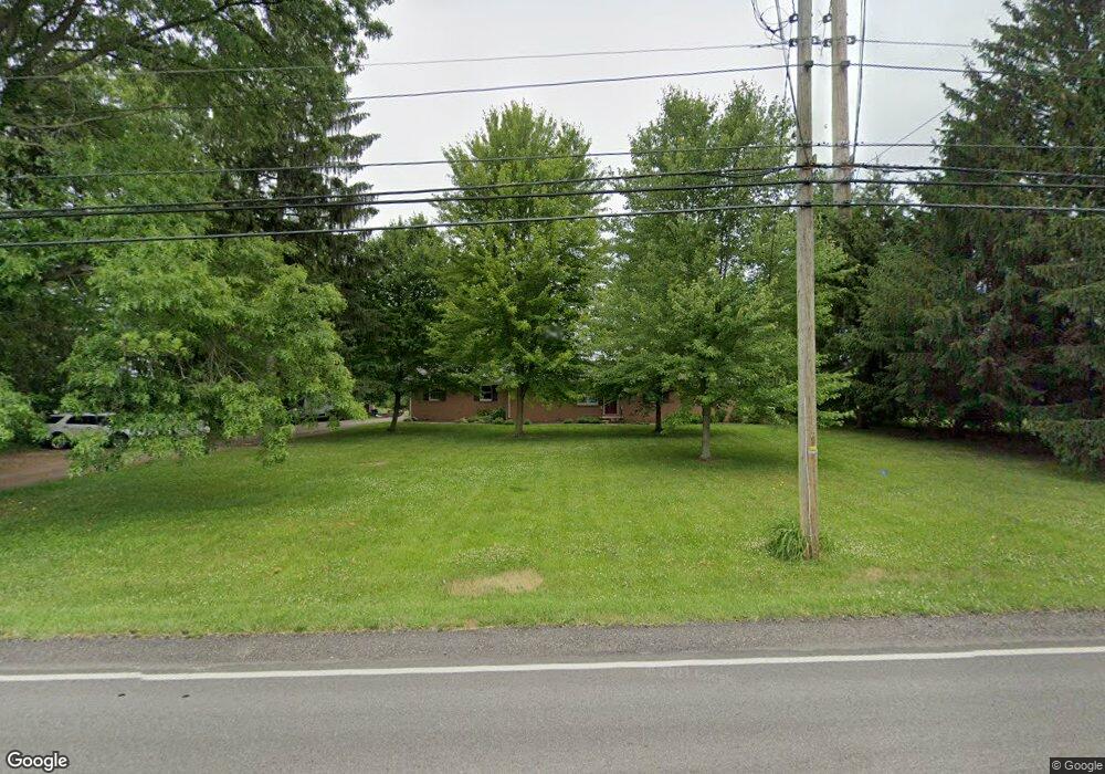
4641 Tallmadge Rd Rootstown, OH 44272
Estimated Value: $243,000 - $291,000
3
Beds
3
Baths
1,352
Sq Ft
$194/Sq Ft
Est. Value
About This Home
This home is located at 4641 Tallmadge Rd, Rootstown, OH 44272 and is currently estimated at $262,805, approximately $194 per square foot. 4641 Tallmadge Rd is a home located in Portage County with nearby schools including Rootstown Middle School - Schnee Building and Rootstown High School.
Ownership History
Date
Name
Owned For
Owner Type
Purchase Details
Closed on
Feb 3, 2023
Sold by
Estelle M Nichols Trust and Irvin Dow Nichols Trust
Bought by
Sorboro Dominic C and Sorboro Leslie A
Current Estimated Value
Home Financials for this Owner
Home Financials are based on the most recent Mortgage that was taken out on this home.
Original Mortgage
$124,000
Outstanding Balance
$120,067
Interest Rate
6.27%
Mortgage Type
New Conventional
Estimated Equity
$142,738
Purchase Details
Closed on
Aug 22, 2003
Sold by
Nichols Paul R and Hall Marian E
Bought by
Nichols Paul R and Hall Marian E
Purchase Details
Closed on
Jun 15, 2003
Sold by
Hall Marian E and Nichols Paul R
Bought by
Sorboro Dominic C and Sorboro Leslie A
Home Financials for this Owner
Home Financials are based on the most recent Mortgage that was taken out on this home.
Original Mortgage
$120,000
Interest Rate
5.5%
Mortgage Type
Seller Take Back
Create a Home Valuation Report for This Property
The Home Valuation Report is an in-depth analysis detailing your home's value as well as a comparison with similar homes in the area
Home Values in the Area
Average Home Value in this Area
Purchase History
| Date | Buyer | Sale Price | Title Company |
|---|---|---|---|
| Sorboro Dominic C | $155,000 | None Listed On Document | |
| Nichols Paul R | -- | -- | |
| Nichols Paul R | -- | -- | |
| Sorboro Dominic C | $160,000 | Midland Commerce Group |
Source: Public Records
Mortgage History
| Date | Status | Borrower | Loan Amount |
|---|---|---|---|
| Open | Sorboro Dominic C | $124,000 | |
| Previous Owner | Sorboro Dominic C | $120,000 |
Source: Public Records
Tax History Compared to Growth
Tax History
| Year | Tax Paid | Tax Assessment Tax Assessment Total Assessment is a certain percentage of the fair market value that is determined by local assessors to be the total taxable value of land and additions on the property. | Land | Improvement |
|---|---|---|---|---|
| 2024 | $3,502 | $87,780 | $12,460 | $75,320 |
| 2023 | $2,960 | $66,150 | $10,990 | $55,160 |
| 2022 | $3,029 | $66,150 | $10,990 | $55,160 |
| 2021 | $2,935 | $66,150 | $10,990 | $55,160 |
| 2020 | $2,637 | $57,230 | $10,470 | $46,760 |
| 2019 | $2,646 | $57,230 | $10,470 | $46,760 |
| 2018 | $2,650 | $47,180 | $11,130 | $36,050 |
| 2017 | $2,294 | $47,180 | $11,130 | $36,050 |
| 2016 | $2,398 | $47,180 | $11,130 | $36,050 |
| 2015 | $2,400 | $47,180 | $11,130 | $36,050 |
| 2014 | $2,445 | $47,180 | $11,130 | $36,050 |
| 2013 | $2,427 | $47,180 | $11,130 | $36,050 |
Source: Public Records
Map
Nearby Homes
- 3987 J A Vaughn Ave
- 0 New Milford Rd Unit 11489599
- 0 New Milford Rd Unit 5108183
- 0 Lynn Rd Unit 5110102
- 4326 Clover Dr
- 4691 Scenic Dr
- 4770 Valley Hills Dr
- 0 Rootstown Rd Unit 5173350
- V/L 2 Lynn Rd
- V/L Lynn Rd
- 3807 Industry Rd
- sub lot Lane Ave
- 3637 Old Forge Rd
- 3021 Hartville Rd
- 5387 State Route 14
- 3401 Biltz Rd
- 5560 Wilkes Rd
- 0 St Andrews Way Unit 5094250
- 4958 Bassett Rd
- 2547 Industry Rd
- 4599 Tallmadge Rd
- 4620 Tallmadge Rd
- 4628 Tallmadge Rd
- 4579 Tallmadge Rd
- 4648 Tallmadge Rd
- 4680 Tallmadge Rd
- 4573 Tallmadge Rd
- 4578 Tallmadge Rd
- 4709 Tallmadge Rd
- 4697 Tallmadge Rd
- 4708 Tallmadge Rd
- 4569 Tallmadge Rd
- 4561 Tallmadge Rd
- 4720 Tallmadge Rd
- 3984 Pfile Dr
- 4729 Tallmadge Rd
- 3959 Pfile Dr
- 3970 Pfile Dr
- 4730 Tallmadge Rd
- 9999 Case Ave