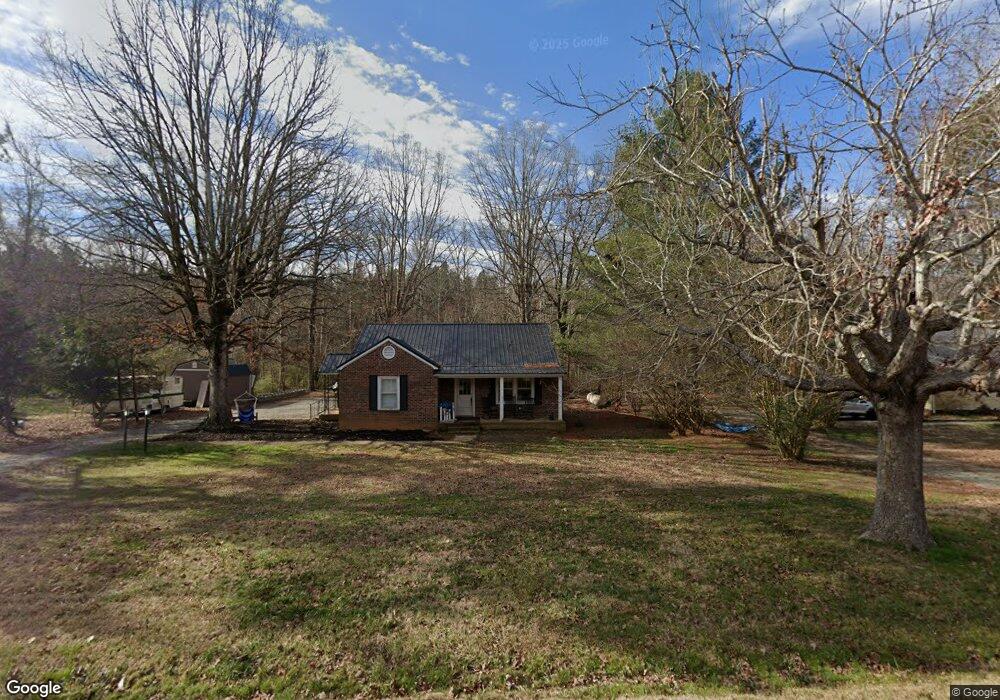
4644 Oxford Rd Roxboro, NC 27574
Estimated Value: $150,000 - $192,972
2
Beds
1
Bath
1,192
Sq Ft
$144/Sq Ft
Est. Value
About This Home
This home is located at 4644 Oxford Rd, Roxboro, NC 27574 and is currently estimated at $171,993, approximately $144 per square foot. 4644 Oxford Rd is a home located in Person County with nearby schools including Person High School.
Ownership History
Date
Name
Owned For
Owner Type
Purchase Details
Closed on
Apr 2, 2018
Sold by
Solomon Vickie P and Solomon Michael
Bought by
Tillman Dale Lee
Current Estimated Value
Home Financials for this Owner
Home Financials are based on the most recent Mortgage that was taken out on this home.
Original Mortgage
$59,300
Outstanding Balance
$35,316
Interest Rate
4.87%
Mortgage Type
Adjustable Rate Mortgage/ARM
Estimated Equity
$136,677
Purchase Details
Closed on
Sep 7, 1999
Bought by
Painter Eveird and Painter Margaret L
Create a Home Valuation Report for This Property
The Home Valuation Report is an in-depth analysis detailing your home's value as well as a comparison with similar homes in the area
Home Values in the Area
Average Home Value in this Area
Purchase History
| Date | Buyer | Sale Price | Title Company |
|---|---|---|---|
| Tillman Dale Lee | $58,000 | None Available | |
| Painter Eveird | -- | -- |
Source: Public Records
Mortgage History
| Date | Status | Borrower | Loan Amount |
|---|---|---|---|
| Open | Tillman Dale Lee | $59,300 |
Source: Public Records
Tax History Compared to Growth
Tax History
| Year | Tax Paid | Tax Assessment Tax Assessment Total Assessment is a certain percentage of the fair market value that is determined by local assessors to be the total taxable value of land and additions on the property. | Land | Improvement |
|---|---|---|---|---|
| 2025 | $1,172 | $172,596 | $0 | $0 |
| 2024 | $901 | $114,569 | $0 | $0 |
| 2023 | $901 | $114,569 | $0 | $0 |
| 2022 | $898 | $114,569 | $0 | $0 |
| 2021 | $758 | $99,358 | $0 | $0 |
| 2020 | $651 | $84,919 | $0 | $0 |
| 2019 | $659 | $84,919 | $0 | $0 |
| 2018 | $619 | $84,919 | $0 | $0 |
| 2017 | $610 | $84,919 | $0 | $0 |
| 2016 | $610 | $84,919 | $0 | $0 |
| 2015 | $610 | $84,919 | $0 | $0 |
| 2014 | $610 | $84,919 | $0 | $0 |
Source: Public Records
Map
Nearby Homes
- 0 Old Surl Rd
- 122 Old Surl Rd
- 0 Doc Bass Rd
- 95 Doc Bass Rd
- 1469 Mollie Mooney Rd
- 243 Victor Chandler Rd
- 2201 Mollie Mooney Rd
- Tract D Antioch Church Rd
- Tract E Antioch Church Rd
- Tract F Antioch Church Rd
- 2735 Lucy Garrett Rd
- 00 Pulliam-Tingen Mine Rd
- 670 Tingen Mine Rd
- 59 Sequoia Dr
- 576 Duncan Rd
- 152 Crystal Lake Dr
- 21 Piney Forest Rd
- 689 Lockamy Rd
- 771 Cedar Grove Church Rd
- 1225 Antioch Church Rd
- 4624 Oxford Rd
- 4666 Oxford Rd
- 4606 Oxford Rd
- 4633 Oxford Rd
- 4682 Oxford Rd
- 4667 Oxford Rd
- 4590 Oxford Rd
- 4601 Oxford Rd
- 4697 Oxford Rd
- 4697 Oxford Rd
- 4566 Oxford Rd
- 4734 Oxford Rd
- 4553 Oxford Rd
- 4711 Oxford Rd
- 4550 Oxford Rd
- TBD Old Surl Rd
- 4735 Oxford Rd
- 4533 Oxford Rd
- 106 Old Surl Rd
- 4517 Oxford Rd