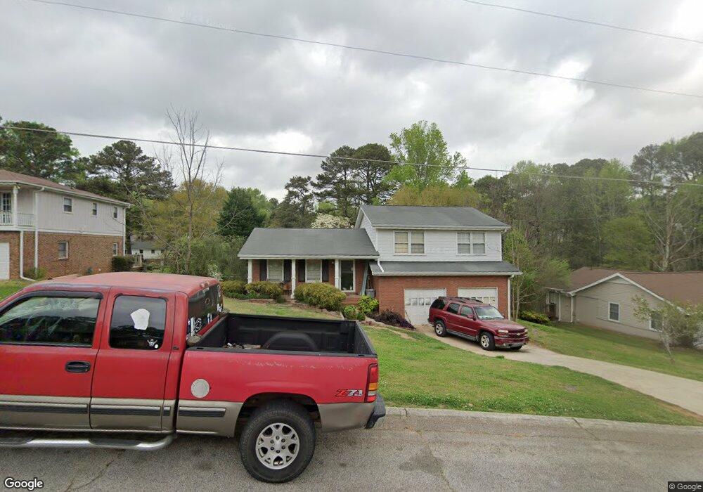
4645 Elmhurst Dr Douglasville, GA 30135
Estimated Value: $254,000 - $321,000
3
Beds
2
Baths
1,734
Sq Ft
$165/Sq Ft
Est. Value
About This Home
This home is located at 4645 Elmhurst Dr, Douglasville, GA 30135 and is currently estimated at $286,485, approximately $165 per square foot. 4645 Elmhurst Dr is a home located in Douglas County with nearby schools including Arbor Station Elementary School, Chestnut Log Middle School, and New Manchester High School.
Ownership History
Date
Name
Owned For
Owner Type
Purchase Details
Closed on
Sep 7, 2018
Sold by
Hall Carolyn C
Bought by
Gardin Robert F
Current Estimated Value
Home Financials for this Owner
Home Financials are based on the most recent Mortgage that was taken out on this home.
Original Mortgage
$106,891
Outstanding Balance
$94,233
Interest Rate
5.12%
Mortgage Type
FHA
Estimated Equity
$192,252
Create a Home Valuation Report for This Property
The Home Valuation Report is an in-depth analysis detailing your home's value as well as a comparison with similar homes in the area
Home Values in the Area
Average Home Value in this Area
Purchase History
| Date | Buyer | Sale Price | Title Company |
|---|---|---|---|
| Gardin Robert F | $116,000 | -- |
Source: Public Records
Mortgage History
| Date | Status | Borrower | Loan Amount |
|---|---|---|---|
| Open | Gardin Robert F | $106,891 |
Source: Public Records
Tax History Compared to Growth
Tax History
| Year | Tax Paid | Tax Assessment Tax Assessment Total Assessment is a certain percentage of the fair market value that is determined by local assessors to be the total taxable value of land and additions on the property. | Land | Improvement |
|---|---|---|---|---|
| 2024 | $2,738 | $102,800 | $20,400 | $82,400 |
| 2023 | $2,738 | $101,360 | $18,360 | $83,000 |
| 2022 | $2,357 | $79,120 | $18,000 | $61,120 |
| 2021 | $2,193 | $70,760 | $13,800 | $56,960 |
| 2020 | $2,347 | $70,760 | $13,800 | $56,960 |
| 2019 | $2,036 | $65,760 | $13,200 | $52,560 |
| 2018 | $279 | $49,240 | $13,200 | $36,040 |
| 2017 | $267 | $32,760 | $9,720 | $23,040 |
| 2016 | $208 | $26,480 | $8,040 | $18,440 |
| 2015 | $258 | $35,240 | $11,040 | $24,200 |
| 2014 | $258 | $29,200 | $9,600 | $19,600 |
| 2013 | -- | $29,160 | $9,600 | $19,560 |
Source: Public Records
Map
Nearby Homes
- 2795 Frank Ln
- 2863 Hillside Dr
- 4800 Timber Ridge Dr
- 5831 Wembley Dr
- LOT 16 Hillside Dr Unit 5
- 4880 Lehigh Dr
- 5791 Epping Ct
- 5767 Wembley Dr
- 5765 Wembley Dr
- 4645 Timber Ridge Dr
- 4625 Fox Hollow Ct
- 2929 Stanway Ave
- 9054 Bond St
- 2472 Cotton Ln
- Boston Plan at Timber Ridge - 50'-60'
- Sarah Plan at Timber Ridge - 42'
- Atlanta Plan at Timber Ridge - 42'
- Boston Plan at Timber Ridge - 42'
- Atlanta Plan at Timber Ridge - 50'-60'
- Columbus Plan at Timber Ridge - 42'
- 4635 Elmhurst Dr
- 4655 Elmhurst Dr
- 4665 Elmhurst Dr
- 4648 Bedford Place
- 4660 Bedford Place
- 4652 Elmhurst Dr
- 4632 Elmhurst Dr
- 4662 Elmhurst Dr
- 4675 Elmhurst Dr
- 0 Bedford Place
- 4670 Bedford Place
- 4670 Bedford Place Unit 31
- 4672 Elmhurst Dr Unit 54
- 4672 Elmhurst Dr
- 4616 Bedford Place
- 4605 Elmhurst Dr
- 4685 Elmhurst Dr
- 4680 Bedford Place
- 4682 Elmhurst Dr
- 4606 Bedford Place