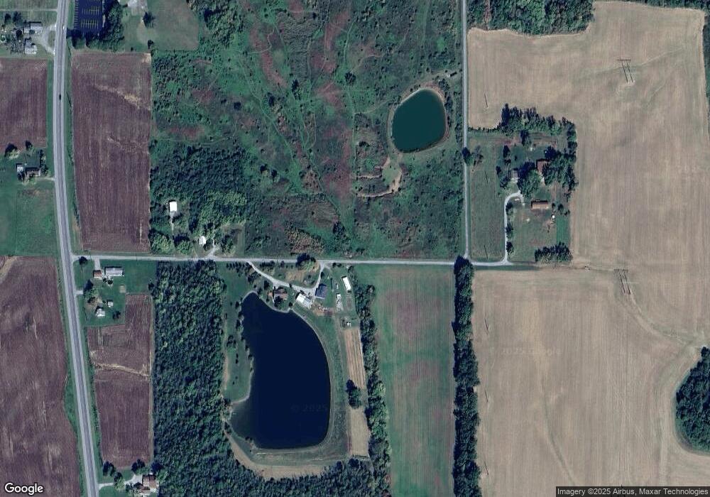
4645 Quail Ridge Rd Pinckneyville, IL 62274
Estimated Value: $221,000 - $362,383
4
Beds
3
Baths
2,352
Sq Ft
$124/Sq Ft
Est. Value
About This Home
This home is located at 4645 Quail Ridge Rd, Pinckneyville, IL 62274 and is currently estimated at $291,128, approximately $123 per square foot. 4645 Quail Ridge Rd is a home located in Perry County with nearby schools including Pinckneyville Elementary School, Pinckneyville Community High School, and Pinckneyville Middle School.
Ownership History
Date
Name
Owned For
Owner Type
Purchase Details
Closed on
Feb 1, 2021
Sold by
Ledford Bryan L and Bond-Ledford Julie A
Bought by
Sweeney Matthew S and Sweeney Evelyn C
Current Estimated Value
Purchase Details
Closed on
Nov 17, 2006
Sold by
Kelly Jp and Kelly Wendy R
Bought by
Ledford Bryan L and Bond Ledford Julie A
Home Financials for this Owner
Home Financials are based on the most recent Mortgage that was taken out on this home.
Original Mortgage
$133,600
Interest Rate
6.36%
Mortgage Type
New Conventional
Create a Home Valuation Report for This Property
The Home Valuation Report is an in-depth analysis detailing your home's value as well as a comparison with similar homes in the area
Home Values in the Area
Average Home Value in this Area
Purchase History
| Date | Buyer | Sale Price | Title Company |
|---|---|---|---|
| Sweeney Matthew S | $260,000 | None Available | |
| Ledford Bryan L | $167,000 | First American Title Insuran |
Source: Public Records
Mortgage History
| Date | Status | Borrower | Loan Amount |
|---|---|---|---|
| Previous Owner | Ledford Bryan L | $133,600 |
Source: Public Records
Tax History Compared to Growth
Tax History
| Year | Tax Paid | Tax Assessment Tax Assessment Total Assessment is a certain percentage of the fair market value that is determined by local assessors to be the total taxable value of land and additions on the property. | Land | Improvement |
|---|---|---|---|---|
| 2023 | -- | $101,459 | $10,143 | $91,316 |
| 2022 | $705 | $63,835 | $2,528 | $61,307 |
| 2021 | $736 | $60,710 | $2,560 | $58,150 |
| 2020 | $3,837 | $56,937 | $2,348 | $54,589 |
| 2019 | $3,835 | $55,552 | $2,248 | $53,304 |
| 2018 | $3,380 | $49,038 | $6,201 | $42,837 |
| 2017 | $3,337 | $47,554 | $6,013 | $41,541 |
| 2016 | $3,101 | $45,676 | $5,775 | $39,901 |
| 2015 | $3,101 | $45,676 | $5,775 | $39,901 |
| 2013 | $2,976 | $44,927 | $5,680 | $39,247 |
Source: Public Records
Map
Nearby Homes
- 4339 Illinois 127
- 5238 Woodhaven Rd
- 0 Business Highway 127
- 000 W Lake Rd
- 432 Indian Trail Dr
- 8 Patton Dr
- 000 Indian Trail
- 3906 Alyssum Rd
- 242 Missouri St
- 407 W Water St
- 4090 Shiloh Cir
- 410 W Water St
- 718 W Water St
- 3 S Beaucoup St
- 118 Missouri St
- 209 S Main St
- Lot 21 Oxbow Rd
- 307 S Main St
- 206 E South St
- 408 Duckworth St
- 4610 Pleasant View Rd
- 4625 Private Road 20
- 4659 Pleasant View Rd
- 4547 Quail Ridge Rd
- 4551 Private Road 20
- 4512 Quail Ridge Rd
- 4464 State Route 127
- 4676 State Route 127
- 4611 State Route 127
- 4571 State Route 127
- 4444 State Route 127
- 4694 State Route 127
- xxx State Route 127 Route
- 4449 State Route 127
- 4433 State Route 127
- 4553 Heron Rd
- 4399 State Route 127
- 4760 State Route 127
- 4413 State Route 127
- 4484 Poppy Rd
