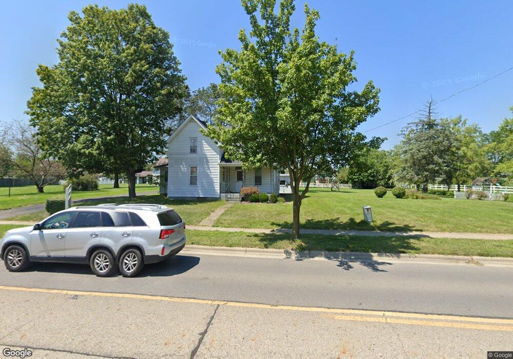
4649 Haughn Rd Grove City, OH 43123
Estimated Value: $255,000 - $278,406
3
Beds
1
Bath
1,237
Sq Ft
$219/Sq Ft
Est. Value
About This Home
This home is located at 4649 Haughn Rd, Grove City, OH 43123 and is currently estimated at $270,352, approximately $218 per square foot. 4649 Haughn Rd is a home located in Franklin County with nearby schools including Hayes Intermediate School, Jc Sommer Elementary School, and Jackson Middle School.
Ownership History
Date
Name
Owned For
Owner Type
Purchase Details
Closed on
Mar 18, 2011
Sold by
Wilcox Gail and Ranke Virginia Mae
Bought by
Hall Ellen and Hall Kenneth
Current Estimated Value
Purchase Details
Closed on
Aug 17, 1999
Sold by
Homewood Homes Inc
Bought by
Hoover Park Ltd
Purchase Details
Closed on
Jun 29, 1999
Sold by
Estate Of Harold E Ranke
Bought by
Ranke Virginia Mae
Purchase Details
Closed on
Jun 21, 1990
Bought by
Ranke Harold E
Create a Home Valuation Report for This Property
The Home Valuation Report is an in-depth analysis detailing your home's value as well as a comparison with similar homes in the area
Home Values in the Area
Average Home Value in this Area
Purchase History
| Date | Buyer | Sale Price | Title Company |
|---|---|---|---|
| Hall Ellen | $83,300 | Attorney | |
| Hoover Park Ltd | -- | -- | |
| Ranke Virginia Mae | -- | -- | |
| Ranke Harold E | -- | -- |
Source: Public Records
Tax History Compared to Growth
Tax History
| Year | Tax Paid | Tax Assessment Tax Assessment Total Assessment is a certain percentage of the fair market value that is determined by local assessors to be the total taxable value of land and additions on the property. | Land | Improvement |
|---|---|---|---|---|
| 2024 | $3,780 | $81,210 | $25,660 | $55,550 |
| 2023 | $3,728 | $81,200 | $25,655 | $55,545 |
| 2022 | $1,478 | $23,670 | $21,530 | $2,140 |
| 2021 | $1,506 | $23,670 | $21,530 | $2,140 |
| 2020 | $1,502 | $23,670 | $21,530 | $2,140 |
| 2019 | $1,415 | $20,660 | $17,960 | $2,700 |
| 2018 | $1,676 | $20,660 | $17,960 | $2,700 |
| 2017 | $1,407 | $20,660 | $17,960 | $2,700 |
| 2016 | $1,942 | $26,080 | $18,450 | $7,630 |
| 2015 | $1,942 | $26,080 | $18,450 | $7,630 |
| 2014 | $1,944 | $26,080 | $18,450 | $7,630 |
| 2013 | $1,195 | $33,915 | $17,570 | $16,345 |
Source: Public Records
Map
Nearby Homes
- 3195 Longridge Way
- 4521 Haughn Rd
- 4598 Gillenbury Loop W
- 4838 Adwell Loop
- 4208 Mayfair Ct N
- 3022 Crabapple Place Unit 4
- 4879 Blossom Way Unit 41
- 3300 Belgreen Dr
- 4754 Glencross Ct
- 2873 Woodgrove Dr
- 3234 Callie Marie Dr
- 4598 Tylar Chase
- 2750 Longridge Way
- Newport Plan at Holton Run - Woodside at Holton Run
- Cambridge Plan at Holton Run - Woodside at Holton Run
- 4793 Woodside Dr Unit 56
- 4256 Eleanor Ave
- 3575 Artberry Way Unit 42
- 4922 Wind Crest Ln
- 4277 Beechgrove Dr
- 4619 Haughn Rd
- 3052 Wynridge Ct
- 3047 Wynridge Ct
- 3090 Longridge Way
- 3100 Longridge Way
- 3062 Wynridge Ct
- 3042 Wynridge Ct
- 3060 Longridge Way
- 3120 Longridge Way
- 3037 Wynridge Ct
- 3050 Longridge Way
- 3050 Longridge Way Unit 1
- 3130 Longridge Way
- 3032 Wynridge Ct
- 3027 Wynridge Ct
- 3140 Longridge Way
- 3040 Longridge Way
- 3095 Longridge Way
- 3022 Wynridge Ct
- 3105 Longridge Way