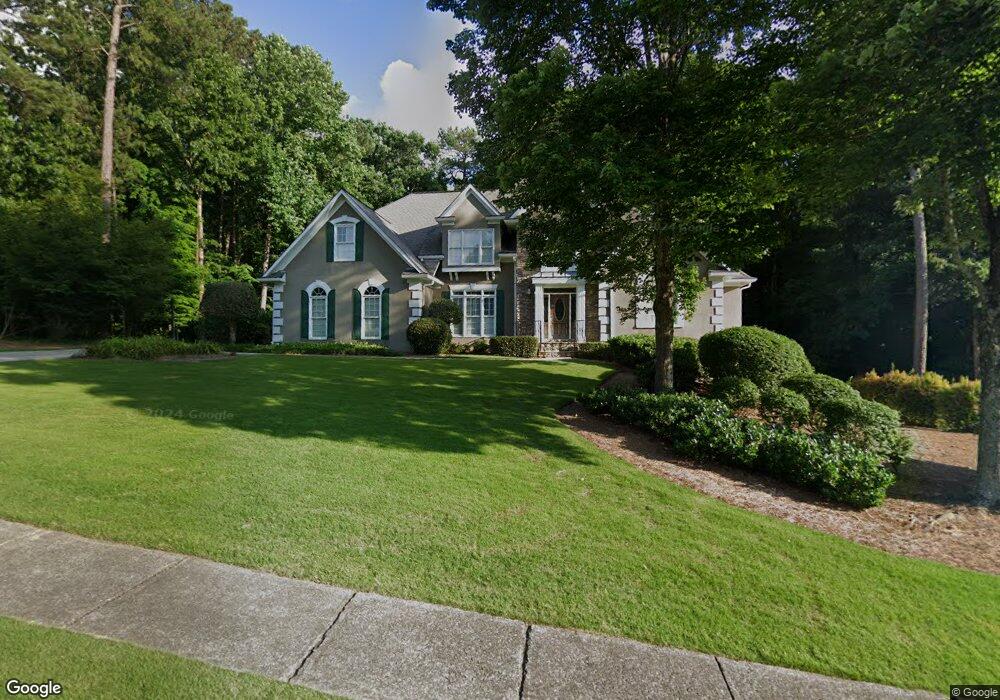
465 Bircham Way Unit 4 Roswell, GA 30075
Estimated Value: $1,037,625 - $1,316,000
4
Beds
5
Baths
4,696
Sq Ft
$248/Sq Ft
Est. Value
About This Home
This home is located at 465 Bircham Way Unit 4, Roswell, GA 30075 and is currently estimated at $1,162,906, approximately $247 per square foot. 465 Bircham Way Unit 4 is a home located in Fulton County with nearby schools including Roswell North Elementary School, Crabapple Middle School, and High Meadows School.
Ownership History
Date
Name
Owned For
Owner Type
Purchase Details
Closed on
Jul 28, 2002
Sold by
Devore Darren W and Devore Pamela F
Bought by
Devore Pamela F
Current Estimated Value
Purchase Details
Closed on
Jan 4, 2001
Sold by
Devore Darren W
Bought by
Devore Pamela F
Home Financials for this Owner
Home Financials are based on the most recent Mortgage that was taken out on this home.
Original Mortgage
$250,500
Interest Rate
7.18%
Mortgage Type
New Conventional
Purchase Details
Closed on
Jul 13, 1993
Sold by
Jv Ashton Woods Atlanta
Bought by
Devore Darren W Pamela F
Home Financials for this Owner
Home Financials are based on the most recent Mortgage that was taken out on this home.
Original Mortgage
$254,250
Interest Rate
7.49%
Create a Home Valuation Report for This Property
The Home Valuation Report is an in-depth analysis detailing your home's value as well as a comparison with similar homes in the area
Home Values in the Area
Average Home Value in this Area
Purchase History
| Date | Buyer | Sale Price | Title Company |
|---|---|---|---|
| Devore Pamela F | -- | -- | |
| Devore Pamela F | -- | -- | |
| Devore Darren W Pamela F | $282,500 | -- |
Source: Public Records
Mortgage History
| Date | Status | Borrower | Loan Amount |
|---|---|---|---|
| Previous Owner | Devore Pamela F | $250,500 | |
| Previous Owner | Devore Darren W Pamela F | $254,250 |
Source: Public Records
Tax History Compared to Growth
Tax History
| Year | Tax Paid | Tax Assessment Tax Assessment Total Assessment is a certain percentage of the fair market value that is determined by local assessors to be the total taxable value of land and additions on the property. | Land | Improvement |
|---|---|---|---|---|
| 2025 | $1,245 | $314,400 | $77,520 | $236,880 |
| 2023 | $7,452 | $264,000 | $59,680 | $204,320 |
| 2022 | $5,610 | $264,000 | $59,680 | $204,320 |
| 2021 | $6,666 | $272,560 | $59,680 | $212,880 |
| 2020 | $6,628 | $257,960 | $61,560 | $196,400 |
| 2019 | $1,045 | $248,000 | $65,560 | $182,440 |
| 2018 | $5,291 | $242,200 | $64,040 | $178,160 |
| 2017 | $5,551 | $212,000 | $57,280 | $154,720 |
| 2016 | $5,354 | $212,000 | $57,280 | $154,720 |
| 2015 | $5,424 | $195,760 | $57,280 | $138,480 |
| 2014 | $4,864 | $176,640 | $51,680 | $124,960 |
Source: Public Records
Map
Nearby Homes
- 230 Tynebrae Place Unit 1
- 1365 Ridgefield Dr
- 2859 Tynewick Dr NE
- 980 Pine Grove Rd
- 1215 Ridgefield Dr
- 2130 Federal Rd Unit II
- 110 Boulder Dr
- 1050 Lakemont Trace
- 2696 Long Lake Terrace NE
- 9650 Coleman Rd
- 1533 Tennessee Walker Dr NE
- 135 Grayton Ln
- 175 Grayton Ln
- 300 Farm Track Unit 3
- 2990 Mountain Trace NE
- 2095 Shallowford Park Manor
- 9480 Coleman Rd
- 325 Farm Trace
- 475 Bircham Way
- 470 Bircham Way
- 480 Bircham Way Unit IV
- 460 Bircham Way
- 440 Bircham Way Unit 4
- 1520 Ridgefield Dr
- 450 Bircham Way Unit 4
- 485 Bircham Way
- 1510 Ridgefield Dr
- 2075 Bushy Run
- 490 Bircham Way Unit 4
- 1530 Ridgefield Dr Unit 5
- 720 Abbeywood Dr
- 730 Abbeywood Dr
- 750 Abbeywood Dr Unit 4
- 740 Abbeywood Dr
- 1540 Ridgefield Dr
- 2065 Bushy Run Unit 3
- 495 Bircham Way Unit 4
- 1500 Ridgefield Dr