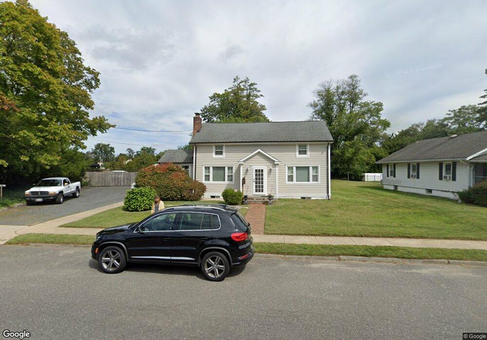
465 Brighton Ave Long Branch, NJ 07740
Estimated Value: $823,265 - $1,030,000
2
Beds
2
Baths
1,584
Sq Ft
$579/Sq Ft
Est. Value
About This Home
This home is located at 465 Brighton Ave, Long Branch, NJ 07740 and is currently estimated at $916,816, approximately $578 per square foot. 465 Brighton Ave is a home located in Monmouth County with nearby schools including Long Branch High School, Holy Trinity School, and Bet Yaakov of the Jersey Shore.
Ownership History
Date
Name
Owned For
Owner Type
Purchase Details
Closed on
May 18, 2011
Sold by
Defazio Anthony L
Bought by
Falvo Donna
Current Estimated Value
Create a Home Valuation Report for This Property
The Home Valuation Report is an in-depth analysis detailing your home's value as well as a comparison with similar homes in the area
Home Values in the Area
Average Home Value in this Area
Purchase History
| Date | Buyer | Sale Price | Title Company |
|---|---|---|---|
| Falvo Donna | $160,000 | Commonwealth Land Title Insu |
Source: Public Records
Tax History Compared to Growth
Tax History
| Year | Tax Paid | Tax Assessment Tax Assessment Total Assessment is a certain percentage of the fair market value that is determined by local assessors to be the total taxable value of land and additions on the property. | Land | Improvement |
|---|---|---|---|---|
| 2025 | $10,303 | $798,000 | $505,000 | $293,000 |
| 2024 | $9,357 | $670,300 | $390,000 | $280,300 |
| 2023 | $9,357 | $602,500 | $335,000 | $267,500 |
| 2022 | $7,312 | $460,700 | $225,000 | $235,700 |
| 2021 | $7,312 | $365,400 | $145,000 | $220,400 |
| 2020 | $7,547 | $361,100 | $142,000 | $219,100 |
| 2019 | $7,271 | $345,900 | $137,000 | $208,900 |
| 2018 | $7,257 | $343,300 | $142,000 | $201,300 |
| 2017 | $6,853 | $332,500 | $135,000 | $197,500 |
| 2016 | $6,718 | $332,400 | $140,000 | $192,400 |
| 2015 | $5,142 | $230,900 | $85,000 | $145,900 |
| 2014 | $4,953 | $234,400 | $105,000 | $129,400 |
Source: Public Records
Map
Nearby Homes
- 264 Norwood Ave
- 440 W End Ave
- 317 Norwood Ave
- 570 Monmouth Place
- 21 Dennis St
- 552 Westwood Ave
- 54 Wall St
- 388 Brookdale Ave
- 2 Hilltop Rd
- 434 Westwood Ave
- 153 Vanderbilt Ave
- 448 Monmouth Place
- 11 Fairway Ave
- 279 W West End Ave
- 23 Woolley Ave
- 57 Hollywood Ave
- 88 Norwood Ave
- 364 Westwood Ave Unit 39
- 364 Westwood Ave Unit 71
- 364 Westwood Ave Unit 21
- 459 Brighton Ave
- 476 Brighton Ave
- 472 Brighton Ave
- 455 Brighton Ave
- 468 Brighton Ave
- 283 Norwood Ave
- 287 Norwood Ave
- 449 Brighton Ave
- 462 W End Ave
- 0 Norwood Ave
- 458 W End Ave
- 450 Brighton Ave
- 452 Brighton Ave
- 295 Norwood Ave
- 456 W End Ave
- 464 W End Ave
- 448 Brighton Ave
- 458 W End Ave
- 466 W End Ave
- 301 Norwood Ave Unit 3