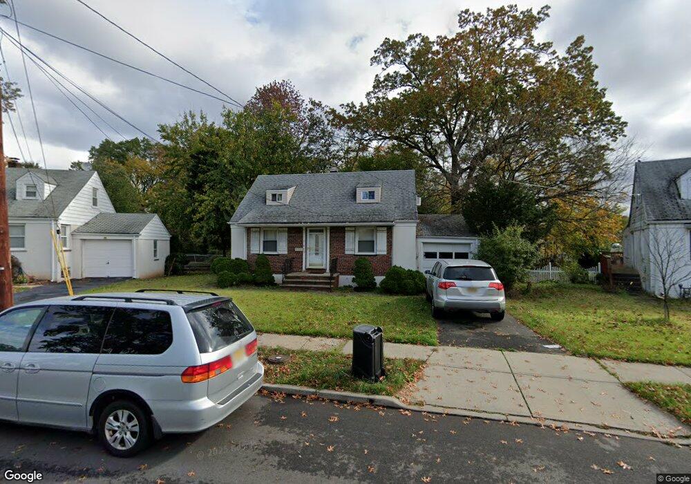
465 Brookside Dr Roselle, NJ 07203
Estimated Value: $414,144 - $489,000
--
Bed
--
Bath
1,042
Sq Ft
$426/Sq Ft
Est. Value
About This Home
This home is located at 465 Brookside Dr, Roselle, NJ 07203 and is currently estimated at $443,786, approximately $425 per square foot. 465 Brookside Dr is a home located in Union County with nearby schools including Dr Charles C Polk School, Grace Wilday Junior High School, and Leonard V. Moore Middle School.
Ownership History
Date
Name
Owned For
Owner Type
Purchase Details
Closed on
Aug 29, 2002
Sold by
Chin Joyce
Bought by
Andrews Brian and Andrews Rasheeda
Current Estimated Value
Home Financials for this Owner
Home Financials are based on the most recent Mortgage that was taken out on this home.
Original Mortgage
$166,249
Interest Rate
6.48%
Purchase Details
Closed on
Feb 29, 1996
Sold by
Leung Chin Ling and Ng Paulina
Bought by
Chin Joyce A
Create a Home Valuation Report for This Property
The Home Valuation Report is an in-depth analysis detailing your home's value as well as a comparison with similar homes in the area
Home Values in the Area
Average Home Value in this Area
Purchase History
| Date | Buyer | Sale Price | Title Company |
|---|---|---|---|
| Andrews Brian | $175,000 | -- | |
| Chin Joyce A | $106,000 | -- |
Source: Public Records
Mortgage History
| Date | Status | Borrower | Loan Amount |
|---|---|---|---|
| Previous Owner | Andrews Brian | $166,249 |
Source: Public Records
Tax History Compared to Growth
Tax History
| Year | Tax Paid | Tax Assessment Tax Assessment Total Assessment is a certain percentage of the fair market value that is determined by local assessors to be the total taxable value of land and additions on the property. | Land | Improvement |
|---|---|---|---|---|
| 2025 | $9,912 | $114,000 | $69,000 | $45,000 |
| 2024 | $9,664 | $114,000 | $69,000 | $45,000 |
| 2023 | $9,664 | $114,000 | $69,000 | $45,000 |
| 2022 | $9,731 | $114,000 | $69,000 | $45,000 |
| 2021 | $9,673 | $114,000 | $69,000 | $45,000 |
| 2020 | $9,642 | $114,000 | $69,000 | $45,000 |
| 2019 | $9,519 | $114,000 | $69,000 | $45,000 |
| 2018 | $9,467 | $114,000 | $69,000 | $45,000 |
| 2017 | $9,416 | $114,000 | $69,000 | $45,000 |
| 2016 | $9,209 | $114,000 | $69,000 | $45,000 |
| 2015 | $9,208 | $114,000 | $69,000 | $45,000 |
| 2014 | $8,951 | $114,000 | $69,000 | $45,000 |
Source: Public Records
Map
Nearby Homes
- 559 Uncas Ave
- 574 Sherman Ave
- 2209 N Wood Ave
- 1809 N Wood Ave Unit D1
- 511 Brooklawn Ave Unit H1
- 382 Douglas Rd
- 414 3rd Ave
- 812 Washington Ave
- 1210 Orchard Terrace
- 1605 Wood Ave Unit F1
- 15 Swarthmore Rd
- 901 Clark St
- 115 Clark St
- 813 N Wood Ave
- 221 Douglas Rd
- 46 Palisade Rd
- 725 N Wood Ave
- 721 N Wood Ave
- 630 Jackson Ave
- 633 Maple Ave
- 469 Brookside Dr
- 1330 Shaffer Ave
- 461 Brookside Dr
- 473 Brookside Dr
- 464 Brookside Dr
- 470 Brookside Dr
- 477 Brookside Dr
- 453 Brookside Dr
- 1326 Shaffer Ave
- 454 Brookside Dr
- 474 Brookside Dr
- 481 Brookside Dr
- 478 Brookside Dr
- 449 Brookside Dr
- 1322 Shaffer Ave
- 50 Heather Ln
- 485 Brookside Dr
- 482 Brookside Dr
- 1318 Shaffer Ave
- 445 Brookside Dr