Estimated Value: $166,267 - $200,000
2
Beds
1
Bath
888
Sq Ft
$205/Sq Ft
Est. Value
About This Home
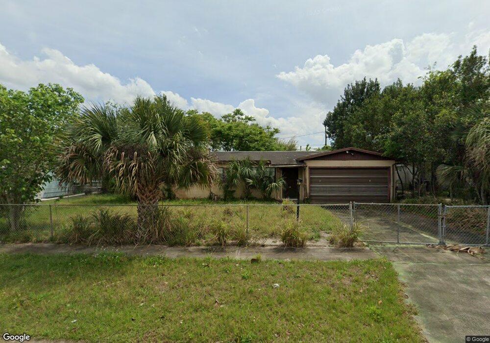
This home is located at 465 Camel Cir, Cocoa, FL 32927 and is currently estimated at $182,317, approximately $205 per square foot. 465 Camel Cir is a home located in Brevard County with nearby schools including Atlantis Elementary School, Space Coast Junior/Senior High School, and East Atlantic Prep of Brevard County.
Create a Home Valuation Report for This Property
The Home Valuation Report is an in-depth analysis detailing your home's value as well as a comparison with similar homes in the area
Home Values in the Area
Average Home Value in this Area
Tax History
| Year | Tax Paid | Tax Assessment Tax Assessment Total Assessment is a certain percentage of the fair market value that is determined by local assessors to be the total taxable value of land and additions on the property. | Land | Improvement |
|---|---|---|---|---|
| 2025 | $2,008 | $125,410 | -- | -- |
| 2024 | $2,047 | $129,310 | -- | -- |
| 2023 | $2,047 | $142,100 | $0 | $0 |
| 2022 | $1,777 | $120,870 | $0 | $0 |
| 2021 | $1,574 | $82,800 | $42,000 | $40,800 |
| 2020 | $1,321 | $79,050 | $40,000 | $39,050 |
| 2019 | $1,236 | $76,170 | $35,000 | $41,170 |
| 2018 | $1,177 | $69,130 | $27,000 | $42,130 |
| 2017 | $1,102 | $58,930 | $24,000 | $34,930 |
| 2016 | $1,010 | $46,340 | $18,000 | $28,340 |
| 2015 | $957 | $33,840 | $15,000 | $18,840 |
| 2014 | $882 | $30,770 | $11,000 | $19,770 |
Source: Public Records
Map
Nearby Homes
- 1050 Barclay Dr
- 1040 Jersey St
- 1029 Illinois Rd
- 1014 Illinois Rd
- 7000 N Highway 1 Unit Gg-205
- 7020 N Highway 1 Unit EE202
- 977 Poinsetta St
- 961 Kaufman St
- 361 Payne Ave
- 973 Poinsetta St
- 7030 N Highway 1 Unit 101
- 7030 N Highway 1 Unit B-106
- 7030 N Highway 1 Unit DD102
- 414 Oakridge Ave
- 6800 N Highway 1 Unit 4202
- 7060 N Highway 1 Unit AA206
- 7060 N Highway 1 Unit 205
- 7060 N Highway 1 Unit AA102
- 6760 N Highway 1 Unit 3204
- 780 Alcazar Ave
Your Personal Tour Guide
Ask me questions while you tour the home.