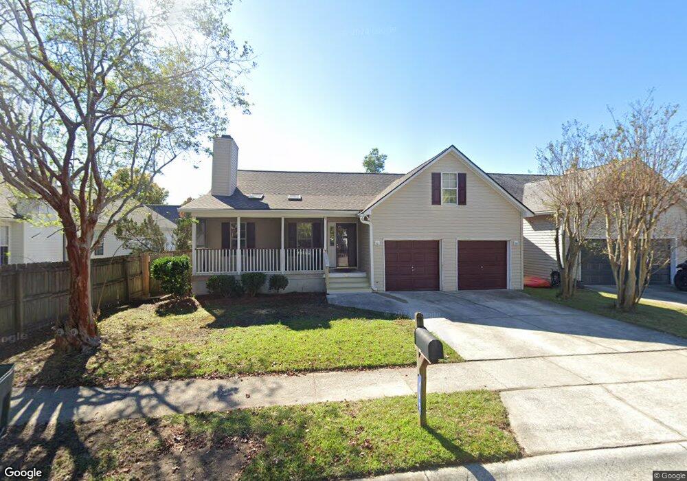
465 Cessna Ave Charleston, SC 29407
Estimated Value: $511,000 - $571,000
4
Beds
3
Baths
2,014
Sq Ft
$268/Sq Ft
Est. Value
About This Home
This home is located at 465 Cessna Ave, Charleston, SC 29407 and is currently estimated at $540,466, approximately $268 per square foot. 465 Cessna Ave is a home located in Charleston County with nearby schools including Stono Park Elementary School, West Ashley High School, and Carolina Voyager Charter.
Ownership History
Date
Name
Owned For
Owner Type
Purchase Details
Closed on
Nov 26, 2024
Sold by
Cessna House Llc
Bought by
Wilson Bartt A and Wilson Dulaney A
Current Estimated Value
Home Financials for this Owner
Home Financials are based on the most recent Mortgage that was taken out on this home.
Original Mortgage
$150,000
Interest Rate
6.69%
Mortgage Type
New Conventional
Purchase Details
Closed on
Dec 3, 2021
Sold by
Wilson Bartt A
Bought by
Cessna House Llc
Purchase Details
Closed on
Aug 16, 2000
Sold by
Wagner Barry P
Bought by
Wilson Bartt A and Wilson Dulaney A
Create a Home Valuation Report for This Property
The Home Valuation Report is an in-depth analysis detailing your home's value as well as a comparison with similar homes in the area
Home Values in the Area
Average Home Value in this Area
Purchase History
| Date | Buyer | Sale Price | Title Company |
|---|---|---|---|
| Wilson Bartt A | -- | None Listed On Document | |
| Cessna House Llc | -- | Nexsen Pruet Pllc | |
| Wilson Bartt A | $152,900 | -- |
Source: Public Records
Mortgage History
| Date | Status | Borrower | Loan Amount |
|---|---|---|---|
| Previous Owner | Wilson Bartt A | $150,000 |
Source: Public Records
Tax History Compared to Growth
Tax History
| Year | Tax Paid | Tax Assessment Tax Assessment Total Assessment is a certain percentage of the fair market value that is determined by local assessors to be the total taxable value of land and additions on the property. | Land | Improvement |
|---|---|---|---|---|
| 2024 | $3,888 | $13,180 | $0 | $0 |
| 2023 | $3,888 | $13,180 | $0 | $0 |
| 2022 | $3,580 | $13,180 | $0 | $0 |
| 2021 | $3,536 | $13,180 | $0 | $0 |
| 2020 | $3,511 | $13,180 | $0 | $0 |
| 2019 | $3,209 | $11,450 | $0 | $0 |
| 2017 | $3,068 | $11,450 | $0 | $0 |
| 2016 | $2,969 | $11,450 | $0 | $0 |
| 2015 | $2,837 | $11,450 | $0 | $0 |
| 2014 | $2,711 | $0 | $0 | $0 |
| 2011 | -- | $0 | $0 | $0 |
Source: Public Records
Map
Nearby Homes
- 507 Stinson Dr Unit 1a
- 507 Stinson Dr Unit 8d
- 507 Stinson Dr Unit D8
- 507 Stinson Dr Unit 7f
- 396 Culver Ave
- 486 Cessna Ave
- 498 Cessna Ave
- 374 Culver Ave
- 2045 Rondo St Unit B
- 323 Millcreek Dr
- 447 Geddes Ave
- 511 Mansfield St
- 439 Geddes Ave
- 516 Arlington Dr Unit B5
- 422 Geddes Ave
- 244 Marsh Oaks Dr
- 233 Lands End Dr Unit T233
- 198 River Breeze Dr Unit 75
- 335 Clayton Dr
- 205 River Breeze Dr Unit A205
- 467 Cessna Ave
- 500 Beechcraft St
- 506 Beechcraft St
- 469 Cessna Ave
- 399 Culver Ave
- 512 Beechcraft St
- 471 Cessna Ave
- 468 Cessna Ave
- 397 Culver Ave
- 464 Cessna Ave
- 470 Cessna Ave
- 451 Cessna Ave
- 462 Cessna Ave
- 472 Cessna Ave
- 505 Beechcraft St
- 473 Cessna Ave
- 395 Culver Ave
- 507 Beechcraft St
- 509 Beechcraft St
- 460 Cessna Ave