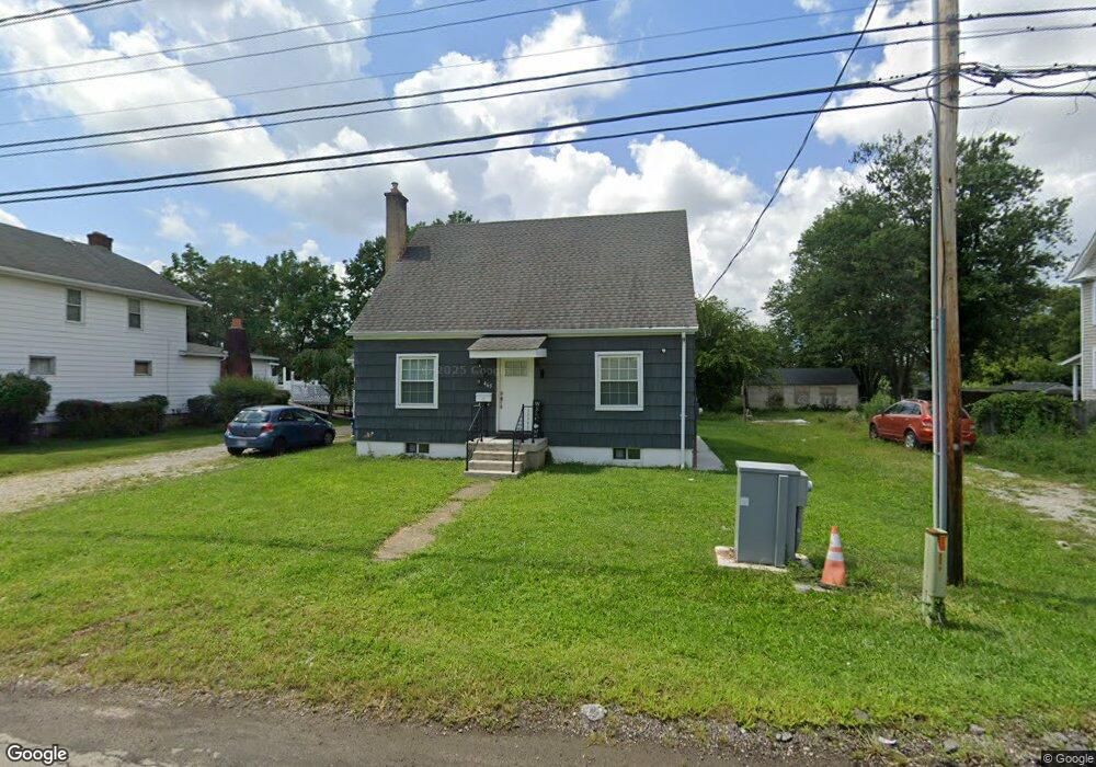
465 Derrer Rd Columbus, OH 43204
Westgate NeighborhoodEstimated Value: $172,000 - $226,000
3
Beds
1
Bath
1,332
Sq Ft
$147/Sq Ft
Est. Value
About This Home
This home is located at 465 Derrer Rd, Columbus, OH 43204 and is currently estimated at $195,933, approximately $147 per square foot. 465 Derrer Rd is a home located in Franklin County with nearby schools including Westgate Alternative Elementary School, Westmoor Middle School, and West High School.
Ownership History
Date
Name
Owned For
Owner Type
Purchase Details
Closed on
Nov 10, 2020
Sold by
Beard Bradley N
Bought by
Altamirano Angel T and Beard Vanessa
Current Estimated Value
Home Financials for this Owner
Home Financials are based on the most recent Mortgage that was taken out on this home.
Original Mortgage
$104,500
Outstanding Balance
$92,138
Interest Rate
2.8%
Mortgage Type
New Conventional
Estimated Equity
$103,795
Purchase Details
Closed on
Oct 5, 2007
Sold by
Beard Tonia L
Bought by
Beard Bradley N
Home Financials for this Owner
Home Financials are based on the most recent Mortgage that was taken out on this home.
Original Mortgage
$107,031
Interest Rate
6.5%
Mortgage Type
FHA
Purchase Details
Closed on
Mar 30, 1994
Bought by
Beard Bradley N
Purchase Details
Closed on
Dec 23, 1992
Create a Home Valuation Report for This Property
The Home Valuation Report is an in-depth analysis detailing your home's value as well as a comparison with similar homes in the area
Home Values in the Area
Average Home Value in this Area
Purchase History
| Date | Buyer | Sale Price | Title Company |
|---|---|---|---|
| Altamirano Angel T | $110,000 | Valmer Land Title Agency | |
| Beard Bradley N | -- | Advance Ti | |
| Beard Bradley N | $62,000 | -- | |
| -- | $59,000 | -- |
Source: Public Records
Mortgage History
| Date | Status | Borrower | Loan Amount |
|---|---|---|---|
| Open | Altamirano Angel T | $104,500 | |
| Closed | Beard Bradley N | $107,031 |
Source: Public Records
Tax History
| Year | Tax Paid | Tax Assessment Tax Assessment Total Assessment is a certain percentage of the fair market value that is determined by local assessors to be the total taxable value of land and additions on the property. | Land | Improvement |
|---|---|---|---|---|
| 2025 | $2,251 | $50,160 | $11,590 | $38,570 |
| 2024 | $2,251 | $50,160 | $11,590 | $38,570 |
| 2023 | $2,222 | $50,155 | $11,585 | $38,570 |
| 2022 | $2,017 | $38,890 | $13,440 | $25,450 |
| 2021 | $2,021 | $38,890 | $13,440 | $25,450 |
| 2020 | $2,224 | $38,890 | $13,440 | $25,450 |
| 2019 | $2,070 | $30,870 | $11,200 | $19,670 |
| 2018 | $1,946 | $30,870 | $11,200 | $19,670 |
| 2017 | $1,990 | $30,870 | $11,200 | $19,670 |
| 2016 | $2,010 | $30,350 | $10,470 | $19,880 |
| 2015 | $1,825 | $30,350 | $10,470 | $19,880 |
| 2014 | $1,830 | $30,350 | $10,470 | $19,880 |
| 2013 | $1,002 | $33,705 | $11,620 | $22,085 |
Source: Public Records
Map
Nearby Homes
- 408 Derrer Rd
- 695 Demorest Rd
- 328 S Sylvan Ave
- 277 Josephine Ave
- 6280 Renner Park Dr
- 227 S Sylvan Ave
- 814 Miriam Dr W
- 139 Demorest Ave
- 162 S Southampton Ave
- 840 Mark Place
- 181 S Westgate Ave
- 3001 Wicklow Rd
- 3866 Eakin Rd
- 3551 Glorious Rd
- 144 S Brinker Ave
- 3340 Miriam Dr S
- 457 Guernsey Ave
- 3318 Miriam Dr S
- 3721 Briggs Rd Unit 723
- 77 S Brinker Ave
- 475 Derrer Rd
- 459 Derrer Rd
- 451 Derrer Rd
- 468 Derrer Rd
- 462 Derrer Rd
- 476 Derrer Rd
- 483 Derrer Rd
- 484 Derrer Rd
- 456 Derrer Rd
- 443 Derrer Rd
- 3442 Parkside Rd
- 108 Derrer Rd
- 102 Derrer Rd
- 96 Derrer Rd
- 448 Derrer Rd
- 0 Derrer Rd Unit 225007825
- 0 Derrer Rd Unit L210 2023696
- 0 Derrer Rd Unit L211 2023698
- 0 Derrer Rd Unit L209 2023694
- 0 Derrer Rd Unit L208 2023692
Your Personal Tour Guide
Ask me questions while you tour the home.