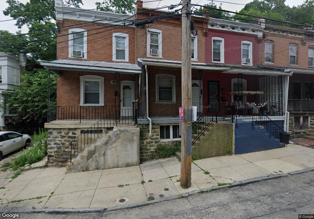
465 E Penn St Philadelphia, PA 19144
East Germantown NeighborhoodEstimated Value: $108,000 - $134,000
3
Beds
1
Bath
784
Sq Ft
$151/Sq Ft
Est. Value
About This Home
This home is located at 465 E Penn St, Philadelphia, PA 19144 and is currently estimated at $118,000, approximately $150 per square foot. 465 E Penn St is a home located in Philadelphia County with nearby schools including Roosevelt Theodore Middle School, Oak Street Elementary School, and Martin Luther King High School.
Ownership History
Date
Name
Owned For
Owner Type
Purchase Details
Closed on
Mar 25, 2014
Sold by
Davis Charles R
Bought by
Gelt Properties Llc
Current Estimated Value
Purchase Details
Closed on
Mar 16, 2001
Sold by
Philadelphia Housing Development Corp
Bought by
Davis Charles R
Purchase Details
Closed on
Aug 9, 1996
Sold by
Goodwin Neresa
Bought by
Philadelphia Housing Development Corp
Create a Home Valuation Report for This Property
The Home Valuation Report is an in-depth analysis detailing your home's value as well as a comparison with similar homes in the area
Home Values in the Area
Average Home Value in this Area
Purchase History
| Date | Buyer | Sale Price | Title Company |
|---|---|---|---|
| Gelt Properties Llc | -- | None Available | |
| Davis Charles R | $8,000 | -- | |
| Philadelphia Housing Development Corp | -- | -- |
Source: Public Records
Tax History Compared to Growth
Tax History
| Year | Tax Paid | Tax Assessment Tax Assessment Total Assessment is a certain percentage of the fair market value that is determined by local assessors to be the total taxable value of land and additions on the property. | Land | Improvement |
|---|---|---|---|---|
| 2026 | $812 | $87,000 | $17,400 | $69,600 |
| 2025 | $812 | $87,000 | $17,400 | $69,600 |
| 2024 | $812 | $87,000 | $17,400 | $69,600 |
| 2023 | $812 | $58,000 | $11,600 | $46,400 |
| 2022 | $606 | $58,000 | $11,600 | $46,400 |
| 2021 | $606 | $0 | $0 | $0 |
| 2020 | $606 | $0 | $0 | $0 |
| 2019 | $633 | $0 | $0 | $0 |
| 2018 | $787 | $0 | $0 | $0 |
| 2017 | $787 | $0 | $0 | $0 |
| 2016 | $787 | $0 | $0 | $0 |
| 2015 | $753 | $0 | $0 | $0 |
| 2014 | -- | $56,200 | $4,347 | $51,853 |
| 2012 | -- | $6,688 | $951 | $5,737 |
Source: Public Records
Map
Nearby Homes
- 5301 Belfield Ave
- 529 E Queen Ln
- 540 E Ashmead St
- 5357 Belfield Ave
- 83 E Ashmead St
- 238 E Queen Ln
- 543 E Locust Ave
- 437 49 E Collom St
- 604 E Locust Ave
- 5220 Wakefield St
- 4950 Wakefield St
- 4995 Sheldon St
- 5335 Wakefield St
- 78 E Penn St
- 345 E Armat St
- 617 E Locust Ave
- 5433 Wakefield St
- 5154 Wakefield St
- 5634 Morton St
- 5638 Morton St
- 467 E Penn St
- 469 E Penn St
- 471 E Penn St
- 445 E Penn St
- 473 E Penn St
- 466 Potterton Heights
- 464 Potterton Heights
- 443 E Penn St
- 468 Potterton Heights
- 470 Potterton Heights
- 475 E Penn St
- 441 E Penn St
- 472 Potterton Heights
- 439 E Penn St
- 477 E Penn St
- 474 Potterton Heights
- 437 E Penn St
- 476 Potterton Heights
- 479 E Penn St
- 435 E Penn St