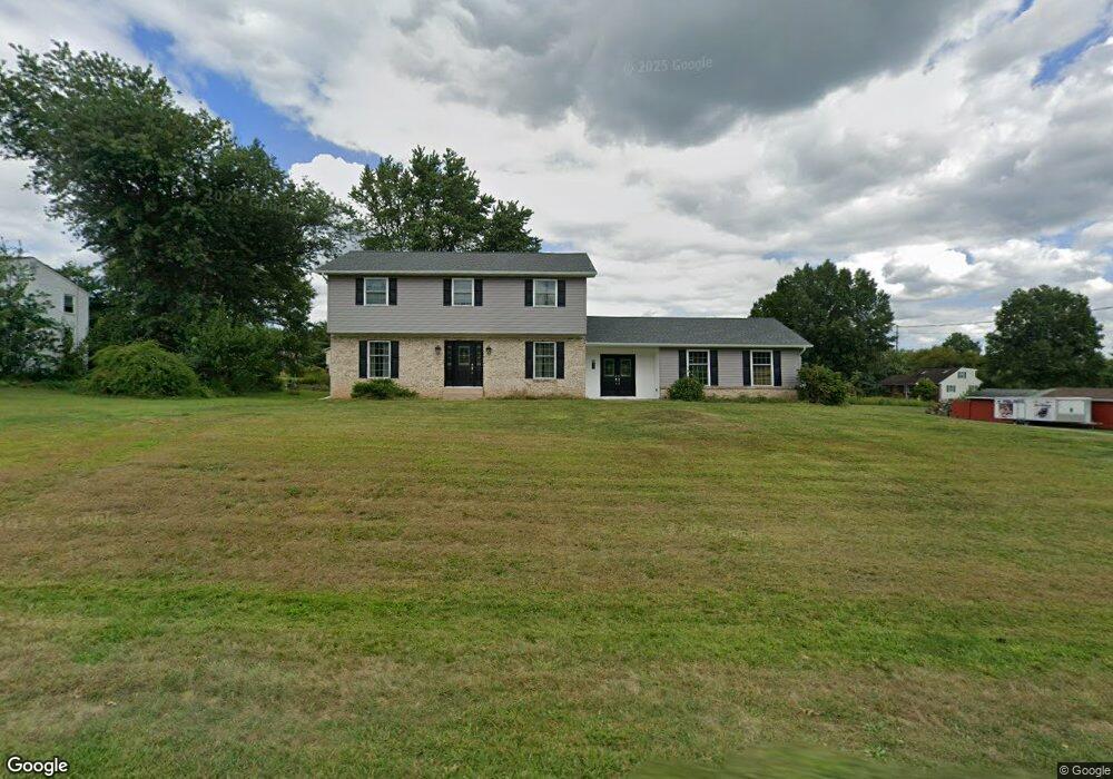
465 Godshall Rd Souderton, PA 18964
Estimated Value: $580,160 - $609,000
4
Beds
3
Baths
2,380
Sq Ft
$248/Sq Ft
Est. Value
About This Home
This home is located at 465 Godshall Rd, Souderton, PA 18964 and is currently estimated at $589,790, approximately $247 per square foot. 465 Godshall Rd is a home located in Montgomery County with nearby schools including Franconia Elementary School, Indian Crest Middle School, and Souderton Area Senior High School.
Ownership History
Date
Name
Owned For
Owner Type
Purchase Details
Closed on
Sep 26, 2011
Sold by
Millard Gloria
Bought by
Mayse Brian M and Mayse Jami M
Current Estimated Value
Home Financials for this Owner
Home Financials are based on the most recent Mortgage that was taken out on this home.
Original Mortgage
$232,000
Outstanding Balance
$159,373
Interest Rate
4.25%
Estimated Equity
$430,417
Create a Home Valuation Report for This Property
The Home Valuation Report is an in-depth analysis detailing your home's value as well as a comparison with similar homes in the area
Home Values in the Area
Average Home Value in this Area
Purchase History
| Date | Buyer | Sale Price | Title Company |
|---|---|---|---|
| Mayse Brian M | $315,000 | None Available |
Source: Public Records
Mortgage History
| Date | Status | Borrower | Loan Amount |
|---|---|---|---|
| Open | Mayse Brian M | $232,000 |
Source: Public Records
Tax History Compared to Growth
Tax History
| Year | Tax Paid | Tax Assessment Tax Assessment Total Assessment is a certain percentage of the fair market value that is determined by local assessors to be the total taxable value of land and additions on the property. | Land | Improvement |
|---|---|---|---|---|
| 2025 | $7,018 | $174,730 | $65,970 | $108,760 |
| 2024 | $7,018 | $174,730 | $65,970 | $108,760 |
| 2023 | $6,696 | $174,730 | $65,970 | $108,760 |
| 2022 | $6,491 | $174,730 | $65,970 | $108,760 |
| 2021 | $6,355 | $174,730 | $65,970 | $108,760 |
| 2020 | $6,269 | $174,730 | $65,970 | $108,760 |
| 2019 | $5,722 | $174,730 | $65,970 | $108,760 |
| 2018 | $6,194 | $174,730 | $65,970 | $108,760 |
| 2017 | $6,038 | $174,730 | $65,970 | $108,760 |
| 2016 | $5,969 | $174,730 | $65,970 | $108,760 |
| 2015 | $5,807 | $174,730 | $65,970 | $108,760 |
| 2014 | $5,807 | $174,730 | $65,970 | $108,760 |
Source: Public Records
Map
Nearby Homes
- 478 Smokepipe Rd
- 314 Harleysville Pike
- 270 Telford Pike
- 317 Pleasant Valley Dr
- 3443 Devlin Way
- 157 Erie Ave
- 155 Harleysville Pike
- 218 Parkview Dr
- 260 Diamond St
- 0000 Halteman Rd
- 141 Farrington Ln
- 654 Allentown Rd
- 110 Trevor Square
- 365 Wile Ave
- 166 Sussex Ln Unit 166
- 114 Green St
- 44 Diamond St
- 25 E Summit St
- 63 Hillside Ave
- 0001 Sydney Ln
- 467 Godshall Rd
- 459 Godshall Rd
- 472 Homestead Ave
- 469 Godshall Rd
- 436 Godshall Rd
- 440 Godshall Rd
- 471 Homestead Ave
- 474 Homestead Ave
- 446 Godshall Rd
- 430 Godshall Rd
- 455 Godshall Rd
- 476 Homestead Ave
- 471 Godshall Rd
- 450 Godshall Rd
- 473 Homestead Ave
- 478 Homestead Ave
- 473 Godshall Rd
- 461 Homestead Ave
- 480 Homestead Ave
- 477 Homestead Ave