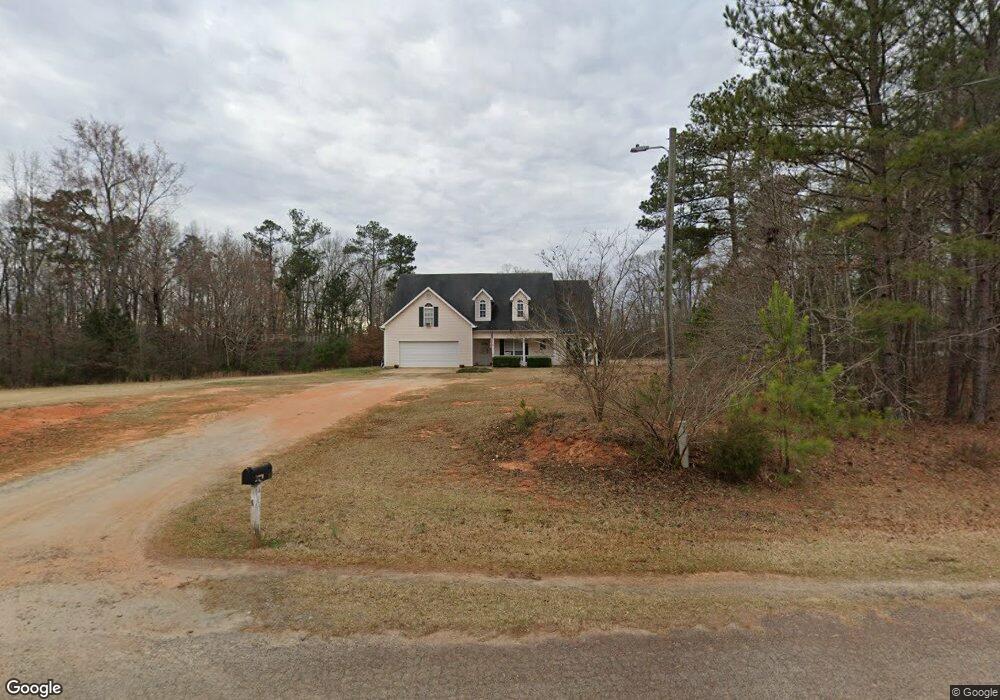
465 Gordon Rd Forsyth, GA 31029
Estimated Value: $321,434 - $347,000
4
Beds
2
Baths
2,191
Sq Ft
$151/Sq Ft
Est. Value
About This Home
This home is located at 465 Gordon Rd, Forsyth, GA 31029 and is currently estimated at $331,109, approximately $151 per square foot. 465 Gordon Rd is a home located in Monroe County with nearby schools including Katherine B. Sutton Elementary School and Mary Persons High School.
Ownership History
Date
Name
Owned For
Owner Type
Purchase Details
Closed on
Sep 8, 2016
Sold by
Mccranie Marvin G and Mccranie Marilyn A
Bought by
Smallwood Michael A and Smallwood Megan L
Current Estimated Value
Home Financials for this Owner
Home Financials are based on the most recent Mortgage that was taken out on this home.
Original Mortgage
$166,829
Outstanding Balance
$133,342
Interest Rate
3.45%
Mortgage Type
VA
Estimated Equity
$197,767
Purchase Details
Closed on
Feb 20, 2004
Bought by
Mccranie Marvin G and Mccranie Marilyn A
Create a Home Valuation Report for This Property
The Home Valuation Report is an in-depth analysis detailing your home's value as well as a comparison with similar homes in the area
Home Values in the Area
Average Home Value in this Area
Purchase History
| Date | Buyer | Sale Price | Title Company |
|---|---|---|---|
| Smallwood Michael A | $161,500 | -- | |
| Mccranie Marvin G | $126,900 | -- |
Source: Public Records
Mortgage History
| Date | Status | Borrower | Loan Amount |
|---|---|---|---|
| Open | Smallwood Michael A | $166,829 |
Source: Public Records
Tax History Compared to Growth
Tax History
| Year | Tax Paid | Tax Assessment Tax Assessment Total Assessment is a certain percentage of the fair market value that is determined by local assessors to be the total taxable value of land and additions on the property. | Land | Improvement |
|---|---|---|---|---|
| 2024 | $1,657 | $73,320 | $12,920 | $60,400 |
| 2023 | $1,657 | $63,240 | $12,920 | $50,320 |
| 2022 | $1,387 | $63,240 | $12,920 | $50,320 |
| 2021 | $1,436 | $63,240 | $12,920 | $50,320 |
| 2020 | $1,472 | $63,240 | $12,920 | $50,320 |
| 2019 | $1,484 | $63,240 | $12,920 | $50,320 |
| 2018 | $1,488 | $63,240 | $12,920 | $50,320 |
| 2017 | $1,630 | $56,080 | $10,320 | $45,760 |
| 2016 | $706 | $57,560 | $10,320 | $47,240 |
| 2015 | $736 | $60,160 | $12,920 | $47,240 |
| 2014 | $709 | $60,160 | $12,920 | $47,240 |
Source: Public Records
Map
Nearby Homes
- 6418 Georgia 42
- 49 Homestead Cir Unit LOT 49A
- 120 Homestead Cir
- 160 Aaron Ct
- 40 Timber Dr
- 381 Homestead Cir
- 1538 Freeman Rd
- 788 Teagle Rd
- 120 Torbet Rd
- 3528 Highway 42 S
- 674 Stokes Store Rd
- 1649 Stokes Store Rd
- 1649 Stokes Store Rd Unit 52
- 1659 Stokes Store Rd
- 0 Garr Rd Unit 10439858
- 739 Westbrooks Rd
- 343 Torbet Dr
- 1653 Stokes Store Rd Unit 51
- Magnolia Plan at Providence Ridge
- Oakwood Plan at Providence Ridge
- 465 Gordon Rd Unit 6
- 445 Gordon Rd
- 466 Gordon Rd
- 473 Gordon Rd
- 225 Gordon Rd
- 230 Gordon Rd
- 215 Gordon Rd
- 215 Gordon Rd Unit Phase 2
- 0 Gordon Rd Unit 8453383
- 0 Gordon Rd Unit 8430210
- 0 Gordon Rd Unit 8320681
- 0 Gordon Rd Unit 8286264
- 0 Gordon Rd Unit 8286262
- 0 Gordon Rd Unit 8262264
- 0 Gordon Rd Unit 3093761
- 0 Gordon Rd Unit 7467641
- 0 Gordon Rd Unit 7535374
- 0 Gordon Rd Unit 7630223
- 0 Gordon Rd Unit 8091679
- 0 Gordon Rd Unit 8185945