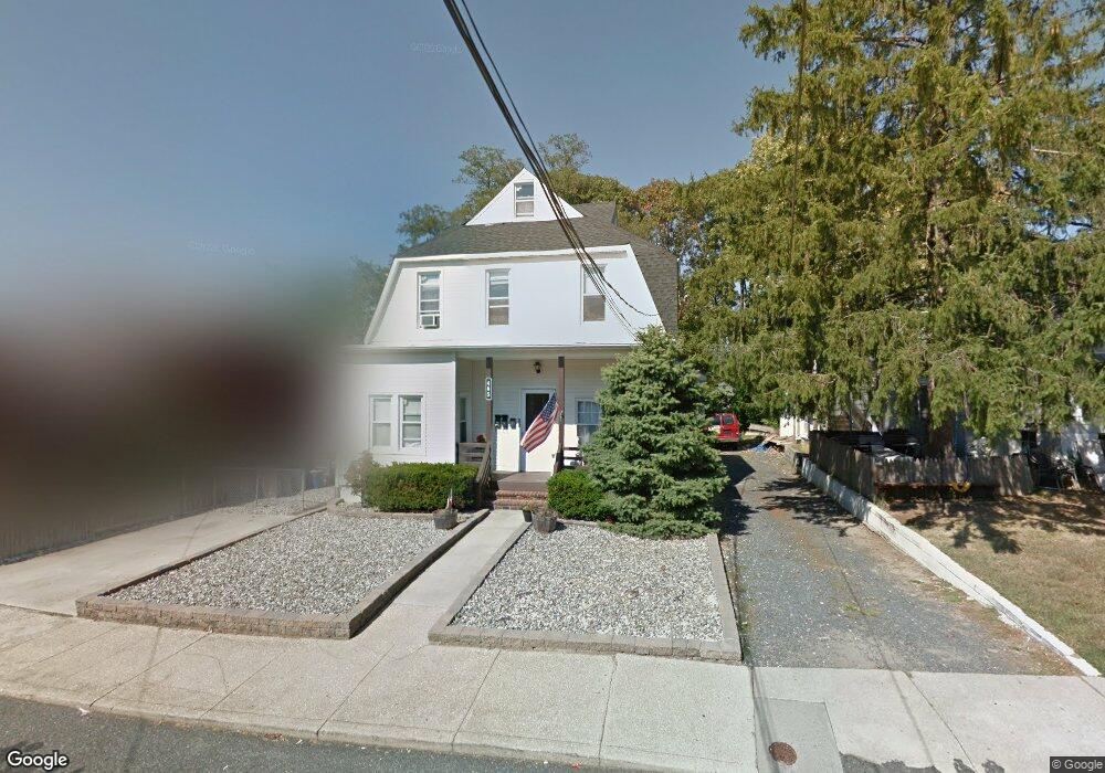
465 Hampton Ave Long Branch, NJ 07740
Estimated Value: $670,835 - $849,000
3
Beds
3
Baths
2,337
Sq Ft
$325/Sq Ft
Est. Value
About This Home
This home is located at 465 Hampton Ave, Long Branch, NJ 07740 and is currently estimated at $758,709, approximately $324 per square foot. 465 Hampton Ave is a home located in Monmouth County with nearby schools including Long Branch High School and Holy Trinity School.
Ownership History
Date
Name
Owned For
Owner Type
Purchase Details
Closed on
Jan 27, 2014
Sold by
465 Hampton Avenue Llc
Bought by
Mcbride Daniel K
Current Estimated Value
Purchase Details
Closed on
Mar 25, 2008
Sold by
Mcbride Daniel
Bought by
465 Hampton Avenue Llc
Purchase Details
Closed on
Mar 28, 2002
Sold by
Jutilia Santos
Bought by
Mcbride Daniel
Home Financials for this Owner
Home Financials are based on the most recent Mortgage that was taken out on this home.
Original Mortgage
$204,000
Interest Rate
6.79%
Mortgage Type
Commercial
Purchase Details
Closed on
Oct 30, 1999
Sold by
Zack David
Bought by
Jutilia Santos
Home Financials for this Owner
Home Financials are based on the most recent Mortgage that was taken out on this home.
Original Mortgage
$120,501
Interest Rate
7.68%
Mortgage Type
FHA
Create a Home Valuation Report for This Property
The Home Valuation Report is an in-depth analysis detailing your home's value as well as a comparison with similar homes in the area
Home Values in the Area
Average Home Value in this Area
Purchase History
| Date | Buyer | Sale Price | Title Company |
|---|---|---|---|
| Mcbride Daniel K | -- | None Available | |
| 465 Hampton Avenue Llc | -- | None Available | |
| Mcbride Daniel | $255,000 | -- | |
| Jutilia Santos | $125,000 | -- |
Source: Public Records
Mortgage History
| Date | Status | Borrower | Loan Amount |
|---|---|---|---|
| Previous Owner | Mcbride Daniel | $204,000 | |
| Previous Owner | Jutilia Santos | $120,501 |
Source: Public Records
Tax History
| Year | Tax Paid | Tax Assessment Tax Assessment Total Assessment is a certain percentage of the fair market value that is determined by local assessors to be the total taxable value of land and additions on the property. | Land | Improvement |
|---|---|---|---|---|
| 2025 | $8,417 | $608,400 | $206,400 | $402,000 |
| 2024 | $7,779 | $547,600 | $181,400 | $366,200 |
| 2023 | $7,779 | $500,900 | $151,400 | $349,500 |
| 2022 | $7,576 | $449,300 | $141,400 | $307,900 |
| 2021 | $7,576 | $378,600 | $116,400 | $262,200 |
| 2020 | $7,589 | $363,100 | $102,400 | $260,700 |
| 2019 | $7,208 | $342,900 | $94,400 | $248,500 |
| 2018 | $7,665 | $362,600 | $87,400 | $275,200 |
| 2017 | $7,343 | $356,300 | $86,400 | $269,900 |
| 2016 | $7,162 | $354,400 | $91,400 | $263,000 |
| 2015 | $6,547 | $294,000 | $91,200 | $202,800 |
| 2014 | $6,075 | $287,500 | $102,600 | $184,900 |
Source: Public Records
Map
Nearby Homes
- 75 Washington St
- 28 Morrell St
- 395 Broadway
- 25 Community Place
- 631 Irving Place
- 25 Howland Place
- 88 Norwood Ave
- 681 Morford Ave
- 401 Joline Ave
- 134 Lippincott Ave
- 288 Morris Ave
- 40 N 5th Ave
- 539 Summer St
- 117 Laurel St
- 554 Winter St
- 139 Sixth Ave
- 657 Campbell Ave
- 516 Atlantic Ave
- 274 N Bath Ave Unit 8
- 274 Bath Ave
- 459 Hampton Ave
- 469 Hampton Ave
- 477 Hampton Ave
- 450 Hampton Ave
- 458 Dewey St
- 452 Dewey St
- 462 Dewey St
- 448 Dewey St
- 466 Hampton Ave
- 464 Hampton Ave
- 476 Hampton Ave
- 446 Dewey St
- 446 Dewey St Unit 2
- 451 Hampton Ave
- 470 Dewey St
- 478 Hampton Ave
- 449 Hampton Ave
- 435 Hampton Ave
- 442 Dewey St
- 482 Hampton Ave
Your Personal Tour Guide
Ask me questions while you tour the home.