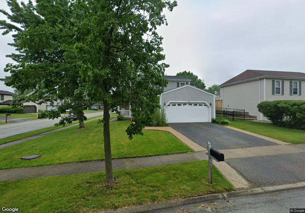
465 Hampton Ln Roselle, IL 60172
Estimated Value: $359,000 - $417,000
3
Beds
2
Baths
1,530
Sq Ft
$252/Sq Ft
Est. Value
About This Home
This home is located at 465 Hampton Ln, Roselle, IL 60172 and is currently estimated at $385,156, approximately $251 per square foot. 465 Hampton Ln is a home located in DuPage County with nearby schools including Waterbury Elementary School, Spring Wood Middle School, and Lake Park High School.
Ownership History
Date
Name
Owned For
Owner Type
Purchase Details
Closed on
Oct 13, 2011
Sold by
Kirstein Inara V
Bought by
Inara V Kirstein Living Trust
Current Estimated Value
Purchase Details
Closed on
Feb 28, 1997
Sold by
Noschese David and Noschese Catherine
Bought by
Kirstein Inara V
Home Financials for this Owner
Home Financials are based on the most recent Mortgage that was taken out on this home.
Original Mortgage
$75,000
Outstanding Balance
$9,249
Interest Rate
7.93%
Estimated Equity
$375,907
Purchase Details
Closed on
Feb 25, 1994
Sold by
Mayes William E and Mayes Dawn M
Bought by
Noschese David and Noschese Catherine
Home Financials for this Owner
Home Financials are based on the most recent Mortgage that was taken out on this home.
Original Mortgage
$123,950
Interest Rate
7.1%
Create a Home Valuation Report for This Property
The Home Valuation Report is an in-depth analysis detailing your home's value as well as a comparison with similar homes in the area
Home Values in the Area
Average Home Value in this Area
Purchase History
| Date | Buyer | Sale Price | Title Company |
|---|---|---|---|
| Inara V Kirstein Living Trust | -- | None Available | |
| Kirstein Inara V | $147,000 | -- | |
| Noschese David | $130,500 | West Counties Title Svcs Inc |
Source: Public Records
Mortgage History
| Date | Status | Borrower | Loan Amount |
|---|---|---|---|
| Open | Kirstein Inara V | $75,000 | |
| Previous Owner | Noschese David | $123,950 |
Source: Public Records
Tax History
| Year | Tax Paid | Tax Assessment Tax Assessment Total Assessment is a certain percentage of the fair market value that is determined by local assessors to be the total taxable value of land and additions on the property. | Land | Improvement |
|---|---|---|---|---|
| 2024 | $6,725 | $105,348 | $35,397 | $69,951 |
| 2023 | $6,162 | $96,340 | $32,370 | $63,970 |
| 2022 | $6,352 | $93,670 | $32,160 | $61,510 |
| 2021 | $6,048 | $89,000 | $30,560 | $58,440 |
| 2020 | $6,066 | $86,820 | $29,810 | $57,010 |
| 2019 | $5,860 | $83,440 | $28,650 | $54,790 |
| 2018 | $6,416 | $88,140 | $27,900 | $60,240 |
| 2017 | $6,524 | $81,690 | $25,860 | $55,830 |
| 2016 | $6,268 | $75,600 | $23,930 | $51,670 |
| 2015 | $5,706 | $70,550 | $22,330 | $48,220 |
| 2014 | $5,148 | $64,320 | $22,330 | $41,990 |
| 2013 | $5,122 | $66,520 | $23,090 | $43,430 |
Source: Public Records
Map
Nearby Homes
- 1396 Carriage Way
- 580 Francesca Ln
- 555 Rodenburg Rd
- 6N505 Gary Ave
- 6N632 Gary Ave
- Lot Foster Ave
- 6N221 Virginia Rd
- 960 Mensching Rd
- 1040 Borden Dr
- 871 Rosebud Ct
- 1408 Welland Ct Unit 13701
- 704 Springfield Dr Unit 2
- 5583 Carmel Dr Unit 121
- 1154 San Simeon Dr
- 6N060 Virginia Rd
- 24W737 Central Ave
- 208 Frisco Ct
- 1235 San Simeon Dr Unit 185
- 5567 Court f Unit 179
- 1224 Hialeah Ln
- 465 Northampton Ln
- 465 Northampton Ln Unit 1C
- 455 Northampton Ln
- 461 Northampton Ln
- 1376 Carriage Way Unit 1B
- 1376 Carriage Way Unit 1B
- 1376 Carriage Way Unit 1376
- 1380 Carriage Way
- 1384 Carriage Way
- 451 Northampton Ln
- 1388 Carriage Way
- 1392 Carriage Way
- 445 Northampton Ln
- 445 Northampton Ln Unit 1C
- 445 Northampton Ln Unit 1C
- 1396 Carriage Way Unit 1B
- 1396 Carriage Way Unit 1B
- 1375 Thames Terrace
- 1375 Thames Terrace Unit 1C
- 441 Northampton Ln Unit 1C
Your Personal Tour Guide
Ask me questions while you tour the home.