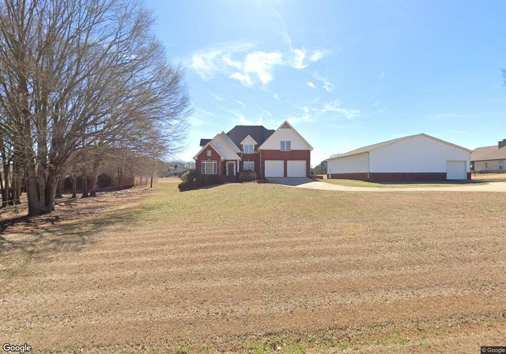
465 Mallard Ln Locust Grove, GA 30248
Estimated Value: $614,374 - $784,000
5
Beds
4
Baths
3,187
Sq Ft
$217/Sq Ft
Est. Value
About This Home
This home is located at 465 Mallard Ln, Locust Grove, GA 30248 and is currently estimated at $692,094, approximately $217 per square foot. 465 Mallard Ln is a home located in Henry County with nearby schools including Bethlehem Elementary School, Luella Middle School, and Luella High School.
Ownership History
Date
Name
Owned For
Owner Type
Purchase Details
Closed on
Jun 17, 2009
Sold by
Zubrod John W and Zubrod Valerie
Bought by
Bunner Todd A and Bunner Andria Y
Current Estimated Value
Home Financials for this Owner
Home Financials are based on the most recent Mortgage that was taken out on this home.
Original Mortgage
$301,600
Outstanding Balance
$190,555
Interest Rate
4.77%
Mortgage Type
New Conventional
Estimated Equity
$501,539
Create a Home Valuation Report for This Property
The Home Valuation Report is an in-depth analysis detailing your home's value as well as a comparison with similar homes in the area
Home Values in the Area
Average Home Value in this Area
Purchase History
| Date | Buyer | Sale Price | Title Company |
|---|---|---|---|
| Bunner Todd A | $377,000 | -- |
Source: Public Records
Mortgage History
| Date | Status | Borrower | Loan Amount |
|---|---|---|---|
| Open | Bunner Todd A | $301,600 |
Source: Public Records
Tax History Compared to Growth
Tax History
| Year | Tax Paid | Tax Assessment Tax Assessment Total Assessment is a certain percentage of the fair market value that is determined by local assessors to be the total taxable value of land and additions on the property. | Land | Improvement |
|---|---|---|---|---|
| 2025 | $7,535 | $247,880 | $39,000 | $208,880 |
| 2024 | $7,535 | $232,280 | $39,000 | $193,280 |
| 2023 | $6,920 | $226,960 | $39,000 | $187,960 |
| 2022 | $6,579 | $189,360 | $39,000 | $150,360 |
| 2021 | $6,504 | $184,560 | $39,000 | $145,560 |
| 2020 | $6,272 | $175,200 | $39,000 | $136,200 |
| 2019 | $6,320 | $176,480 | $39,000 | $137,480 |
| 2018 | $5,896 | $159,720 | $36,400 | $123,320 |
| 2016 | $4,756 | $130,000 | $36,400 | $93,600 |
| 2015 | $5,219 | $138,240 | $36,920 | $101,320 |
| 2014 | $4,739 | $124,760 | $36,000 | $88,760 |
Source: Public Records
Map
Nearby Homes
- 51 Mallard Ln
- 7 Mallard Ln
- 0 Mallard Ln Unit LOT 51
- 1615 Avery Dr
- 1143 Eagles Brooke Dr
- 335 Canvasback Trail
- 1509 Royce Dr
- Meridian II Plan at Kingston
- Wagener Plan at Kingston
- Lauren II Plan at Kingston
- 512 Dolce Rd
- Wynwood Plan at Kingston
- Clarity Plan at Kingston
- Henry II Plan at Kingston
- Rosemary II Plan at Kingston
- 238 Linford Dr
- 211 Linford Dr
- Rainier Plan at Kingston
- 2234 Golden Eagle Dr
- 2200 Golden Eagle Dr
- 445 Mallard Ln
- 485 Mallard Ln
- 460 Mallard Ln
- 480 Mallard Ln
- 450 Mallard Ln
- 425 Mallard Ln Unit 42 43
- 425 Mallard Ln
- 425 Mallard Ln Unit 42
- 505 Mallard Ln
- 0 Pintail Way Unit 66 7128801
- 0 Pintail Way Unit 66 7544700
- 77 Mallard Ln
- 500 Mallard Ln
- 107 Pintail Way
- 95 Mallard Ln
- 405 Mallard Ln
- 525 Mallard Ln
- 67 Mallard Ln
- 105 Mallard Ln
- 40 Pintail Way