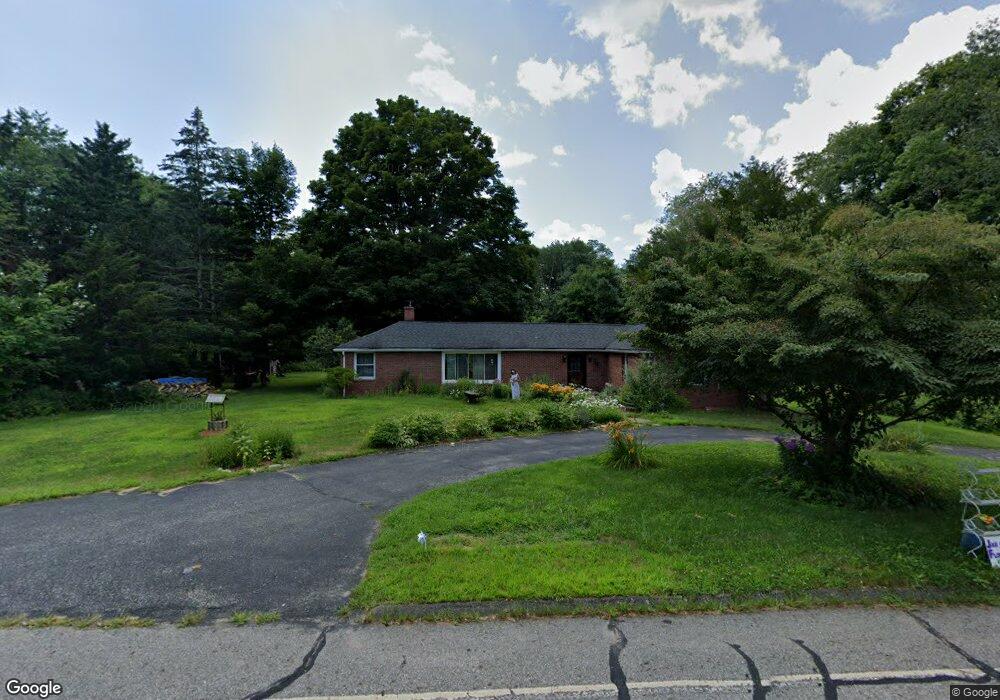
465 Mansfield Ave Mansfield Center, CT 06250
Estimated Value: $315,000 - $347,000
2
Beds
2
Baths
1,388
Sq Ft
$240/Sq Ft
Est. Value
About This Home
This home is located at 465 Mansfield Ave, Mansfield Center, CT 06250 and is currently estimated at $333,643, approximately $240 per square foot. 465 Mansfield Ave is a home located in Tolland County with nearby schools including Annie E. Vinton School, Mansfield Elementary School, and Mansfield Middle School.
Ownership History
Date
Name
Owned For
Owner Type
Purchase Details
Closed on
Aug 10, 1990
Sold by
Chobot Jeffrey
Bought by
Garrett Wayne
Current Estimated Value
Home Financials for this Owner
Home Financials are based on the most recent Mortgage that was taken out on this home.
Original Mortgage
$105,500
Interest Rate
10.04%
Mortgage Type
Purchase Money Mortgage
Create a Home Valuation Report for This Property
The Home Valuation Report is an in-depth analysis detailing your home's value as well as a comparison with similar homes in the area
Home Values in the Area
Average Home Value in this Area
Purchase History
| Date | Buyer | Sale Price | Title Company |
|---|---|---|---|
| Garrett Wayne | $115,000 | -- |
Source: Public Records
Mortgage History
| Date | Status | Borrower | Loan Amount |
|---|---|---|---|
| Open | Garrett Wayne | $100,000 | |
| Closed | Garrett Wayne | $35,000 | |
| Closed | Garrett Wayne | $50,000 | |
| Closed | Garrett Wayne | $105,500 |
Source: Public Records
Tax History Compared to Growth
Tax History
| Year | Tax Paid | Tax Assessment Tax Assessment Total Assessment is a certain percentage of the fair market value that is determined by local assessors to be the total taxable value of land and additions on the property. | Land | Improvement |
|---|---|---|---|---|
| 2025 | $4,128 | $206,400 | $43,700 | $162,700 |
| 2024 | $3,730 | $122,200 | $41,100 | $81,100 |
| 2023 | $3,852 | $122,200 | $41,100 | $81,100 |
| 2022 | $3,712 | $122,200 | $41,100 | $81,100 |
| 2021 | $3,781 | $120,500 | $41,100 | $79,400 |
| 2020 | $3,781 | $120,500 | $41,100 | $79,400 |
| 2019 | $3,618 | $115,300 | $43,200 | $72,100 |
| 2018 | $3,560 | $115,300 | $43,200 | $72,100 |
| 2017 | $3,532 | $115,300 | $43,200 | $72,100 |
| 2016 | $3,444 | $115,300 | $43,200 | $72,100 |
| 2015 | $3,444 | $115,300 | $43,200 | $72,100 |
| 2014 | $3,860 | $138,110 | $49,630 | $88,480 |
Source: Public Records
Map
Nearby Homes
- 378 Mansfield Ave
- 29 Kathleen Dr Unit 5E
- 73 Holbrook Ave
- 23 Circle Dr
- 77 Woods Rd
- 399 High St
- 23 Liberty Dr Unit 23
- 2 Pequot Square Unit 2
- 1 Heritage Square Unit 1
- 0 Oak Dr Unit LOT 33
- 76 Highland Rd
- 39 Jacobs Hill Rd
- 384 Prospect St
- 19 Eastbrook Heights Unit C
- 27 Briar Cliff Rd
- 54 Meadowbrook Ln
- 98 Windham St
- 31 Adeline Place
- 29 Eastbrook Heights Unit A
- 289 Church St
- 500 Mansfield Ave
- 169 Pleasant Valley Rd
- 153 Pleasant Valley Rd
- 132 Pleasant Valley Rd
- 206 Pleasant Valley Rd
- 126 Pleasant Valley Rd
- 185 Pleasant Valley Rd
- 145 Pleasant Valley Rd
- 179 Pleasant Valley Rd
- 155 Pleasant Valley Rd
- 197 Pleasant Valley Rd
- 122 Pleasant Valley Rd
- 118 Pleasant Valley Rd
- 83 Roanoak Ave
- 77 Roanoak Ave
- 89 Roanoak Ave
- 55 Roanoak Ave
- 71 Roanoak Ave
- 47 Roanoak Ave
- 63 Roanoak Ave