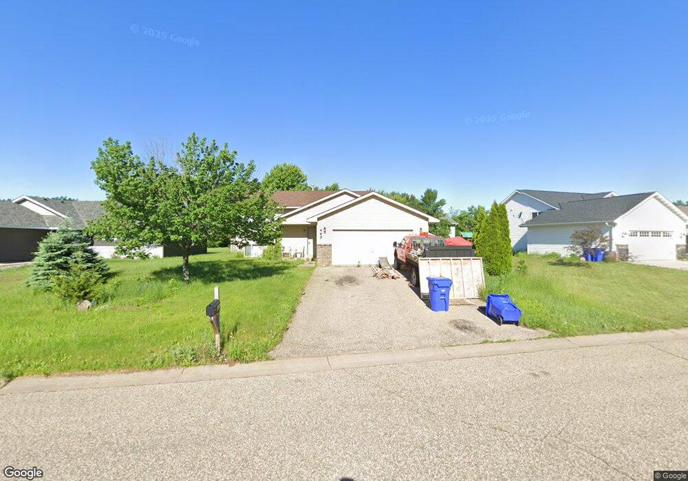
465 Martin Way Somerset, WI 54025
Estimated Value: $306,000 - $326,405
2
Beds
1
Bath
930
Sq Ft
$342/Sq Ft
Est. Value
About This Home
This home is located at 465 Martin Way, Somerset, WI 54025 and is currently estimated at $318,351, approximately $342 per square foot. 465 Martin Way is a home located in St. Croix County with nearby schools including Somerset Elementary School, Somerset Middle School, and Somerset High School.
Ownership History
Date
Name
Owned For
Owner Type
Purchase Details
Closed on
Apr 22, 2010
Sold by
Nationstar Mortgage Llc
Bought by
Emmeck David M
Current Estimated Value
Home Financials for this Owner
Home Financials are based on the most recent Mortgage that was taken out on this home.
Original Mortgage
$114,458
Outstanding Balance
$75,740
Interest Rate
4.87%
Mortgage Type
FHA
Estimated Equity
$242,611
Purchase Details
Closed on
Dec 15, 2009
Sold by
Ruiz Esteban M and Ruiz Byanka
Bought by
Nationstar Mortgage Llc
Create a Home Valuation Report for This Property
The Home Valuation Report is an in-depth analysis detailing your home's value as well as a comparison with similar homes in the area
Home Values in the Area
Average Home Value in this Area
Purchase History
| Date | Buyer | Sale Price | Title Company |
|---|---|---|---|
| Emmeck David M | $116,000 | None Available | |
| Nationstar Mortgage Llc | $165,396 | None Available |
Source: Public Records
Mortgage History
| Date | Status | Borrower | Loan Amount |
|---|---|---|---|
| Open | Emmeck David M | $114,458 |
Source: Public Records
Tax History Compared to Growth
Tax History
| Year | Tax Paid | Tax Assessment Tax Assessment Total Assessment is a certain percentage of the fair market value that is determined by local assessors to be the total taxable value of land and additions on the property. | Land | Improvement |
|---|---|---|---|---|
| 2024 | $46 | $201,500 | $29,000 | $172,500 |
| 2023 | $4,694 | $201,500 | $29,000 | $172,500 |
| 2022 | $3,811 | $201,500 | $29,000 | $172,500 |
| 2021 | $3,251 | $201,500 | $29,000 | $172,500 |
| 2020 | $3,099 | $201,500 | $29,000 | $172,500 |
| 2019 | $3,278 | $132,400 | $20,000 | $112,400 |
| 2018 | $3,075 | $132,400 | $20,000 | $112,400 |
| 2017 | $3,011 | $132,400 | $20,000 | $112,400 |
| 2016 | $3,011 | $132,400 | $20,000 | $112,400 |
| 2015 | $2,564 | $114,800 | $20,000 | $94,800 |
| 2014 | $2,505 | $114,800 | $20,000 | $94,800 |
| 2013 | $2,460 | $112,500 | $20,000 | $92,500 |
Source: Public Records
Map
Nearby Homes
- 481 Martin Way
- 315 Harriman St
- 316 Evergreen Dr
- 441 White Pine Ln
- 357 Harriman St
- 206 Red Pine Dr
- 441 Charles Ln
- 1932 64th St
- 325 Church Hill Rd
- The Rockport Plan at Pine Vale
- The Newport Plan at Pine Vale
- The Brook View Plan at Pine Vale
- The Cheyenne Plan at Pine Vale
- The Ashton Plan at Pine Vale
- The Waverly Plan at Pine Vale
- The Mulbery Plan at Pine Vale
- The Primrose Plan at Pine Vale
- The Water Stone Plan at Pine Vale
- 270 Main St
- 302 Main St
- 463 Martin Way Unit OR
- 463 Martin Way
- 469 Martin Way
- 301 Harriman St
- 303 Harriman St
- 285 Harriman St
- 462 Martin Way
- 473 Martin Way
- 305 Harriman St
- 2520 Harriman St
- 294-296 Harriman St
- 288-290 Harriman St
- 466 Martin Way
- 281 Harriman St
- 470 Martin Way
- 307 Harriman St
- 294 Harriman St
- 290 Harriman St
- 296 Harriman St
- 288 Harriman St