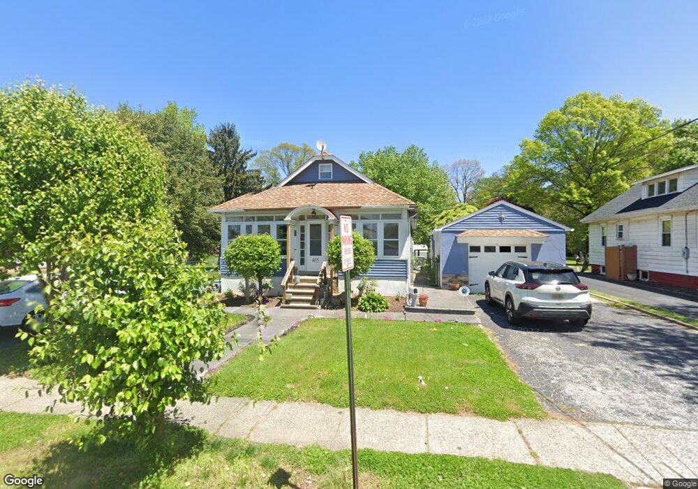
465 N Forklanding Rd Maple Shade, NJ 08052
Estimated Value: $312,000 - $421,000
3
Beds
3
Baths
1,960
Sq Ft
$193/Sq Ft
Est. Value
About This Home
This home is located at 465 N Forklanding Rd, Maple Shade, NJ 08052 and is currently estimated at $377,882, approximately $192 per square foot. 465 N Forklanding Rd is a home located in Burlington County with nearby schools including Ralph J Steinhauer Elementary School, Maude M. Wilkins Elementary School, and Howard R Yocum School.
Ownership History
Date
Name
Owned For
Owner Type
Purchase Details
Closed on
Oct 13, 2017
Sold by
Hart Daniel B and Hart Patricia Kains
Bought by
Voiro Jaclyn and Powell Scott
Current Estimated Value
Purchase Details
Closed on
Mar 8, 2013
Sold by
Hart Daniel B
Bought by
Hart Daniel B and Hart Patricia
Purchase Details
Closed on
Jul 15, 2005
Sold by
Palfy Robert D and Palfy Lorraine H
Bought by
Hart William D
Home Financials for this Owner
Home Financials are based on the most recent Mortgage that was taken out on this home.
Original Mortgage
$188,000
Interest Rate
5.12%
Mortgage Type
Fannie Mae Freddie Mac
Create a Home Valuation Report for This Property
The Home Valuation Report is an in-depth analysis detailing your home's value as well as a comparison with similar homes in the area
Home Values in the Area
Average Home Value in this Area
Purchase History
| Date | Buyer | Sale Price | Title Company |
|---|---|---|---|
| Voiro Jaclyn | $150,000 | None Available | |
| Hart Daniel B | -- | None Available | |
| Hart William D | $235,000 | Commonwealth Land Title Insu |
Source: Public Records
Mortgage History
| Date | Status | Borrower | Loan Amount |
|---|---|---|---|
| Previous Owner | Hart William D | $188,000 |
Source: Public Records
Tax History Compared to Growth
Tax History
| Year | Tax Paid | Tax Assessment Tax Assessment Total Assessment is a certain percentage of the fair market value that is determined by local assessors to be the total taxable value of land and additions on the property. | Land | Improvement |
|---|---|---|---|---|
| 2025 | $7,565 | $199,300 | $68,000 | $131,300 |
| 2024 | $7,346 | $199,300 | $68,000 | $131,300 |
| 2023 | $7,346 | $199,300 | $68,000 | $131,300 |
| 2022 | $7,233 | $199,300 | $68,000 | $131,300 |
| 2021 | $7,163 | $199,300 | $68,000 | $131,300 |
| 2020 | $7,183 | $199,300 | $68,000 | $131,300 |
| 2019 | $6,920 | $199,300 | $68,000 | $131,300 |
| 2018 | $6,800 | $199,300 | $68,000 | $131,300 |
| 2017 | $6,720 | $199,300 | $68,000 | $131,300 |
| 2016 | $6,621 | $199,300 | $68,000 | $131,300 |
| 2015 | $6,477 | $199,300 | $68,000 | $131,300 |
| 2014 | $6,280 | $199,300 | $68,000 | $131,300 |
Source: Public Records
Map
Nearby Homes
- 4 W Germantown Ave
- 12 Collins Ln
- 432 N Coles Ave
- 41 Orchard Ave
- 218 E Germantown Ave
- 301 N Coles Ave
- 505 Greenwood Ave
- 29 W Broadway
- 48 N Terrace Ave
- 480 W Front St
- 22 Theodore Ave
- 425 Stiles Ave
- 104 E Laurelton Ave
- 124 Stiles Ave
- 15 N Poplar Ave
- 524 W Main St
- 431 E Park Ave
- 57 S Terrace Ave
- 3422 Palace Ct
- 8534 Orchard Ave
- 461 N Forklanding Rd
- 475 N Forklanding Rd
- 440 N Forklanding Rd
- 448 N Forklanding Rd
- 436 N Forklanding Rd
- 447 N Forklanding Rd
- 18 E Germantown Ave
- 4 E Germantown Ave
- 432 N Forklanding Rd
- 428 N Forklanding Rd
- 503 N Forklanding Rd
- 8 W Germantown Ave
- 443 N Forklanding Rd
- 424 N Forklanding Rd
- 21 E Germantown Ave
- 447 Oakland Ave
- 443 Oakland Ave
- 12 W Germantown Ave
- 439 Oakland Ave
- 451 Oakland Ave