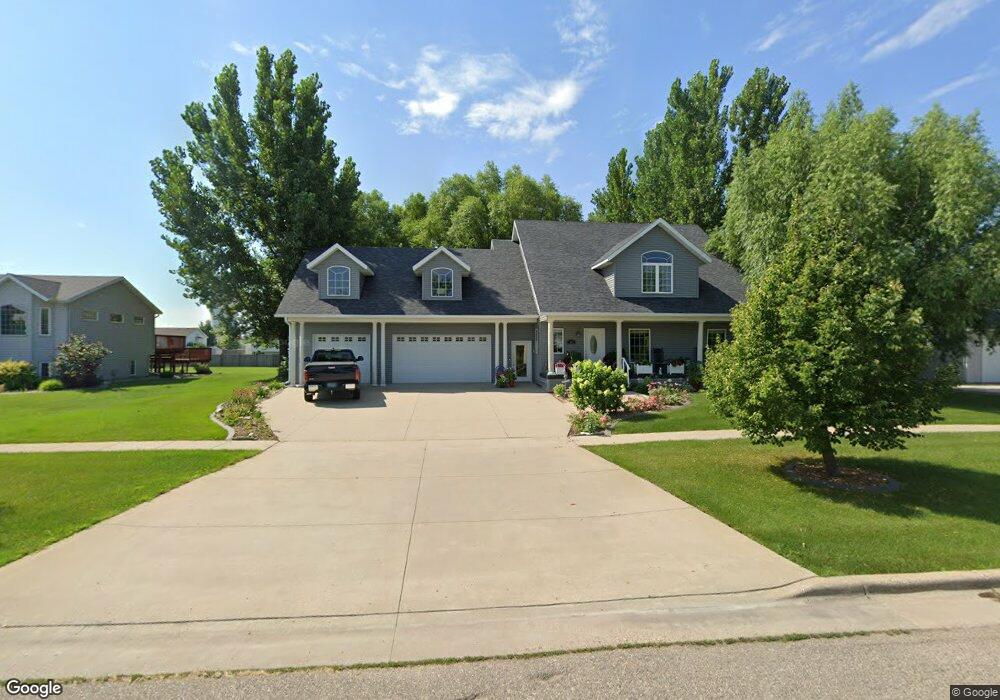
465 Prescott Place West Fargo, ND 58078
Eagle Run NeighborhoodEstimated Value: $434,000 - $513,624
4
Beds
4
Baths
2,788
Sq Ft
$172/Sq Ft
Est. Value
About This Home
This home is located at 465 Prescott Place, West Fargo, ND 58078 and is currently estimated at $478,906, approximately $171 per square foot. 465 Prescott Place is a home located in Cass County with nearby schools including Aurora Elementary School, Liberty Middle School, and West Fargo Sheyenne High School.
Ownership History
Date
Name
Owned For
Owner Type
Purchase Details
Closed on
Feb 13, 2009
Sold by
Dietz Dorothy and Dietz Douglas
Bought by
Miller Roger and Miller Debra
Current Estimated Value
Home Financials for this Owner
Home Financials are based on the most recent Mortgage that was taken out on this home.
Original Mortgage
$150,000
Interest Rate
5.06%
Mortgage Type
New Conventional
Create a Home Valuation Report for This Property
The Home Valuation Report is an in-depth analysis detailing your home's value as well as a comparison with similar homes in the area
Home Values in the Area
Average Home Value in this Area
Purchase History
| Date | Buyer | Sale Price | Title Company |
|---|---|---|---|
| Miller Roger | -- | -- |
Source: Public Records
Mortgage History
| Date | Status | Borrower | Loan Amount |
|---|---|---|---|
| Closed | Miller Roger | $150,000 |
Source: Public Records
Tax History Compared to Growth
Tax History
| Year | Tax Paid | Tax Assessment Tax Assessment Total Assessment is a certain percentage of the fair market value that is determined by local assessors to be the total taxable value of land and additions on the property. | Land | Improvement |
|---|---|---|---|---|
| 2024 | $6,717 | $255,350 | $37,300 | $218,050 |
| 2023 | $6,914 | $243,500 | $37,300 | $206,200 |
| 2022 | $6,509 | $223,650 | $37,300 | $186,350 |
| 2021 | $6,221 | $210,000 | $31,100 | $178,900 |
| 2020 | $5,831 | $199,800 | $31,100 | $168,700 |
| 2019 | $6,054 | $203,850 | $31,100 | $172,750 |
| 2018 | $5,816 | $196,050 | $31,100 | $164,950 |
| 2017 | $5,758 | $197,950 | $31,100 | $166,850 |
| 2016 | $5,968 | $196,000 | $31,100 | $164,900 |
| 2015 | $5,909 | $178,700 | $18,950 | $159,750 |
| 2014 | $5,891 | $167,000 | $18,950 | $148,050 |
| 2013 | $5,779 | $159,950 | $18,950 | $141,000 |
Source: Public Records
Map
Nearby Homes
- 909 38 1 2 Ave W
- 3662 N Sedona Ct
- 4337 66th St S
- 4355 66th St S
- 3830 3rd St E
- 1040 39th Ave W
- 6511 Osgood Pkwy S
- 1054 42nd Ave W
- 3755 Houkom Dr E
- 4534 Westport Pkwy
- 4507 Newport Ln
- 1156 42nd Ave W Unit A
- 414 Westview Ln E
- 4509 11th St W
- 1168 43rd Ave W
- 421 Westview Ln E
- 1381 Westport Beach Way
- 1236 S Beach Way
- 522 Westview Ln E
- 3784 Bell Blvd E
- 503 Prescott Place
- 453 Prescott Place
- 466 Prescott Place
- 441 Prescott Place
- 515 Prescott Place
- 504 Prescott Place
- 454 Prescott Place
- 446 S Sedona Dr
- 448 S Sedona Dr
- 456 S Sedona Dr
- 442 Prescott Place
- 516 Prescott Place
- 527 Prescott Place
- 440 S Sedona Dr
- 510 S Sedona Dr
- 429 Prescott Place
- 432 S Sedona Dr
- 430 Prescott Place
- 518 S Sedona Dr
- 539 Prescott Place