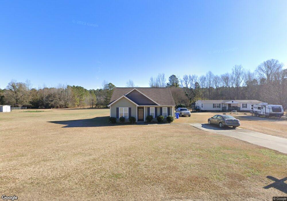
465 Ray Byrd Rd Lillington, NC 27546
Estimated Value: $218,000 - $239,000
3
Beds
2
Baths
1,175
Sq Ft
$191/Sq Ft
Est. Value
About This Home
This home is located at 465 Ray Byrd Rd, Lillington, NC 27546 and is currently estimated at $224,551, approximately $191 per square foot. 465 Ray Byrd Rd is a home located in Harnett County with nearby schools including Lillington-Shawtown Elementary School, Harnett Central Middle School, and Harnett Central High School.
Ownership History
Date
Name
Owned For
Owner Type
Purchase Details
Closed on
Feb 14, 2019
Sold by
Campbell Peggy
Bought by
Campbell Ricky
Current Estimated Value
Purchase Details
Closed on
Sep 24, 2008
Sold by
Byrd Jimmy L and Byrd Tonya H
Bought by
Campbell Ricky and Campbell Peggy
Home Financials for this Owner
Home Financials are based on the most recent Mortgage that was taken out on this home.
Original Mortgage
$108,673
Outstanding Balance
$71,952
Interest Rate
6.34%
Mortgage Type
Commercial
Estimated Equity
$152,599
Create a Home Valuation Report for This Property
The Home Valuation Report is an in-depth analysis detailing your home's value as well as a comparison with similar homes in the area
Home Values in the Area
Average Home Value in this Area
Purchase History
| Date | Buyer | Sale Price | Title Company |
|---|---|---|---|
| Campbell Ricky | -- | None Available | |
| Campbell Ricky | $111,500 | -- |
Source: Public Records
Mortgage History
| Date | Status | Borrower | Loan Amount |
|---|---|---|---|
| Open | Campbell Ricky | $108,673 |
Source: Public Records
Tax History Compared to Growth
Tax History
| Year | Tax Paid | Tax Assessment Tax Assessment Total Assessment is a certain percentage of the fair market value that is determined by local assessors to be the total taxable value of land and additions on the property. | Land | Improvement |
|---|---|---|---|---|
| 2025 | $1,094 | $141,868 | $0 | $0 |
| 2024 | $1,094 | $141,868 | $0 | $0 |
| 2023 | $1,094 | $141,868 | $0 | $0 |
| 2022 | $1,026 | $141,868 | $0 | $0 |
| 2021 | $1,026 | $108,130 | $0 | $0 |
| 2020 | $1,026 | $108,130 | $0 | $0 |
| 2019 | $1,011 | $108,130 | $0 | $0 |
| 2018 | $1,011 | $108,130 | $0 | $0 |
| 2017 | $1,011 | $108,130 | $0 | $0 |
| 2016 | $1,040 | $111,480 | $0 | $0 |
| 2015 | -- | $111,480 | $0 | $0 |
| 2014 | -- | $111,480 | $0 | $0 |
Source: Public Records
Map
Nearby Homes
- 485 Ray Byrd Rd
- 1139 Stockyard Rd
- 122 Smith Farms Dr
- 101 Smith Farms Dr
- 81 Smith Farms Dr
- 65 Smith Farms Dr
- 47 Smith Farms Dr
- 0 Stockyard Rd Unit 10123378
- 00 Stockyard Rd
- 1521 U S 401
- 160 Cemetery Ln
- 2670 Nc 210 S
- 55 Lockhart Ln
- 135 Bethea Rd
- 2527 Joel Johnson Rd
- 2657 Joel Johnson Rd
- 2068 Nc 27 W
- 922 McNeill Hobbs Rd
- 1203 S 3rd St
- 1309 S 11th St
- 425 Ray Byrd Rd
- 450 Ray Byrd Rd
- 470 Ray Byrd Rd
- 490 Ray Byrd Rd
- 430 Ray Byrd Rd
- 405 Ray Byrd Rd
- 510 Ray Byrd Rd
- 410 Ray Byrd Rd
- 390 Ray Byrd Rd
- 365 Ray Byrd Rd
- 370 Ray Byrd Rd
- 143 Jordan Temple Ln
- 345 Ray Byrd Rd
- 325 Ray Byrd Rd
- 330 Ray Byrd Rd
- 0 Ray Byrd Rd Unit LP471570
- 0 Ray Byrd Rd Unit LP420348
- 181 Ray Byrd Rd
- 0 Ray Byrd Rd Unit TR1933593
- 181 Ray Byrd Rd Unit 28