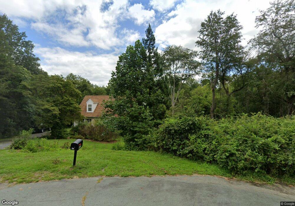
465 Riverside Dr Amissville, VA 20106
Estimated Value: $426,000 - $467,315
3
Beds
3
Baths
1,664
Sq Ft
$263/Sq Ft
Est. Value
About This Home
This home is located at 465 Riverside Dr, Amissville, VA 20106 and is currently estimated at $437,579, approximately $262 per square foot. 465 Riverside Dr is a home located in Culpeper County with nearby schools including Emerald Hill Elementary School, Culpeper Middle School, and Culpeper County High School.
Ownership History
Date
Name
Owned For
Owner Type
Purchase Details
Closed on
Jan 6, 2023
Sold by
Leanne A Malulani Trust
Bought by
Robinson Kayla and Connor Aubrey
Current Estimated Value
Home Financials for this Owner
Home Financials are based on the most recent Mortgage that was taken out on this home.
Original Mortgage
$380,000
Outstanding Balance
$367,397
Interest Rate
6.58%
Mortgage Type
New Conventional
Estimated Equity
$70,182
Purchase Details
Closed on
Aug 15, 2017
Sold by
Malulani Leanne A
Bought by
Malulani Leanne A and The Leanne A Malulani Trust Dated August
Create a Home Valuation Report for This Property
The Home Valuation Report is an in-depth analysis detailing your home's value as well as a comparison with similar homes in the area
Home Values in the Area
Average Home Value in this Area
Purchase History
| Date | Buyer | Sale Price | Title Company |
|---|---|---|---|
| Robinson Kayla | $345,000 | Ratified Title | |
| Malulani Leanne A | -- | None Available |
Source: Public Records
Mortgage History
| Date | Status | Borrower | Loan Amount |
|---|---|---|---|
| Open | Robinson Kayla | $380,000 |
Source: Public Records
Tax History Compared to Growth
Tax History
| Year | Tax Paid | Tax Assessment Tax Assessment Total Assessment is a certain percentage of the fair market value that is determined by local assessors to be the total taxable value of land and additions on the property. | Land | Improvement |
|---|---|---|---|---|
| 2025 | -- | $390,700 | $128,800 | $261,900 |
| 2024 | -- | $365,100 | $113,800 | $251,300 |
| 2023 | $0 | $365,100 | $113,800 | $251,300 |
| 2022 | $1,478 | $268,700 | $88,800 | $179,900 |
| 2021 | $1,690 | $272,500 | $88,800 | $183,700 |
| 2020 | $1,690 | $272,600 | $75,500 | $197,100 |
| 2019 | $1,690 | $272,600 | $75,500 | $197,100 |
| 2018 | $1,717 | $256,200 | $73,800 | $182,400 |
| 2017 | $1,717 | $256,200 | $73,800 | $182,400 |
| 2016 | $1,690 | $231,500 | $68,900 | $162,600 |
| 2015 | -- | $231,500 | $68,900 | $162,600 |
Source: Public Records
Map
Nearby Homes
- Rt 688 (Leeds Manor NW Rt 688 NW
- 8105 Willboyd Ct
- 9467 Old Waterloo Rd
- 20131 Stonehaven Ave
- Harlow II Plan at Stonehaven - Executive Collection
- Innisbrook Plan at Stonehaven - Executive Collection
- Columbia Plan at Stonehaven - Executive Collection
- 2124 Berwick Dr
- 2114 Whithorn Hill
- 9172 Lee Hwy
- 2110 Whithorn Hill
- 18438 Gleneagle Dr Unit MACARTHUR LOT 2318
- 18442 Gleneagle Dr Unit AZALEA LOT 2319
- 1468 Parker Place
- 17046 Lee Hwy
- 17246 Pepperstock Ln
- LOT 6 Piney Mountain Rd
- 2387 Burlington Dr
- LOT C Peaceful Place
- 3534 Southampton Dr
- 405 Riverside Dr
- 455 Riverside Dr
- 462 Riverside Dr
- 111 Testing Street Way
- 423 Riverside Dr
- 430 Riverside Dr
- 18460 Waterloo Rd
- 494 Old Bridge Rd
- 1006 Old Bridge Rd
- 468 Old Bridge Rd
- 438 Old Bridge Rd
- 18437 Waterloo Rd
- 18478 Waterloo Rd
- 374 Old Bridge Rd
- 1034 Old Bridge Rd
- 18496 Waterloo Rd
- 18276 Waterloo Rd
- 1070 Old Bridge Rd
- 1083 Shetley Rd
- 489 Old Bridge Rd