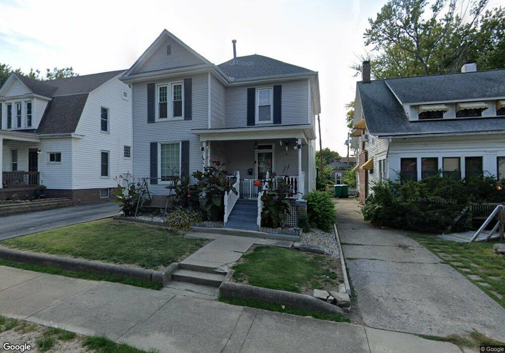
465 S Monroe St Decatur, IL 62522
Near West NeighborhoodEstimated Value: $62,193 - $79,000
3
Beds
2
Baths
1,950
Sq Ft
$37/Sq Ft
Est. Value
About This Home
This home is located at 465 S Monroe St, Decatur, IL 62522 and is currently estimated at $71,548, approximately $36 per square foot. 465 S Monroe St is a home located in Macon County with nearby schools including Dennis Lab School, St. Patrick School, and Teen Challenge-Home For Girls.
Ownership History
Date
Name
Owned For
Owner Type
Purchase Details
Closed on
Apr 27, 2009
Sold by
Tabor Mark J and Tabor Deborah M
Bought by
Ellis Kevin M
Current Estimated Value
Home Financials for this Owner
Home Financials are based on the most recent Mortgage that was taken out on this home.
Original Mortgage
$48,600
Outstanding Balance
$30,707
Interest Rate
4.85%
Mortgage Type
New Conventional
Estimated Equity
$40,841
Purchase Details
Closed on
Jul 28, 2006
Sold by
Webb Justin and Webb Stacey
Bought by
Tabor Mark J and Tabor Deborah M
Home Financials for this Owner
Home Financials are based on the most recent Mortgage that was taken out on this home.
Original Mortgage
$49,860
Interest Rate
6.82%
Mortgage Type
New Conventional
Create a Home Valuation Report for This Property
The Home Valuation Report is an in-depth analysis detailing your home's value as well as a comparison with similar homes in the area
Home Values in the Area
Average Home Value in this Area
Purchase History
| Date | Buyer | Sale Price | Title Company |
|---|---|---|---|
| Ellis Kevin M | $54,000 | None Available | |
| Tabor Mark J | $55,500 | None Available |
Source: Public Records
Mortgage History
| Date | Status | Borrower | Loan Amount |
|---|---|---|---|
| Open | Ellis Kevin M | $48,600 | |
| Previous Owner | Tabor Mark J | $49,860 |
Source: Public Records
Tax History Compared to Growth
Tax History
| Year | Tax Paid | Tax Assessment Tax Assessment Total Assessment is a certain percentage of the fair market value that is determined by local assessors to be the total taxable value of land and additions on the property. | Land | Improvement |
|---|---|---|---|---|
| 2024 | $1,919 | $19,820 | $1,076 | $18,744 |
| 2023 | $1,903 | $19,118 | $1,038 | $18,080 |
| 2022 | $1,809 | $17,692 | $961 | $16,731 |
| 2021 | $1,700 | $16,522 | $897 | $15,625 |
| 2020 | $1,675 | $15,755 | $855 | $14,900 |
| 2019 | $1,675 | $15,755 | $855 | $14,900 |
| 2018 | $1,661 | $15,807 | $858 | $14,949 |
| 2017 | $1,700 | $16,229 | $881 | $15,348 |
| 2016 | $1,732 | $16,395 | $890 | $15,505 |
| 2015 | $1,646 | $16,105 | $874 | $15,231 |
| 2014 | $1,529 | $15,945 | $865 | $15,080 |
| 2013 | $1,579 | $16,544 | $898 | $15,646 |
Source: Public Records
Map
Nearby Homes
- 628 W Forest Ave
- 617 W Decatur St
- 441 S Seigel St
- 437 Powers Ln
- 612 W Macon St
- 530 Powers Ln
- 657 W Wood St
- 450 W Macon St
- 440 W Macon St
- 650 S Crea St
- 580 Powers Ln
- 717 W Prairie Ave Unit 2
- 899 W Main St
- 320 W Main St
- 452 W Prairie Ave
- 442 W Prairie Ave
- 609 W William St
- 281 W Prairie Ave
- 233 N Edward St
- 1005 W Main St
- 473 S Monroe St
- 463 S Monroe St
- 495 S Monroe St
- 616 W Forest Ave
- 459 S Monroe St
- 480 S Monroe St
- 468 S Monroe St
- 634 W Forest Ave
- 454 S Monroe St
- 437 S Monroe St
- 640 W Forest Ave
- 442 S Monroe St
- 609 W Forest Ave
- 619 W Forest Ave
- 629 W Forest Ave
- 434 S Monroe St
- 462 S Seigel St
- 456 S Seigel St
- 446 S Seigel St
- 487 S Ewing Ave