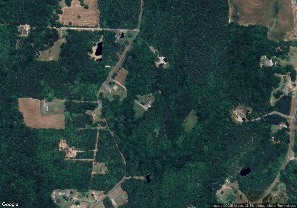
465 Starnes Rd Salisbury, NC 28146
Estimated Value: $195,000 - $327,000
--
Bed
2
Baths
1,904
Sq Ft
$147/Sq Ft
Est. Value
About This Home
This home is located at 465 Starnes Rd, Salisbury, NC 28146 and is currently estimated at $280,333, approximately $147 per square foot. 465 Starnes Rd is a home located in Rowan County with nearby schools including Morgan Elementary School, Charles C Erwin Middle School, and East Rowan High School.
Ownership History
Date
Name
Owned For
Owner Type
Purchase Details
Closed on
May 29, 2020
Sold by
Honeycutt Sandra and Honeycutt Javin
Bought by
Honeycutt Sandra
Current Estimated Value
Purchase Details
Closed on
Jan 15, 2009
Sold by
Burris Alice Lynnette
Bought by
Burris Alice Lynnette and Honeycutt Sandra Burris
Purchase Details
Closed on
Jan 1, 2000
Bought by
Honeycutt Sandra Marie Burris
Create a Home Valuation Report for This Property
The Home Valuation Report is an in-depth analysis detailing your home's value as well as a comparison with similar homes in the area
Home Values in the Area
Average Home Value in this Area
Purchase History
| Date | Buyer | Sale Price | Title Company |
|---|---|---|---|
| Honeycutt Sandra | -- | None Available | |
| Burris Alice Lynnette | -- | None Available | |
| Honeycutt Sandra Marie Burris | -- | -- |
Source: Public Records
Tax History Compared to Growth
Tax History
| Year | Tax Paid | Tax Assessment Tax Assessment Total Assessment is a certain percentage of the fair market value that is determined by local assessors to be the total taxable value of land and additions on the property. | Land | Improvement |
|---|---|---|---|---|
| 2025 | $1,405 | $212,852 | $60,417 | $152,435 |
| 2024 | $1,405 | $212,852 | $60,417 | $152,435 |
| 2023 | $1,405 | $212,852 | $60,417 | $152,435 |
| 2022 | $1,127 | $152,770 | $46,984 | $105,786 |
| 2021 | $1,087 | $152,770 | $46,984 | $105,786 |
| 2020 | $1,087 | $152,770 | $46,984 | $105,786 |
| 2019 | $1,087 | $152,770 | $46,984 | $105,786 |
| 2018 | $967 | $137,025 | $46,983 | $90,042 |
| 2017 | $967 | $137,025 | $46,983 | $90,042 |
| 2016 | $967 | $137,025 | $46,983 | $90,042 |
| 2015 | $982 | $137,025 | $46,983 | $90,042 |
| 2014 | $988 | $140,582 | $46,983 | $93,599 |
Source: Public Records
Map
Nearby Homes
- 8725 Bringle Ferry Rd
- 1370 Poole Rd
- 360 Tamarac Shores Dr
- 1225 Poole Rd
- 160 Dockside Dr
- 237 Panfish Ln
- 0 Catfish Terrace
- 1083 Elljoy Ln
- 0 Sapona Dr Unit LotWP001
- 260 Knollwood Dr
- 00 File Rd
- 0 Scout Rd
- 6415 Bringle Ferry Rd
- 0 Playground Ln Unit 22 CAR4285926
- 0 Playground Ln Unit 21 CAR4285915
- 0 Playground Ln Unit 1170706
- 0 Playground Ln Unit L25-26 CAR4222360
- 265 Saint Matthew Church Rd
- 255 Topsail Rd
- 23 AC Ned Marsh Rd
- 485 Starnes Rd
- 470 Starnes Rd
- 560 Starnes Rd
- 420 Starnes Rd
- 540 Starnes Rd
- 725 Starnes Rd
- 730 Starnes Rd
- 3440 Poole Rd
- 550 Starnes Rd
- 580 Starnes Rd
- 735 Starnes Rd
- 3390 Poole Rd
- 3250 Poole Rd
- 255 Burris Dr
- 8385 Bringle Ferry Rd
- 766 Starnes Rd
- 3460 Poole Rd
- 3420 Poole Rd
- 785 Starnes Rd
- 788 Starnes Rd
