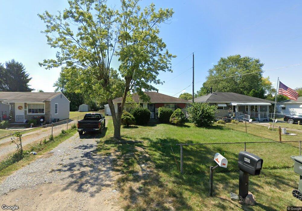
465 Stockbridge Rd Columbus, OH 43207
Obetz-Lockbourne NeighborhoodEstimated Value: $141,000 - $172,000
2
Beds
1
Bath
768
Sq Ft
$207/Sq Ft
Est. Value
About This Home
This home is located at 465 Stockbridge Rd, Columbus, OH 43207 and is currently estimated at $158,903, approximately $206 per square foot. 465 Stockbridge Rd is a home located in Franklin County with nearby schools including Parsons Elementary School, Buckeye Middle School, and Marion-Franklin High School.
Ownership History
Date
Name
Owned For
Owner Type
Purchase Details
Closed on
Oct 19, 2007
Sold by
Walters Estell
Bought by
Walters Troy L
Current Estimated Value
Home Financials for this Owner
Home Financials are based on the most recent Mortgage that was taken out on this home.
Original Mortgage
$40,000
Outstanding Balance
$24,727
Interest Rate
6.38%
Mortgage Type
Purchase Money Mortgage
Estimated Equity
$134,176
Purchase Details
Closed on
Feb 22, 1990
Bought by
Walters Estell
Purchase Details
Closed on
Mar 1, 1984
Create a Home Valuation Report for This Property
The Home Valuation Report is an in-depth analysis detailing your home's value as well as a comparison with similar homes in the area
Home Values in the Area
Average Home Value in this Area
Purchase History
| Date | Buyer | Sale Price | Title Company |
|---|---|---|---|
| Walters Troy L | $50,000 | Valmer Land | |
| Walters Estell | $35,000 | -- | |
| -- | -- | -- |
Source: Public Records
Mortgage History
| Date | Status | Borrower | Loan Amount |
|---|---|---|---|
| Open | Walters Troy L | $40,000 |
Source: Public Records
Tax History
| Year | Tax Paid | Tax Assessment Tax Assessment Total Assessment is a certain percentage of the fair market value that is determined by local assessors to be the total taxable value of land and additions on the property. | Land | Improvement |
|---|---|---|---|---|
| 2025 | $2,487 | $50,930 | $17,610 | $33,320 |
| 2024 | $2,487 | $50,930 | $17,610 | $33,320 |
| 2023 | $2,329 | $50,925 | $17,605 | $33,320 |
| 2022 | $1,064 | $20,030 | $9,420 | $10,610 |
| 2021 | $1,066 | $20,030 | $9,420 | $10,610 |
| 2020 | $1,068 | $20,030 | $9,420 | $10,610 |
| 2019 | $1,040 | $16,730 | $8,190 | $8,540 |
| 2018 | $1,091 | $16,730 | $8,190 | $8,540 |
| 2017 | $1,148 | $16,730 | $8,190 | $8,540 |
| 2016 | $1,256 | $18,480 | $3,850 | $14,630 |
| 2015 | $1,143 | $18,480 | $3,850 | $14,630 |
| 2014 | $1,146 | $18,480 | $3,850 | $14,630 |
| 2013 | $595 | $19,460 | $4,060 | $15,400 |
Source: Public Records
Map
Nearby Homes
- 3380 Parsons Ave
- 1633-1635 E Greenway Ave
- 691 Colton Rd
- 435 Carolann Ave
- 460 Coulter Ave
- 780 Basswood Rd
- 562 Ashwood Rd
- 135 Rumsey Rd
- 3302 Hilock Place
- 228 Currier Dr
- 860 Basswood Rd
- 3251 Hilock Ct
- 525 Ashwood Rd
- 0 Williams Rd
- 211 Delaney Dr
- 245 Marilla Rd
- 83 Rumsey Rd
- 577 Barcher Rd
- 484 Cedarwood Rd
- 884 Bruckner Rd
- 453 Stockbridge Rd
- 479 Stockbridge Rd
- 441 Stockbridge Rd
- 493 Stockbridge Rd
- 490 Rumsey Rd
- 500 Rumsey Rd
- 464 Rumsey Rd
- 470 Stockbridge Rd
- 507 Stockbridge Rd
- 458 Stockbridge Rd
- 506 Rumsey Rd
- 474 Rumsey Rd
- 460 Rumsey Rd
- 494 Stockbridge Rd
- 450 Stockbridge Rd
- 512 Rumsey Rd
- 456 Rumsey Rd
- 440 Stockbridge Rd
- 500 Stockbridge Rd
- 513 Stockbridge Rd
Your Personal Tour Guide
Ask me questions while you tour the home.