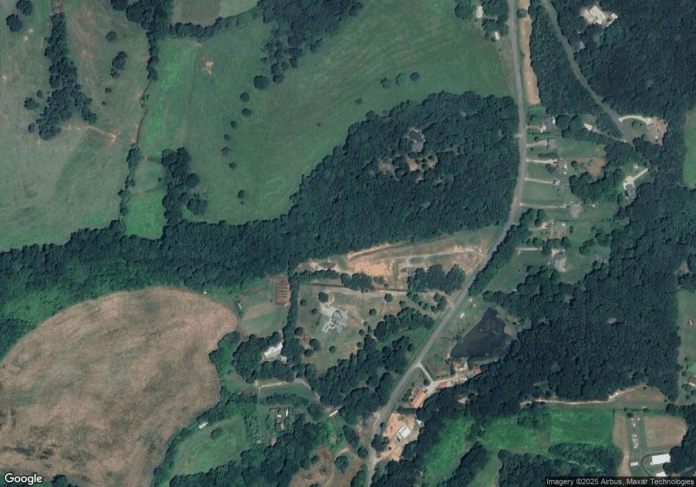
465 Thomas Rd Cleveland, GA 30528
Estimated Value: $350,000 - $511,000
3
Beds
3
Baths
1,716
Sq Ft
$249/Sq Ft
Est. Value
About This Home
This home is located at 465 Thomas Rd, Cleveland, GA 30528 and is currently estimated at $426,571, approximately $248 per square foot. 465 Thomas Rd is a home with nearby schools including Tesnatee Gap Elementary (Old White County Intermediate), White County 9th Grade Academy, and Jack P. Nix Elementary School.
Ownership History
Date
Name
Owned For
Owner Type
Purchase Details
Closed on
Sep 9, 2010
Sold by
Turner Fannie Grace
Bought by
Turner Donna Renee
Current Estimated Value
Purchase Details
Closed on
Dec 1, 2007
Sold by
Not Provided
Bought by
Turner Donna Renee
Purchase Details
Closed on
Nov 14, 2005
Sold by
Turner Daniel
Bought by
Turner Donna
Purchase Details
Closed on
Jun 22, 2005
Sold by
Turner Daniel
Bought by
Turner Donna
Purchase Details
Closed on
Jun 21, 2005
Sold by
Chesser C J
Bought by
Turner Daniel and Turner Grace
Create a Home Valuation Report for This Property
The Home Valuation Report is an in-depth analysis detailing your home's value as well as a comparison with similar homes in the area
Home Values in the Area
Average Home Value in this Area
Purchase History
| Date | Buyer | Sale Price | Title Company |
|---|---|---|---|
| Turner Donna Renee | -- | -- | |
| Turner Donna Renee | -- | -- | |
| Turner Donna Renee | -- | -- | |
| Turner Donna | -- | -- | |
| Turner Donna | -- | -- | |
| Turner Daniel | -- | -- | |
| Chesser C J | -- | -- |
Source: Public Records
Tax History Compared to Growth
Tax History
| Year | Tax Paid | Tax Assessment Tax Assessment Total Assessment is a certain percentage of the fair market value that is determined by local assessors to be the total taxable value of land and additions on the property. | Land | Improvement |
|---|---|---|---|---|
| 2025 | $2,456 | $189,356 | $51,400 | $137,956 |
| 2024 | $2,456 | $135,296 | $38,552 | $96,744 |
| 2023 | $2,274 | $135,296 | $38,552 | $96,744 |
| 2022 | $2,340 | $135,296 | $38,552 | $96,744 |
| 2021 | $2,784 | $111,440 | $34,828 | $76,612 |
| 2020 | $2,752 | $101,940 | $32,340 | $69,600 |
| 2019 | $2,760 | $101,940 | $32,340 | $69,600 |
| 2018 | $2,760 | $101,940 | $32,340 | $69,600 |
| 2017 | $2,694 | $96,280 | $32,340 | $63,940 |
| 2016 | $2,694 | $96,280 | $32,340 | $63,940 |
| 2015 | $1,789 | $167,500 | $32,340 | $63,940 |
| 2014 | $1,628 | $152,190 | $0 | $0 |
Source: Public Records
Map
Nearby Homes
- 4872 Highway 115 W
- 0 Long Mountain Rd Unit 10607992
- LOT 28 Long Mountain Rd
- 0 Westmoreland Rd Unit 10596625
- LOT 55 Teel Mtn Dr
- 705 & Long Mountain Rd
- 0 Asbury Mill Rd Unit 10599324
- 0 Asbury Mill Rd Unit 7644389
- LOT 57 Teel Mtn Dr
- 705 Long Mountain Rd
- 705 & 0 Long Mountain Rd
- 254 Jeb Dr
- 174 Leighs Crossing
- 0 Jeb Dr Unit 10628544
- 3395 Asbury Mill Rd
- LOT 24 Luther Palmer Rd
- 59 Rocket Dr
- 489 Asbury Mill Rd
- 25 Long Mountain Trail
- 00 Partin Rd
- 455 Thomas Rd
- 488 Thomas Rd
- 185 Thomas Rd
- 500 Thomas Rd
- 518 Thomas Rd
- 556 Thomas Rd
- 536 Thomas Rd
- 0 Crop Dr Unit 8265208
- 0 Crop Dr Unit 7589054
- 0 Crop Dr Unit 8514227
- 574 Thomas Rd
- 584 Thomas Rd
- 236 Thomas Rd
- 301 Thomason Rd
- 0 Thomason Rd Unit 7308234
- 0 Thomason Rd Unit 7192459
- 0 Thomason Rd Unit 3022488
- 4740 Highway 115 W
- 213 Thomason Rd
- 350 Thomason Rd
