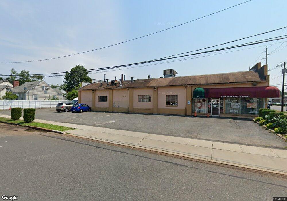
465 W Union Ave Bound Brook, NJ 08805
Estimated Value: $869,726
--
Bed
--
Bath
6,060
Sq Ft
$144/Sq Ft
Est. Value
About This Home
This home is located at 465 W Union Ave, Bound Brook, NJ 08805 and is currently estimated at $869,726, approximately $143 per square foot. 465 W Union Ave is a home located in Somerset County with nearby schools including LaMonte Annex Elementary School, Lafayette Elementary School, and Bound Brook High School.
Ownership History
Date
Name
Owned For
Owner Type
Purchase Details
Closed on
Jul 28, 2021
Sold by
Newman John B
Bought by
Lo Presti Clearview Llc
Current Estimated Value
Purchase Details
Closed on
Dec 7, 2017
Sold by
Francisco Antonio and Francisco Lucilia Francisco
Bought by
Francisco Pedro and Francisco Antonio
Home Financials for this Owner
Home Financials are based on the most recent Mortgage that was taken out on this home.
Interest Rate
3.94%
Purchase Details
Closed on
Apr 6, 2000
Sold by
Direnzo Philip
Bought by
Francisco Antonio and Lucilia Francisco
Purchase Details
Closed on
Mar 20, 1996
Sold by
Solomon Carl
Bought by
Direnzo Philip and Direnzo Giovanna
Home Financials for this Owner
Home Financials are based on the most recent Mortgage that was taken out on this home.
Original Mortgage
$40,000
Interest Rate
6.99%
Mortgage Type
Commercial
Create a Home Valuation Report for This Property
The Home Valuation Report is an in-depth analysis detailing your home's value as well as a comparison with similar homes in the area
Home Values in the Area
Average Home Value in this Area
Purchase History
| Date | Buyer | Sale Price | Title Company |
|---|---|---|---|
| Lo Presti Clearview Llc | $600,000 | None Available | |
| Francisco Pedro | -- | -- | |
| Francisco Antonio | $200,000 | -- | |
| Direnzo Philip | $300,000 | -- |
Source: Public Records
Mortgage History
| Date | Status | Borrower | Loan Amount |
|---|---|---|---|
| Previous Owner | Francisco Pedro | -- | |
| Previous Owner | Direnzo Philip | $40,000 |
Source: Public Records
Tax History Compared to Growth
Tax History
| Year | Tax Paid | Tax Assessment Tax Assessment Total Assessment is a certain percentage of the fair market value that is determined by local assessors to be the total taxable value of land and additions on the property. | Land | Improvement |
|---|---|---|---|---|
| 2025 | $17,086 | $788,000 | $368,000 | $420,000 |
| 2024 | $17,086 | $753,000 | $353,000 | $400,000 |
| 2023 | $16,506 | $700,000 | $323,000 | $377,000 |
| 2022 | $16,421 | $660,000 | $303,000 | $357,000 |
| 2021 | $22,345 | $670,000 | $283,000 | $387,000 |
| 2020 | $21,773 | $705,300 | $268,000 | $437,300 |
| 2019 | $22,345 | $690,300 | $268,000 | $422,300 |
| 2018 | $23,015 | $690,300 | $268,000 | $422,300 |
| 2017 | $23,205 | $680,300 | $268,000 | $412,300 |
| 2016 | $23,035 | $680,300 | $268,000 | $412,300 |
| 2015 | $20,869 | $630,300 | $268,000 | $362,300 |
| 2014 | $18,179 | $530,300 | $168,000 | $362,300 |
Source: Public Records
Map
Nearby Homes
- 601 Thompson Ave
- 307 W Union Ave
- 606 Vosseller Ave
- 617 Vosseller Ave
- 641 Crescent Dr
- 510 Dalay Place
- 512 W 2nd St
- 722 Lawrence Rd
- 143 Vosseller Ave
- 542 Wheatland Ave
- 130 W High St Unit 132
- 126 W High St
- 301 Stratford Place
- 432 Talmage Ave
- 102 W Franklin St
- 40 van Keuren Ave Unit 42
- 504 Stratford Place
- 34 van Keuren Ave Unit 38
- 105 La Monte Ave
- 520 Winsor St
- 465 W Union Ave Unit 465
- 418 Clearview Place
- 420 Clearview Place
- 415 Clearview Place
- 419 Highland Place
- 419 Clearview Place
- 423 Highland Place
- 423 Clearview Place
- 438 W Maple Ave
- 434 W Maple Ave
- 430 W Maple Ave
- 446 W Maple Ave
- 426 W Maple Ave
- 415 Longwood Ave
- 413 Longwood Ave
- 416 Highland Place
- 427 Longwood Ave
- 411 Longwood Ave
- 448 W Maple Ave
- 570 Thompson Ave