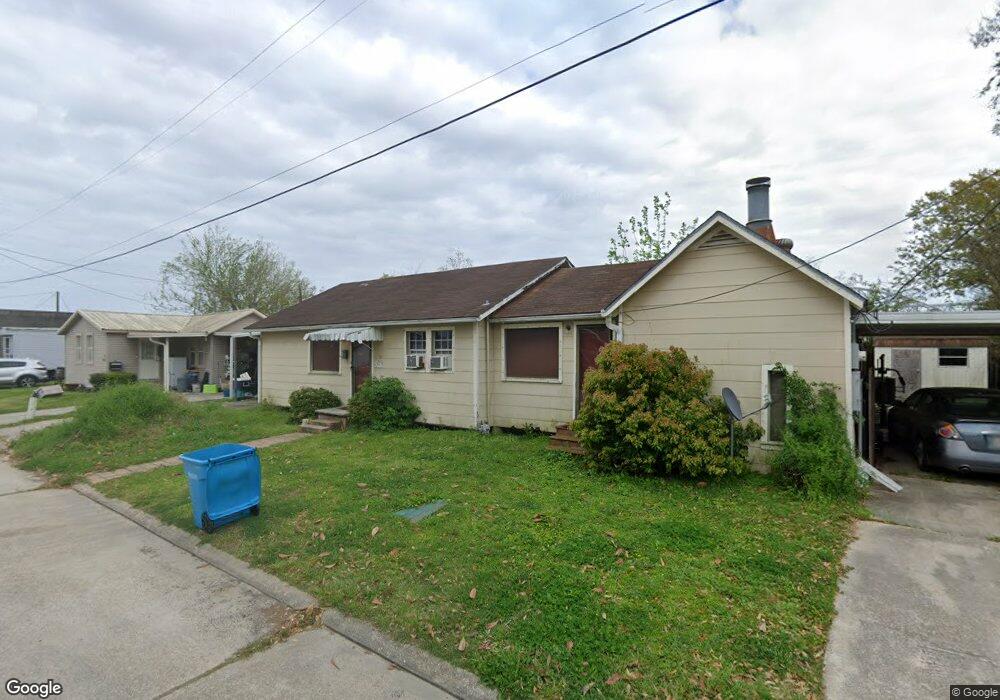
465 Wilson St Berwick, LA 70342
Estimated Value: $105,000 - $122,000
3
Beds
2
Baths
1,436
Sq Ft
$80/Sq Ft
Est. Value
About This Home
This home is located at 465 Wilson St, Berwick, LA 70342 and is currently estimated at $115,000, approximately $80 per square foot. 465 Wilson St is a home located in St. Mary Parish with nearby schools including Berwick Elementary School, Berwick Junior High School, and Berwick High School.
Ownership History
Date
Name
Owned For
Owner Type
Purchase Details
Closed on
Oct 7, 2020
Sold by
Topham Larry G and Saunders-Topham Lisa
Bought by
Wilson Street Llc
Current Estimated Value
Purchase Details
Closed on
Mar 27, 2018
Sold by
Voisin 2Nd Ernest J
Bought by
Topham Larry G and Saunders-Topham Lisa
Home Financials for this Owner
Home Financials are based on the most recent Mortgage that was taken out on this home.
Original Mortgage
$102,960
Interest Rate
4.43%
Mortgage Type
Purchase Money Mortgage
Create a Home Valuation Report for This Property
The Home Valuation Report is an in-depth analysis detailing your home's value as well as a comparison with similar homes in the area
Home Values in the Area
Average Home Value in this Area
Purchase History
| Date | Buyer | Sale Price | Title Company |
|---|---|---|---|
| Wilson Street Llc | $95,622 | None Available | |
| Topham Larry G | $128,700 | -- |
Source: Public Records
Mortgage History
| Date | Status | Borrower | Loan Amount |
|---|---|---|---|
| Previous Owner | Topham Larry G | $102,960 |
Source: Public Records
Tax History
| Year | Tax Paid | Tax Assessment Tax Assessment Total Assessment is a certain percentage of the fair market value that is determined by local assessors to be the total taxable value of land and additions on the property. | Land | Improvement |
|---|---|---|---|---|
| 2025 | $992 | $9,718 | $1,102 | $8,616 |
| 2024 | $904 | $9,718 | $1,102 | $8,616 |
| 2023 | $703 | $9,718 | $1,102 | $8,616 |
| 2022 | $903 | $9,718 | $1,102 | $8,616 |
| 2021 | $906 | $9,718 | $1,102 | $8,616 |
| 2020 | $1,139 | $12,227 | $1,005 | $11,222 |
| 2019 | $1,091 | $12,227 | $1,005 | $11,222 |
| 2018 | $1,091 | $12,227 | $1,005 | $11,222 |
| 2017 | $525 | $5,865 | $905 | $4,960 |
| 2016 | $416 | $5,865 | $905 | $4,960 |
| 2015 | $678 | $7,688 | $905 | $6,783 |
| 2014 | $156 | $7,688 | $905 | $6,783 |
| 2013 | $156 | $7,688 | $905 | $6,783 |
Source: Public Records
Map
Nearby Homes
- 4012 John St
- 1030 2nd St
- 1215 Federal Ave
- 1513 Nevada St
- 1420 N 3rd St
- 1510 N 3rd St
- 1513 Ellzey St
- 909 Fourth St
- 1648 N 2nd St
- 922 Fourth St
- 920 Fourth St
- 512 Marshall St
- 616 Federal Ave
- 616 Grove St Unit 1
- 3819,3803,3817 Pharr St
- 417 Leona St
- 814 Spruce St
- 811 Belanger St
- 1501 Cedar St
- 616 Willow St
Your Personal Tour Guide
Ask me questions while you tour the home.